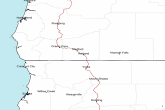
Florence OR to Point St. George between 150 and 250 NM Offshore Forecast
| Today...W To Nw Winds 10 To 15 Kt. Seas 6 To 8 Ft. Chance Of Rain. |
| Tonight...Nw Winds 10 To 15 Kt. Seas 6 To 7 Ft. |
| Sat...N To Nw Winds 10 To 15 Kt. Seas 6 To 8 Ft. |
| Sat Night...N To Nw Winds 10 To 15 Kt. Seas 7 To 8 Ft. |
| Sun...W To Nw Winds 10 To 15 Kt. Seas 6 To 8 Ft. |
| Sun Night...N Winds 15 To 20 Kt. Seas 6 To 8 Ft. |
| Mon...N To Nw Winds 10 To 20 Kt. Seas 6 To 9 Ft. |
| Mon Night...N To Nw Winds 10 To 20 Kt. Seas 7 To 10 Ft. |
| Tue...W To Nw Winds 10 To 15 Kt, Becoming W To Sw 5 To 15 Kt. Seas 8 To 10 Ft. |
| Tue Night...Sw Winds 10 To 20 Kt. Seas 8 To 10 Ft. |
| Area Forecast Discussion National Weather Service Medford OR 208pm PST Fri Mar 6 2026 Northerly flow aloft under the leading edge of a Pacific ridge is the guiding feature for area weather today. Mid and high level clouds are reaching the northern border of the CWA (County Warning Area) but are generally breaking up by the time they reach northern California. This flow is keeping slight chances (20-40%) of precipitation along the Oregon coast north of Cape Blanco through this evening. Other areas will see seasonable daytime highs under those passing clouds. These clouds are minimizing chances for fog development overnight, although patchy fog may develop in some low- lying areas. That ridge flattens and expands over the area over the weekend, bringing daytime highs 5 to 15 degrees above normal. Most areas will see highs in the low to mid 60s through the weekend. Low elevation inland areas in Curry County (Ex: Agness, Brookings) have a 70-90% chance to see highs exceed 70 degrees. Parts of the Klamath River Valley may see similar temperatures. On Sunday, the Pacific ridge is further compressed from the north by a low pressure system moving into the Gulf of Alaska. This will allow Coos, Curry, and Douglas counties to see a few degrees of daytime cooling while highs in Siskiyou and Modoc counties rise. This brings 70-90% chances to exceed 70 degrees to Highway 89 (McCloud) as well as 50-70% chances around Adin and south of Alturas. A Gulf of Alaska low lingers above the Pacific ridge to start next week, bringing zonal/slightly northwest flow aloft. Cold air advection to start to week will bring seasonal daytime highs on Monday and Tuesday, generally in the low to mid 50s across the area, and cool nighttime lows. For Monday night into Tuesday morning, low temperatures may reach freezing levels for west side valleys. Snow levels have come up slightly (in the 2000-3000 foot range on Tuesday morning and afternoon) and slight precipitation chances limited to the Oregon coast and Cascades north of Lake of the s. Significant winter impacts are not expected. While a zonal flow pattern looks to continue into midweek and beyond, there's some uncertainty in how moisture will move along the zonal flow. The chances of moisture moving to our area from the Pacific is keeping slight but constant 20-40% chances for light showers along the Oregon coast and Cascades through much of next week. In the absence of an atmospheric lifting mechanism, shower chances for other areas are minimal. Towards the end of the week, long-term models diverge in their expectations. GFS (Global Forecast System) meteograms keep zonal flow in place, with a few pulses of moisture bringing west side shower chances for next weekend. ECMWF (European Centre for Medium-Range Weather Forecasts) ensemble members favor a strengthening ridge with dry conditions and warmer temperatures. At this point, nothing in the long-term forecast resembles a hazardous pattern. -TAD Marine Updated 100pm PST Friday, March 6, 2026...Swell dominated seas will persist into early Saturday, gradually lowering some this afternoon. Meanwhile, north winds will increase some this afternoon from Brookings southward, and this could lead to a brief period of advisory conditions this afternoon/evening. North winds increase and spread northward Saturday afternoon into Sunday, then persist into early next week. Steep seas are expected from Gold Beach southward by Saturday afternoon and are likely to persist into early next week. Areas of very steep seas are possible from Brookings southward on Monday. Improving conditions are possible around mid-week. /BR-y NOAA Medford OR Office: Watches - Warnings - Advisories OR...None. CA...None. PACIFIC COASTAL WATERS...Small Craft Advisory from 4pm Saturday to 5 am PST Monday for PZZ356-376. |
 Medford OR Radar
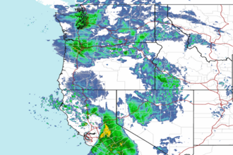
 Northwest Radar