Santa Cruz Island CA to 120W between 150 and 250 NM Offshore Forecast
| Today...N To Nw Winds 10 To 15 Kt, Becoming 10 To 20 Kt Early, Then Becoming 10 To 15 Kt. Seas 5 To 6 Ft. |
| Tonight...Nw Winds 10 To 20 Kt. Seas 5 To 8 Ft. |
| Thu...Nw Winds 15 To 25 Kt. Seas 6 To 8 Ft. |
| Thu Night...Nw Winds 15 To 25 Kt. Seas 7 To 9 Ft. |
| Fri...N To Nw Winds 10 To 20 Kt. Seas 7 To 9 Ft. |
| Fri Night...N To Nw Winds 10 To 20 Kt. Seas 6 To 8 Ft. |
| Sat...N To Nw Winds 5 To 15 Kt. Seas 6 To 8 Ft. |
| Sat Night...Nw Winds 10 To 15 Kt, Diminishing To 5 To 10 Kt. Seas 6 To 8 Ft. |
| Sun...Nw Winds 5 To 10 Kt. Seas 6 To 7 Ft. |
| Sun Night...W To Nw Winds 5 To 10 Kt. Seas 5 To 7 Ft. |
| Area Forecast Discussion National Weather Service San Diego CA 241am PDT Wednesday April 29 2026 Synopsis High temperatures will continue warming today to around average with not much change on Thursday. There will be additional warming for Friday and Saturday with Saturday high temperatures 5 to 10 degrees above average for inland areas. A low pressure system moving slowly into California will bring a cooling trend for Sunday through Tuesday with Tuesday high temperatures as much as 10 to 15 degrees below average for the mountains. There is also a slight chance of showers some time around Tuesday. For Extreme Southwestern California Including Orange... San Diego...Western Riverside and Southwestern San Bernardino Counties Short Term - Today Through Friday Dry weather will continue through the weekend. High temperatures will warm slightly near the coast today to around 5 degrees for the deserts to within a few degrees of average for most areas with not much change on Thursday. High temperatures will range from the mid to upper 60s near the coast to the mid 70s to lower 80s for the Inland Empire with the lower deserts around 90. There will be additional warming for Friday and Saturday with Friday high temperatures warming as much as 5 to locally 10 degrees for the valleys and lower elevations of the mountains. With the warming, high temperatures will range from around 70 near the coast to the lower to mid 80s for the Inland Empire with the lower deserts in the mid 90s. Long Term - Saturday through Tuesday High temperatures on Saturday will warm a few more degrees, to 5 to 10 degrees above average for inland areas, with high temperatures ranging from around 70 near the coast to the 80s for the Inland Empire with the mid to upper 90s for the lower deserts. A closed low pressure system centered off the California coast on Sunday will move slowly inland into California on Monday and Tuesday. This will bring a cooling trend for Sunday through Tuesday with Tuesday high temperatures 5 to 10 degrees below average for inland areas to as much as 10 to 15 degrees below average for the mountains. High temperatures on Tuesday will be mostly in the mid 60s to lower 70s for the coast and valleys with the lower deserts in the upper 70s to mid 80s. There is also a slight chance of showers some time around Tuesday. Marine No hazardous marine conditions are expected today through Sunday. Skywarn Skywarn activation is not requested. However weather spotters are encouraged to report significant weather conditions. NOAA San Diego CA Office: Watches - Warnings - Advisories CA...None. PZ...None. |
 San Diego Radar
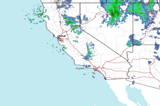
 Pacific Southwest Radar