James River From The James River Bridge To The Hampton Roads Bridge Tunnel Marine Forecast
| Through 7 Pm...E Winds 10 To 15 Kt With Gusts Up To 20 Kt. Waves Around 2 Ft. |
| Tonight...E Winds 10 To 15 Kt With Gusts Up To 20 Kt. Waves Around 2 Ft. |
| Sat...E Winds 10 Kt. Waves Around 2 Ft In The Morning, Then 1 Foot Or Less. |
| Sat Night...Se Winds 10 Kt, Becoming S After Midnight. Waves 1 Foot. |
| Sun...Sw Winds 5 To 10 Kt. Waves 1 Foot. |
| Sun Night...Sw Winds 10 Kt. Waves 1 Foot. |
| Mon...Sw Winds 5 To 10 Kt. Waves 1 Foot. |
| Mon Night...Sw Winds 10 Kt. Waves 1 Foot. |
| Tue...Sw Winds 10 Kt. Waves 1 Foot. |
| Tue Night...Sw Winds 10 Kt. Waves 1 Foot. |
| Area Forecast Discussion National Weather Service Wakefield VA 347pm EDT Fri April 26 2024 Synopsis High pressure will slide to just off the New England coast tonight, moving south into early next week, with a ridge building over the area and temperatures well above normal through next week. An unsettled pattern sets up from Tuesday into next weekend with daily chances for showers and storms. Near Term - Until 6am Saturday Morning As of 345pm EDT Friday... Late this afternoon. surface high pressure was centered over New England. The high was providing a partly to mostly sunny sky and cool temps across the area. Temps were ranging from the upper 50s to the upper 60s. The high will slide to just off the New England coast tonight, allowing a weak warm front to approach from the west. Expect increasing clouds, esply late tonight into Sat morning. An isolated shower could occur toward morning in our extrm WNW counties. Lows tonight will range through the 40s to near 50. Short Term - 6am Saturday Morning Through Monday As of 345pm EDT Friday... That weak warm front will lift across our extrm northern counties Sat into Sat evening, while the surface high will drift south to off the northern Mid Atlantic coast. Also, upper ridging will build into the area during this time period. The warm front could trigger isolated showers over the extrm northern counties. But otherwise, expect a partly sunny to mostly cloudy sky on Sat with highs ranging through the 60s to near 70. Partly to mostly cloudy Sat night with lows in the upper 40s to lower 50s. Upper ridge then strengthens over the region for Sunday aftn through Mon, resulting in increasingly warmer temps for Sunday and Mon. The surface high pressure will continue drifting south from off the Mid Atlantic coast to off the SE coast. Under a partly to mostly sunny sky, high temps on Sunday will be in the upper 70s to lower 80s. Under a sunny or mostly sunny sky on Mon, highs will mainly be in the lower to mid 80s, but there will likely be some upper 80s inland/Piedmont of VA. Long Term - Monday Night Through Friday As of 345pm EDT Friday... The ridge builds over the area early next week, becoming less amplified by midweek, but lingering through the week regardless with well above normal temps expected. Highs in the mid to upper 80s Tue, in the upper 70s to mid 80s Wednesday and Thu. Next week will not only "feel" Summer-like due to warm temps, but also in the sense that an unsettled pattern develops from Tue-Fri with daily chances for showers/storms. Several shortwaves move through the area during this time. However, global models disagree with timing for each of these subtle features. As such, have maintained a slight chance to chance PoPs, mainly for aftn/evening showers/storms Tuesday through Thu. The best chance will likely be Fri aftn/evening (30-40% PoPs), as a cold front approaches from the WNW. Highs also look to be a touch cooler on Fri (mid 70s to lower 80s). Marine As of 245pm EDT Friday... Key Messages: - SCAs (Small Craft Advisories) continue for the southern coastal waters and the mouth of the bay until later this evening. SCAs (Small Craft Advisories) in for the coastal waters N of Cape Charles light have been cancelled. -Sub-SCA (Small Craft Advisory) conditions expected through the middle of next week. A large area of high pressure is situated over Eastern Canada/the NE CONUS this afternoon and has been building toward local waters. Onshore winds continue with latest obs showing 10-15kt. Buoy obs are showing a downward trend in seas, but onshore flow is making this improvement slow. Seas N of Cape Charles Light have consistently been under 5ft for several hours, so have cancelled the SCA (Small Craft Advisory) for those zones. Will continue to monitor buoy observations and take down SCAs (Small Craft Advisories) as appropriate. Onshore winds of 10-15kt continue through Saturday as high pressure is slowly pushed offshore. Later in the weekend and into early next week, high pressure moves further offshore and gets pushed S. With this movement, winds become southerly (still at 10- 15kt) Sunday through Tues. During this period, seas will be 3-4ft and waves 1-2ft. NOAA Wakefield VA Office: Watches - Warnings - Advisories MD...None. NC...None. VA...None. Marine Small Craft Advisory until 1am EDT Saturday for ANZ634-656. Small Craft Advisory until 4am EDT Saturday for ANZ658. |
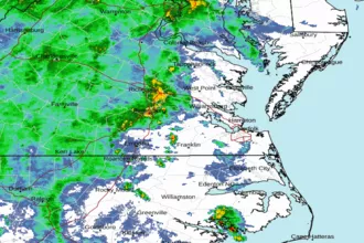 Wakefield Norfolk VA Radar
 Northeast Radar
 East Coast Satellite