Savannah, GA to Altamaha Sound, GA including Grays Reef National Marine Sanctuary Marine Forecast
| Tonight...E Winds 15 To 20 Kt With Gusts To 25 Kt, Diminishing To 10 To 15 Kt Late. Seas 3 To 4 Ft. Wave Detail: E 4 Ft At 5 Seconds And E 1 Ft At 10 Seconds. A Slight Chance Of Showers Early This Evening. |
| Sat...E Winds 10 To 15 Kt. Seas 4 To 5 Ft. Wave Detail: E 4 Ft At 6 Seconds And E 1 Ft At 9 Seconds. |
| Sat Night...E Winds 10 To 15 Kt. Seas 4 To 5 Ft. Wave Detail: E 4 Ft At 7 Seconds. |
| Sun...E Winds 10 To 15 Kt. Seas 4 To 5 Ft, Subsiding To 3 To 4 Ft In The Afternoon. Wave Detail: E 4 Ft At 7 Seconds. |
| Sun Night...Se Winds 5 To 10 Kt. Seas 3 To 4 Ft. Wave Detail: E 4 Ft At 7 Seconds. |
| Mon...Se Winds 5 To 10 Kt. Seas 3 To 4 Ft. Wave Detail: E 4 Ft At 8 Seconds. |
| Mon Night...Se Winds 10 Kt. Seas 3 Ft. |
| Tue...S Winds 10 Kt. Seas 3 Ft. |
| Tue Night...S Winds 10 Kt. Seas 3 Ft. |
| Wed...S Winds 10 Kt. Seas 2 To 3 Ft. |
| Wed Night...S Winds 10 Kt. Seas 2 To 3 Ft. |
| Area Forecast Discussion National Weather Service Charleston SC 748pm EDT Fri April 26 2024 Synopsis High pressure will prevail through much of next week. A weak cold front could approach late next week. Near Term - Until 6am Saturday Morning Early this evening: Aloft, the upper ridge axis will continue to shift eastward and should be aligned up the Eastern Seaboard by sunrise. At the surface, high pressure centered near the New England coast will remain the primary feature, with some hints of a coastal trough just offshore. The overnight is expected to be dry, though we will periodically see offshore showers push toward the coast and dissipate. These showers are developing within narrow corridors of convergence noted in visible satellite imagery, but they have consistently weakened once they get within about 20 miles of shore. We do not expected to see another round of fog and stratus again tonight. Overnight lows should range in the upper 50s to low 60s in most areas, though portions of the coast might not fall out of the mid 60s. Short Term - 6am Saturday Morning Through Monday Aloft, a strong mid-upper level ridge will remain directly over the Southeast United States this weekend, then shift offshore early next week. At the sfc, the local area will remain along the southern periphery of cool high pressure centered to the north while subtle coastal troughing takes place off the Southeast Coast. The setup will favor onshore flow each day, with surface winds slowly veering during the weekend and resulting in a slight warming trend as the ridge aloft starts to slide offshore early next week. Latest guidance continues to suggest low-level flow bringing sufficient moisture onshore in the form of scattered/broken stratocumulus Saturday morning and potentially Sunday morning. High temps should peak into the upper 70s/lower 80s away from the coast this weekend, then low-mid 80s away from the beaches on Monday. Overnight lows should range in the upper 50s inland to mid 60s near the beaches Saturday night and Sunday night. However, lows could be dip into the mid 50s well inland Sunday night due to lighter winds and clear skies leading to more favorable radiational cooling conditions. Long Term - Monday Night Through Friday Mainly dry weather is expected through much of next week as a zonal flow develops across the Southeast by mid-week while surface high pressure centered across the western Atlantic extends across the Southeast. Warm air advection and ample sunshine will yield a warming trend through the week, with high temps peaking in the upper 80s to lower 90s mid to late week. The next chance of rainfall should come with a front potentially reaching the local area next weekend. Marine Tonight: East winds around 15 kt will hold through the night. Seas build under the persistent easterly flow and long fetch building to 3-5 ft and possibly as high as 6 ft late overnight and through much of the upcoming weekend in the Georgia offshore leg out 20-60 NM. We will be hoisting a Small Craft Advisory for that offshore leg starting at 4am early Saturday morning and continuing through Sunday afternoon. Saturday through Tuesday: High pressure centered well north of the region will favor a long east-northeast fetch across local waters this weekend, and support seas building up to 6-7 ft across offshore Georgia waters, where a Small Craft Advisory remains in effect until late Sunday afternoon. Otherwise, marine conditions remain fairly quiet across remaining coastal waters with east-northeast winds peaking near 15-20 kt on Saturday slowly veering to south-southeast during the weekend and weakening to 10-15 kt or less early next week. Rip Currents Moderate onshore winds will continue through the weekend, while approximately 3 ft waves every 6-7 seconds reach the beaches. The local rip current calculator indicates a Moderate Risk of rip currents along all beaches Saturday, then lingering along the Georgia beaches Sunday. NOAA Charleston SC Office: Watches - Warnings - Advisories GA...None. SC...None. Marine Small Craft Advisory from 4am Saturday to 6pm EDT Sunday for AMZ374. |
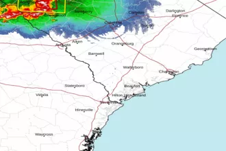 Charleston SC Radar
 Southeast Radar