Tarpon Springs to Suwannee River FL out 20 - 60 NM Marine Forecast
| Overnight...Northeast Winds 5 To 10 Knots, Becoming East 10 To 15 Knots. Seas Around 2 Feet. Wave Detail: East 2 Feet At 3 Seconds And South 1 Foot At 6 Seconds. |
| Thursday...East Winds 10 To 15 Knots, Becoming Northeast 5 To 10 Knots In The Afternoon. Seas Around 2 Feet. Wave Detail: Southeast 2 Feet At 4 Seconds. |
| Thursday Night...Northeast Winds 5 To 10 Knots, Becoming East After Midnight. Seas 1 Foot Or Less, Then Around 2 Feet After Midnight. Wave Detail: East 1 Foot At 3 Seconds And South 1 Foot At 5 Seconds, Becoming Southeast 1 Foot At 4 Seconds. A Slight Chance Of Showers. |
| Friday...East Winds 5 To 10 Knots. Seas Around 2 Feet. Wave Detail: East 1 Foot At 3 Seconds And South 1 Foot At 6 Seconds. A Slight Chance Of Showers. |
| Friday Night...Northeast Winds 5 To 10 Knots, Becoming East After Midnight. Seas Around 2 Feet. Wave Detail: Northeast 1 Foot At 3 Seconds And South 1 Foot At 5 Seconds. A Slight Chance Of Showers In The Evening. |
| Saturday...East Winds Around 10 Knots, Becoming Northeast In The Afternoon. Seas Around 2 Feet. Wave Detail: South 2 Feet At 7 Seconds And East 1 Foot At 3 Seconds. |
| Saturday Night...North Winds 5 To 10 Knots, Becoming East After Midnight. Seas Around 2 Feet. |
| Sunday...Southeast Winds 5 To 10 Knots, Becoming Southwest In The Afternoon. Seas Around 2 Feet In The Morning, Then 1 Foot Or Less. |
| Sunday Night...Northwest Winds 5 To 10 Knots. Seas 1 Foot Or Less. A Slight Chance Of Showers. |
| Monday...North Winds 10 To 15 Knots. Seas Around 2 Feet. A Chance Of Showers. |
GMZ800 Synopsis Issued: 1026 AM EDT Tue Oct 15 2024
Synopsis...
High Pressure Over The Area Will Keep Winds Of Around 10 Knots Or Less And Seas Of 2 Feet Or Less Today. A Cold Front Will Move Across The Waters Wednesday Followed By Increasing Northeasterly Winds Reaching Advisory Levels Through The Weekend.
...
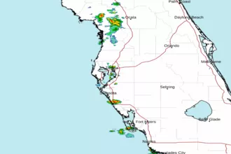 Tampa Bay FL Radar
 Gulf Radar