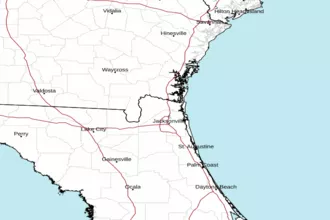
Altamaha Sound, GA to Fernandina Beach, FL 20 - 60 NM Marine Forecast
| Rest Of Today...Southeast Winds 5 To 10 Knots. Seas Around 3 Feet. Wave Detail: Southeast 3 Feet At 7 Seconds. |
| Tonight...Southeast Winds Around 10 Knots. Seas Around 3 Feet. Wave Detail: Southeast 3 Feet At 7 Seconds. |
| Wednesday...South Winds 10 To 15 Knots. Seas 2 To 3 Feet. Wave Detail: Southeast 3 Feet At 7 Seconds And Southeast 2 Feet At 4 Seconds. |
| Wednesday Night...South Winds 15 To 20 Knots, Diminishing To 10 To 15 Knots After Midnight. Seas 3 To 4 Feet, Occasionally To 5 Feet. Wave Detail: Southeast 3 Feet At 6 Seconds. |
| Thursday...South Winds 10 To 15 Knots. Seas 3 To 4 Feet, Occasionally To 5 Feet. Wave Detail: Southeast 3 Feet At 6 Seconds. |
| Thursday Night...Southwest Winds 10 To 15 Knots, Becoming West After Midnight. Seas 2 To 3 Feet. Wave Detail: Southeast 3 Feet At 6 Seconds. A Slight Chance Of Showers. |
| Friday...North Winds Around 10 Knots, Becoming South. Seas 2 To 3 Feet. A Slight Chance Of Showers In The Morning, Then A Slight Chance Of Thunderstorms In The Afternoon. A Chance Of Showers Through The Night. A Chance Of Thunderstorms Through The Night. Showers Likely After Midnight. |
| Saturday...Northwest Winds 5 To 10 Knots, Becoming Southeast. Seas 2 To 3 Feet. A Slight Chance Of Thunderstorms In The Morning. A Chance Of Showers Through The Day. A Chance Of Thunderstorms In The Afternoon, Then A Slight Chance Of Thunderstorms In The Evening. A Slight Chance Of Showers Through The Night. Winds And Seas Higher In And Near Thunderstorms. |
| Area Forecast Discussion National Weather Service Jacksonville FL 716am EDT Tuesday May 5 2026 .KEY MESSAGES... For the latest NE FL and SE GA Daily Key Messages please visit: https:/www.weather.gov/media/jax/briefings/nws-jax-briefing.pdf - Elevated Fire Danger through Thursday. Critically Low Humidity Values Expected Inland Today and Wednesday - Moderate Rip Current Risk at Area Beaches through Wednesday - Near Record High Temperatures on Wednesday and Thursday - Breezy with Scattered Thunderstorms on Thursday Afternoon & Evening. Strong to Isolated Severe Storms Possible Across Inland Southeast GA - Scattered Thunderstorms Friday through Early Next Week - Historic Drought Conditions Prevail Across Most of Our Area Near Term - Through Tonight Main Highligheights This Period: - Elevated Fire Danger at Inland Locations this Afternoon. Near Critically Low Humidity Values are Forecast, with High Daytime Dispersion Values for Inland Locations North of Waycross, GA. - Moderate Risk of Rip Currents at All Area Beaches Early morning surface analysis depicts Atlantic high pressure (1021 millibars) centered near Bermuda, with this feature extending its axis southwestward across our area. Meanwhile, a pair of cold fronts were advancing southeastward from the Upper Midwest and the Great Lakes region. Aloft...northwesterly flow was deepening across the southeastern states on the periphery of a stout ridge that was positioned over Mexico and the Bay of Campeche (southwestern Gulf) that was building northeastward. Latest GOES-East derived Total Precipitable Water imagery indicates that a seasonably dry air mass remains in place across our region, with PWATs (Precipitable Waters) generally ranging from one-half to three quarters of an inch. The northwesterly flow pattern was directing a thin veil of cirrus across southeast GA and portions of northeast FL, with fair skies otherwise prevailing across our region. Winds have mostly decoupled overnight at inland locations, while a light southeast to southerly breeze was continuing at most coastal locations. Temperatures ranged from the lower 50s at a few inland locations to the mid and upper 60s at some coastal locations as of 08Z, with dewpoints ranging from the upper 40s to the mid 50s. Heigheights aloft will begin to rise locally today as a mid-level ridge builds northeastward across the Gulf towards the FL peninsula. The dry air mass over our region will gradually erode from south to north this afternoon, with PWATs (Precipitable Waters) rising above 1 inch at most locations by tonight. Otherwise, "Bermuda" surface ridging will continue to extend its axis southwestward across our area, with a loosening local pressure gradient allowing both the Gulf and Atlantic sea breezes to develop early this afternoon, with these boundaries progressing inland and colliding towards sunset this evening near or just east of the Interstate 75 corridor. There may be just enough moisture around this evening for a few light showers to develop from this mesoscale boundary collision across the Suwannee Valley, but measurable rain chances will remain less than 10 percent for any given location in our area. Plenty of sunshine this morning through the mid-afternoon hours will boost highs to the mid to upper 80s at most inland locations, with highs at coastal locations topping out around 80 before onshore winds strengthen during the mid afternoon hours as the Atlantic sea breeze pushes inland. Low level flow will veer to southerly overnight tonight, with gradually thickening cirrus expected to overspread our area after midnight. This cloud cover should prevent significant fog formation, although some low stratus and fog advecting northward from Apalachee Bay could clip locations along the Suwannee and Alapaha Rivers towards sunrise on Wednesday. Lows will only fall to the upper 50s and lower 60s inland, with a light southerly breeze overnight keeping coastal lows generally in the mid 60s. Short Term - Wednesday Through Thursday Night Main Highligheights This Period: - Initially Dry Weather with Warm Temperatures - Potential for Thunderstorms over SE Georgia on Thursday - Moderate Rip Current Risk at Area Beaches Chances for showers and storms will increase for southeast Georgia and portions of northeast Florida mainly along and north of the I-10 corridor on Thursday as high pressure moves off to the east ahead of an advancing cold front from out of the northwest with the frontal boundary expected to stall in the vicinity of the Georgia / Florida border. High temperatures for Wednesday and Thursday will rise into the lower to mid 90s with overnight low temperatures dropping down into the 60s for inland areas and in the upper 60s and lower 70s along the coastline. Long Term - Friday Through Monday Main Highligheights This Period: - Thunderstorm Chances Continue into Weekend - Stalling Front Late Week - Minor Cool Down & Passing NE FL Showers Convection will continue on through the end of the week into the weekend with the stalled frontal boundary anticipated to lift off to the northeast, resulting in a more moist southwesterly flow establishing over the forecast area for the beginning of next week with widespread convection expected to form ahead of an advancing cold front pressing into the region likely before midweek. Temperatures will be nearer to the seasonal average for southeast Georgia and portions of northeast Florida near and north of the I-10 corridor, with above average temps expected over north central Florida. Marine Atlantic high pressure centered near Bermuda will continue to extend its axis across the northeast Florida waters through Wednesday night. Onshore winds will become breezy across the near shore waters this afternoon and evening, and speeds will likely reach Caution levels on Wednesday afternoon and evening. Otherwise, a cold front entering the southeastern states on Wednesday night will shift prevailing winds to southwesterly across our local waters, with this front then slowing its forward progress as it moves across the Georgia waters on Thursday night, followed by this front stalling over the northeast Florida waters on Friday and Saturday. Scattered showers and thunderstorms are expected to develop along and just ahead of the frontal boundary across the Georgia waters on Thursday evening, with a few strong storms possible through around midnight. Scattered to numerous showers and thunderstorms are then expected to develop throughout our local waters on Friday and Friday evening. Scattered showers and thunderstorms will be possible during the weekend as the front slowly lifts northward ahead of the next possible frontal passage, which is forecast to occur by Monday night or next Tuesday. Rip Currents Persistent onshore winds will become breezy on Tuesday and Wednesday afternoons, with these winds combining with a lingering easterly ocean swell to maintain a higher end moderate risk at the northeast FL beaches and a lower end moderate risk at the southeast GA beaches, where surf heigheights will likely remain around 2 feet. Breezy southwesterly winds should yield a low risk at area beaches on Thursday. Winds will shift to northeasterly on Friday, likely resulting in a moderate risk at area beaches. Fire Weather - High Dispersions Inland Each Afternoon Through Thursday Dry weather is expected to prevail area-wide through Wednesday as high pressure remains in control. With the drier airmass behind the recent front, very good mixing inland each day through Wednesday will result in minRH near critically low values during the afternoon and evening, as well as an overall increase in daytime dispersions each day. The next frontal boundary to affect the area will approach Wednesday Night, bring chances of rain mainly for southeast GA on Thursday with lower chances across northeast FL as the front weakens Thursday Night and into Friday. Thunderstorms will also be possible with the front, especially north of about the I-10 corridor. FOG POTENTIAL AND OTHER REMARKS: Patchy, shallow inland fog possible Tuesday morning. Patchy to areas of fog will be possible at inland locations during the predawn and early morning hours on Wednesday. Climate Record High Temperatures at NE FL/SE GA climate sites for: Wed, May 6: JAX: 96/2012 CRG: 96/2012 GNV: 96/1955 AMG: 95/2012 Thu, May 7: JAX: 94/1977 CRG: 94/1977 GNV: 96/1955 AMG: 93/1962 NOAA Jacksonville FL Office: Watches - Warnings - Advisories FL...None. GA...None. Marine None. |
 Jacksonville Radar
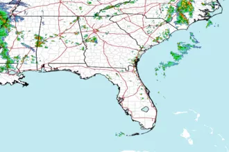
 Southeast Radar