Lake Okeechobee Marine Forecast
| Today...N Winds 5 To 10 Kt, Becoming Ne This Afternoon. Lake Waters Light Chop. A Slight Chance Of Showers And Tstms This Afternoon. |
| Tonight...Ne Winds 10 To 15 Kt, Diminishing To 5 To 10 Kt After Midnight. Lake Waters A Moderate Chop. |
| Tue...Ne Winds 5 To 10 Kt. Lake Waters Light Chop. |
| Tue Night...E Winds 10 To 15 Kt, Diminishing To 5 To 10 Kt After Midnight. Lake Waters A Moderate Chop. |
| Wed...Se Winds Around 5 Kt. Lake Waters Smooth. |
| Wed Night...S Winds 5 To 10 Kt, Becoming Sw After Midnight. Lake Waters Light Chop. |
| Thu Through Fri...S Winds 10 To 15 Kt. Lake Waters A Moderate Chop. Winds And Waves Higher In And Near Tstms. |
| Area Forecast Discussion National Weather Service Miami FL 753am EDT Monday April 27 2026 .SHORT TERM... (Today through Tuesday) Issued at 220am EDT Monday April 27 2026 Persistent mid level troughing will slowly start to push further to the east today in the Atlantic. At the same time, there will still be yet another, but weaker mid level shortwave impulse of energy that pushes through the area, and then rounds the base of the trough offshore as the day progresses. At the surface, a deepening area of low pressure will continue to move northeast as it races further away from the Mid-Atlantic and New England Coastline. The frontal boundary associated with this system will gradually push through the region as the day progresses. This frontal boundary will be in a weakening state as it slowly pushes through the region. Winds across the region will remain rather light and sea breeze driven through most of the day, however, the synoptic scale flow will gradually become northeasterly later in the day behind the frontal boundary. While there will still be enough lift and instability in place to support another round of isolated to scattered showers and thunderstorms this afternoon as the front pushes through, overall coverage looks to be lower when compared to yesterday. This has to do with some more drier air working in across the mid to upper levels and PWAT (Precipitable Water) values generally ranging between 1.3 and 1.5 inches later this afternoon. The best chances of convective development will remain over the interior and Southwest Florida this afternoon where sea breeze boundaries collide. While coverage of storms may be lower this afternoon, An isolated strong storm cannot be entirely ruled out as there remains enough cold air aloft (500mb temps of -10 to -11C) as well as enough instability due to peak diurnal heating. The strongest storms will once again be capable of producing heavy downpours, gusty winds, and small hail. High temperatures today will generally range from the mid 80s across the east coast metro areas to the lower 90s across interior portions of Southwest Florida. A pattern change begins to take place heading into Tuesday as a mid level ridge centered over Mexico and the southwestern Gulf begins to sprawill eastward towards the Florida Peninsula. At the surface, a rather elongated area of high pressure will build into the region from the north. While this will allow for most areas to remain dry on Tuesday, there may be just enough lower level moisture in place to support the potential for a brief shower mainly over the Atlantic waters and immediate east coast. As high pressure moves closer to the area, the pressure gradient will tighten up a bit which will allow for northeasterly wind flow to increase as the day progresses. High temperatures will remain rather warm as they range from the lower 80s along the immediate east coast to the lower 90s across interior portions of Southwest Florida. Long Term (Tuesday night through Sunday) Issued at 220am EDT Monday April 27 2026 Mid level ridging continues to hold over the region on Wednesday, however, it does flatten a little bit as a mid level shortwave passes by well off to the north. At the surface, high pressure remains in firm control of the weather pattern across South Florida as it shifts southeastward into the western Atlantic as the day progresses. This will continue to keep most of the area dry throughout the day. With the center of the surface high remaining close to the region throughout most of the day, winds will remain rather light and sea breeze driven. High temperatures on Wednesday will remain rather warm as they will range from the mid 80s across the east coast metro areas to the lower 90s across interior portions of Southwest Florida. Heading towards the second half of the week, a deepening mid level low/trough complex will dive southeastward from Canada into the Great Lakes region as well as the Northeast and Mid Atlantic States. While this mid level low/trough complex will remain well off to the north of the region, it will flatten the mid level ridge over the Florida Peninsula which will lead to more of a zonal flow during this time frame. At the surface, a deepening surface low will slowly push over the Mid Atlantic and Northeastern states on Thursday into Friday. The cold front associated with system will push through the Deep South and into Northern Florida on Thursday before pushing into Central Florida on Thursday night into Friday. The latest guidance suite has come into better agreement with having this weakening frontal boundary stall out near the Lake Okeechobee region or just to the north during this time frame. While most of the area looks to remain pretty dry for both Thursday and Friday, the frontal boundary looks to get close enough where there may be a slight chance of shower and thunderstorm development mainly near the Lake Okeechobee region. Temperatures will be on a warming trend area wide during this time frame as the synoptic wind flow becomes more south to southwesterly out ahead of the stalled frontal boundary. High temperatures on Thursday and Friday will generally rise into the upper 80s to lower 90s across most of South Florida. Heading into the upcoming weekend, mid level ridging to the south will try to sneak into the region for Saturday which will help to keep the region dry and warm during this time frame. Looking further upstream though, a potent mid level shortwave will start to push out of the Southern Plains and into the Southeast heading into the second half of the weekend. At the surface, the latest global and ensemble guidance is hinting at cyclogenesis taking place along the northern Gulf Coast heading into Sunday and then pushing a frontal boundary close to the region heading into the early portion of next week. This portion of the forecast remains highly uncertain as this is towards the end of the forecast period and guidance does have some differences in regards to the strength and intensity of the mid level shortwave as well as the location of the surface low development and intensity. The latest forecast takes a blend of the forecast models and increases the chances of showers and thunderstorms later in the weekend and into the early portion of next week. This will continue to be monitored as the week progresses. Marine Issued at 220am EDT Monday April 27 2026 A gentle to moderate northeasterly breeze will gradually develop across most of the local waters today as a weakening frontal boundary pushes through the region. The exception to this will be across the Gulf waters, where winds may become west northwest in the afternoon as a Gulf breeze develops. Gentle to moderate east northeasterly wind flow will remain in place across all local waters on Tuesday before become more southeasterly towards the middle of the week. Seas across the Atlantic waters will range between 1 to 3 feet today before increasing to 3 to 6 feet tonight into Tuesday as a northeasterly swell develops behind the frontal boundary. Seas across the Gulf waters will remain at 2 feet or less through the middle of the week. Beaches Issued at 220am EDT Monday April 27 2026 A moderate risk of rip currents will develop across the Palm Beaches today as a northeasterly swell begins to build in the Atlantic waters and onshore flow starts to increase. NOAA Miami FL Office: Watches - Warnings - Advisories FL...None. AM...None. GM...None. |
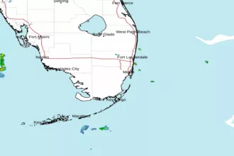
 Miami FL Radar
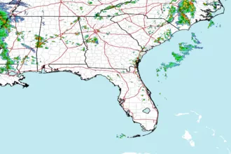
 Southeast Radar