Tropical Depression Henri
Tropical Depression Henri Tracking
Tropical Depression Henri Wind Forecast
Tropical Depression Henri Rainfall Forecast


Tropical Depression Henri Surge Forecast

2026 Storm Names
• Arthur
• Bertha
• Cristobal
• Dolly
• Edouard
• Fay
• Gonzalo
• Hanna
• Isaias
• Josephine
• Kyle
• Leah
• Marco
• Nana
• Omar
• Paulette
• Rene
• Sally
• Teddy
• Vicky
• Wilfred


Tropical Discussion
Atlantic Tropical Weather Discussion
NWS National Hurricane Center Miami FL
8:15PM EDT (0015 UTC) Sun June 7 2026
Tropical Weather Discussion for North America, Central America, Gulf of America (Gulf of Mexico), Caribbean Sea, northern sections of South America, and Atlantic Ocean to the African coast from the Equator to 31N. The following information is based on satellite imagery, weather observations, radar and meteorological analysis.
Based on 1800 UTC surface analysis and satellite imagery through 2230 UTC.
Tropical Waves
The tropical wave that emerged off of Africa earlier this morning has it axis along 20W, south of 15N, moving W at around 15 kt. Widely scattered moderate convection is depicted from 03N to 08N between 14W and 26W.
A tropical wave is near 32W, south of 13N, moving W at 15 kt. Scattered moderate convection is noted where the wave meets the monsoon trough from 02N to 06N between 27W and 34W.
Another tropical wave is along 57W-58W, south of 13.5N, moving westward at 15 to 20 kt. Scattered moderate isolated strong convection is evident from 02.5N to 12N between 51W and 59W.
A tropical wave is over the eastern Caribbean Sea along 66W, south of 15N, moving westward at 15 to 20 kt. The wave appears to enhance convection over portions of Venezuela, but no significant convection is seen over the Caribbean.
Another tropical wave is moving across the western Caribbean Sea. Its axis is along 82W-83W, south of 19N into the EPAC region, moving W at 15 kt. Scattered moderate to strong convection is observed behind the wave N of 15N and across the waters and islands of Jamaica, and eastern Cuba, as it interacts with an upper trough along 80W. Scattered moderate to strong convection is also near the southern portion of the wave axis and along the eastern end of the EPAC monsoon trough.
Monsoon Trough And Intertropical Convergence Zone - ITCZ
(The ITCZ is also known by sailors as the doldrums)
The monsoon trough enters the Atlantic through the coast of Senegal near 14N17W and continues southwestward to 03N35W. The ITCZ extends from 03N35W to the coast of Brazil near 01.5N50W. Widely scattered moderate convection is about the ITCZ from 02N to 06N between 35W and 48W. Additional convection across the area is related to the tropical waves mentioned above.
...Discussion: Gulf Of America (Gulf Of Mexico)
High pressure over the western Atlantic W of Bemuda extends west-southwestward into the SE United States and NE Gulf waters, supporting gentle to moderate SE to S winds across most of the basin, with the exception of moderate to fresh E-NE winds through the Florida Straits. Seas are slight to moderate within these wind speeds, with maximum seas to 6 ft occurring NW of the Yucatan Peninsula. A surface trough over the western part of the basin is supporting scattered moderate convection south of 26.5N and west of 92W. Scattered moderate convection over coastal Mississippi and Alabama is shifting into those area coastal waters.
For the forecast, the west Atlantic ridge will continue to dominate the Gulf region, supporting gentle to moderate E to SE winds over the eastern Gulf and moderate to fresh SE to S winds over the western Gulf through Mon. Winds will be easterly at mostly fresh speeds across most of the western and central Gulf S of 26N through midweek. The exception will be off the Yucatan Peninsula, where a diurnal trough will support moderate winds to pulse to fresh, occasionally strong, during the evenings through Wed. Slight to moderate seas will prevail with these winds.
...Discussion: Caribbean Sea
Two tropical waves are moving westward across the Caribbean Sea. Please, see the Tropical Waves section above for more details.
High pressure north of the area is centered just W of Bermuda, and is combining with lower pressures across South America to support moderate to locally fresh E-SE trade winds and moderate seas across the majority of the basin, with the exception of the SW Caribbean where light to gentle winds are noted. An upper level trough along 80W is supporting scattered moderate to strong convection N of 15N between 70W and 80W, including diurnal convection over Hispaniola, Jamaica, and Cuba, as will as along the monsoon trough in the SW Caribbean. Elsewhere, patches of low level clouds, embedded in the trade wind flow, are noted producing isolated to scattered passing showers.
For the forecast, moderate to fresh E to SE trade winds and moderate seas will persist across the Caribbean through Sun as the Atlantic ridge north of the area weakens and shifts eastward. Winds will begin to increase again over the central Caribbean late tonight into Sun, and over the NW part of the basin Sun night into Monday as the pressure gradient tightens between the Atlantic ridge and a broad area of low pressure located over the eastern Pacific offshore waters of Central America.
...Discussion: Atlantic Ocean
Three tropical waves are moving westward between the W coast of Africa and the Lesser Antilles. Please refer to the Tropical Waves section for more details.
A stalled frontal boundary extends through 31N58W to near 25N76W. SE of the front, a surface trough extends from 27N64W to eastern Cuba. Scattered showers and thunderstorms are along and S of these two features. 1022 mb high pressure over the southeastern United States and the western Atlantic follows this frontal boundary. The remainder of the Atlantic forecast area is dominated by a broad subtropical ridge, anchored by a 1028 mb high pressure situated SW of the Azores near 33N33W. Under the influence of this feature, a gentle to moderate E to SE flow is seen N of 22N E of front to about 45W. Fresh to strong NE winds and rough seas are found north of 17N and east of 40W, including the Canary Islands. The strongest winds are between the islands. Moderate to fresh trades and moderate seas are elsewhere S of 20N between the coast of Africa and the Lesser Antilles, except between Barbados and 50W where recent satellite altimeter data showed a broad zone of 7-8 ft seas.
For the forecast west of 55W, the aforementioned frontal boundary will will dissipate tonight. A surface trough extending to its southeast and into the southeastern Bahamas will drift westward through Monday night. A new cold front will reach from near 31N59W by late Tue, from near 30N55W to 26N63W and stationary to 27N69W, then shift E of the area Thursday as a high center N of the area slides eastward along 33N. This weather pattern will generally support gentle to moderate winds and moderate seas into next week, except for moderate to fresh trades S of 22N between Hispaniola and Cuba starting late Wed.
Forecaster: Scott Stripling, National Hurricane Center
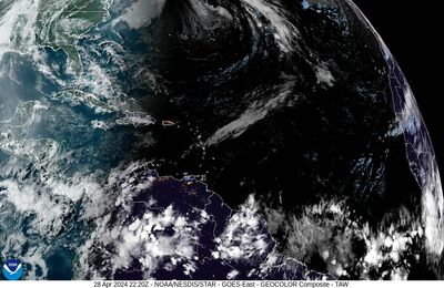 Tropical Atlantic Satellite
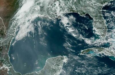 Gulf Satellite
 East Coast Satellite