Buzzards Bay Marine Forecast
| This Afternoon...Se Winds Around 5 Kt, Becoming S. Seas 1 Foot Or Less. Wave Detail: N 1 Ft At 4 Seconds And S 1 Ft At 5 Seconds. |
| Tonight...Sw Winds 5 To 10 Kt. Seas 1 Foot Or Less. Wave Detail: Sw 1 Ft At 3 Seconds And Ne 1 Ft At 4 Seconds. |
| Sat...W Winds 5 To 10 Kt, Becoming Sw 10 To 15 Kt In The Afternoon. Seas 1 Foot Or Less. Wave Detail: Sw 1 Ft At 3 Seconds And Ne 1 Ft At 3 Seconds. |
| Sat Night...Sw Winds 10 To 15 Kt. Seas Around 2 Ft In The Evening, Then 1 Foot Or Less. Wave Detail: Sw 1 Ft At 4 Seconds And Se 1 Ft At 8 Seconds. |
| Sun...Sw Winds 10 To 15 Kt. Gusts Up To 20 Kt In The Afternoon. Seas 1 Foot Or Less. Wave Detail: Sw 1 Ft At 4 Seconds And Se 1 Ft At 8 Seconds. |
| Sun Night...Sw Winds 10 To 15 Kt. Seas 1 Foot Or Less. Wave Detail: Sw 1 Ft At 4 Seconds And Se 1 Ft At 9 Seconds. |
| Mon Through Tue...Se Winds 5 To 10 Kt. Seas 1 Foot Or Less. |
| Tue Night...S Winds Around 10 Kt. Seas 1 Foot Or Less. A Chance Of Showers. Seas Are Reported As Significant Wave Height, Which Is The Average Of The Highest Third Of The Waves. Individual Wave Heights May Be More Than Twice The Significant Wave Height. |
| Area Forecast Discussion National Weather Service Boston/Norton MA 1107am EDT Fri April 26 2024 Synopsis High pressure across the northeastern states allows for dry weather, chilly nights, and comfortable afternoons through the first-half of the weekend. Unsettled pattern sets up for Sunday into early next week with shower chances. Temperatures turn milder for some but a back door cold front likely keeps the warmest air over western SNE Monday. Near Term - Until 6pm This Evening 1100am Update: Another stellar day today weatherwise as high pressure dominates. Conditions hould again be very similar to yesterday, with bluebird skies and lots of sun, sea- breezes near the coasts, although temperatures a few degrees milder than yesterday. Seabreeze on the eastern MA coast already has developed and should take place closer to early/midafternoon along the South Coast of RI/MA and Narrangasett Bay. Sea breezes will also keep coastal areas colder with higher dewpoints in the low to mid 30s, compared to quite low dewpoints in the upper single digits to mid teens inland. Tried to better show the trend in dewpoints by blending in some the WRF-ARW dewpoints into the official forecast. But overall another pleasant day on tap. Previous discussion: A quiet and sunny day ahead with surface high pressure firmly in place over southern New England. Nearly a carbon copy forecast from Thursday. After starting with temperatures in the 20s and low 30s, today warms into the upper 50s and low 60s for most, though coastal towns remain cooler. Why? An on shore wind/ sea breeze develops by mid-morning. Here temperatures reach the low 50s. With a sprawling high pressure system the mean wind direction of the boundary layer is tough to nail down, do think wind direction is a bit variable today, though eastern Massachusetts sees an easterly wind due to the sea breeze. Southern Rhode Island and south coast of Massachusetts seas more of a southerly wind, once again due to the sea breeze. Short Term - 6pm This Evening Through 6pm Saturday Copy & Paste: Yet another dry, clear, and cold night across southern New England. That said, do not think temperatures dip as low as it has done the past two nights. Given repetitiveness of the forecast, leaned on the biased-correct CONSMOS and made manual adjustments to our prone locations that radiate on clear and calm nights. Overall, widespread lows in the middle and upper 30s for the coastal plain and upper 20s and low 30s across the interior. Where we could see temperatures drop lower, our known radiators; I-495 corridor, hallows of eastern CT, and Martha's Vineyard - Here temperatures may drop between 28F and 32F. Given the limited area, will hold off this morning on issuing a Freeze Watch. This situation might be better handled with a Frost Advisory, but will leave that up to the day crew after reviewing the latest data. As for Saturday, a sunny and comfortable one with surface high pressure anchored south of Block Island. Light winds and clear skies will allow for temperatures to climb into the low and middle 60s away from the coast. At the coast, a sea breeze likely to develop given persistent pattern, highs will only reach the middle and upper 50s. By late afternoon a mid-level shortwave approaches from the west with a surface warm front. Day light hours remain dry, though mid and high clouds begin to move in from west to east during the late afternoon. Long Term - Saturday Night Through Thursday Key Points... * Scattered showers Saturday night become more hit-and-miss Sunday into Monday; more widespread rain chances through mid week with potential for a thunderstorm. * Warming trend through next week but a back door cold front likely keeps warmest air confined to western SNE. Details... Sunday and Monday... A passing warm front and weak isentropic lift will lead to widely scattered showers across southern New England Saturday night. Lack of strong forcing will limit rainfall amounts to a few hundredths to a few tenths focused over western MA/CT with lesser amounts to the east. This comes as high pressure sinks south of the region and the trough of low pressure drops from Canada into New England Sunday into Monday. Thus, despite being on the periphery of a mid level ridge can't rule out some hit-and-miss showers each day with a good amount of cloudcover. The biggest impact of the track of this low will be a backdoor cold front that, despite a steadily warming mid level airmass (850 mb temps up to +10C by Monday for some), will keep the more significant warm up confined to western MA/CT on Monday. There remains a high degree of uncertainty with respect to high temperatures, especially Monday as the front looks to drop through Sunday night. Tuesday through Thursday... Guidance is looking slower to kick steering flow back to southerly for Tuesday which is not increasing confidence in the temperature forecast beyond Monday either. A seasonable airmass does look to remain in place though, with highs in the low to mid 60s for Tuesday and warming further Wed/Thu. Again, this will be highly dependent on the how the pattern evolves beyond Monday which remains uncertain. What is largely agreed upon is our mid level ridging finally breaking down with a shortwave and frontal system moving through on Tuesday bringing the return of more widespread rain showers. Some thunderstorms are possible, mainly over western MA/CT where there exists several hundred J/kg of CAPE but forcing does not look especially strong. Marine Forecaster Confidence Levels: Low - less than 30 percent. Medium - 30 to 60 percent. High - greater than 60 percent. Today through Saturday... High confidence. Tranquil boating conditions through Saturday as high pressure builds southeastward into the coastal waters. Today: Sunny. Light north winds (easterly near shore) early today, this afternoon, winds turn southerly around 10-15 kt. Seas 3 ft or less. Tonight: Dry. Winds becomes more westerly and are less than 10 knots. Seas 2 ft or less. Saturday: Sunny. Increasing southwest winds 10 to 15 knots, seas 2-3 ft. Outlook /Saturday Night through Tuesday/... Saturday Night through Sunday Night: Winds less than 25 kt. Slight chance of rain showers. Monday: Winds less than 25 kt. Monday Night: Winds less than 25 kt. Slight chance of rain showers. Tuesday: Winds less than 25 kt. Seas locally approaching 5 ft. NOAA Boston MA Office: Watches - Warnings - Advisories CT...None. MA...None. RI...None. Marine None. |
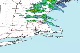 Boston MA Radar
 Northeast Radar
 East Coast Satellite