Cape Cod Bay Alt Marine Forecast
| Today...Sw Winds 10 To 15 Kt With Gusts Up To 20 Kt. Seas Around 2 Ft. Wave Detail: Sw 1 Ft At 2 Seconds And E 1 Ft At 9 Seconds. |
| Tonight...Sw Winds 10 To 15 Kt, Becoming W After Midnight. Seas Around 2 Ft. Wave Detail: E 2 Ft At 10 Seconds And Sw 1 Ft At 3 Seconds. Patchy Fog. Vsby 1 To 3 Nm. |
| Mon...N Winds 5 To 10 Kt With Gusts Up To 20 Kt. Seas Around 2 Ft. Wave Detail: E 2 Ft At 10 Seconds And Nw 1 Ft At 3 Seconds. |
| Mon Night...E Winds Around 5 Kt, Becoming N After Midnight. Seas Around 2 Ft. Wave Detail: Ne 2 Ft At 7 Seconds And Nw 1 Ft At 4 Seconds. |
| Tue And Tue Night...Se Winds 5 To 10 Kt. Seas Around 2 Ft. Wave Detail: E 1 Ft At 3 Seconds And Ne 1 Ft At 6 Seconds. A Chance Of Rain. |
| Wed...E Winds 5 To 10 Kt. Seas Around 2 Ft. Wave Detail: E 1 Ft At 2 Seconds And Ne 1 Ft At 6 Seconds. A Chance Of Rain. |
| Wed Night Through Thu Night...S Winds 5 To 10 Kt. Seas 1 Foot Or Less. Seas Are Reported As Significant Wave Height, Which Is The Average Of The Highest Third Of The Waves. Individual Wave Heights May Be More Than Twice The Significant Wave Height. |
| Area Forecast Discussion National Weather Service Boston/Norton MA 640am EDT Sunday April 28 2024 Synopsis Warm but unsettled conditions today with a few chances of widely scattered showers through early Monday. Mainly dry and warm temperatures on tap for Monday, except it's considerably cooler along portions of the immediate coast. A backdoor cold front will bring cooler temperatures Tuesday and Wednesday before it warms up again by late in the week. The greatest risk for a period of showers will be later Tuesday into Wednesday. Next period of unsettled weather arrives around Saturday. Near Term - Until 6pm This Evening Numerous showers across southern New England into northern New York early this morning, in northern New York there is enough instability for rumbles of thunder. These showers are associated with a warm front that is slowly making its way across the northeast states. Would not be shocked if a couple make it to western Massachusetts or northwestern Connecticut. Otherwise, showers east of the CT River will diminish shortly after sunrise. Surface high pressure which gave us wonderful conditions over the past couple of days is shifting south along with surface pressure falls. Today features more clouds than sunshine. WAA (Warm Air Advection - the movement of warm air) increases PWATs (Precipitable Waters) across southern New England, well above an inch in most cases. Aloft, mid-level ridge with pulses of energy provides enough lift to keep the clouds about and a few hit-and-miss showers. An isolated rumble of thunder is not out of the question for areas furtherest north and west where a some breaks in the clouds may allow for a few hundreds units of CAPE. Window for these showers are between 22z and 03z, does look to be more sct'd in nature. Will say there are some discrepancies in the CAMs this morning, most notably the ARW, which shows more widespread light to moderate rains with potential for embedded thunder into southern Connecticut. Given higher PWATs, higher humidity is on tap today, dewpoints are increasing through the 40s and 50s. This is most noticeable since the previous two days have featured dewpoints in the 20s and 30s. Highs this afternoon climb into the upper 60s and lower 70s away from the coast. Perhaps a few mid 70s in the mid CT River Valley. The coastal plain, areas south of Boston to Providence area in the mid 60s. The immediate south coast will be the coolest do to the onshore winds, from the southwest, keep temperatures in the mid 50s to 60 degrees. Short Term - 6pm This Evening Through 6pm Monday A mild night ahead, many locations are in the lower and mid 50s, at the coast temperatures are slightly cooler in the upper 40s and low 50s. Deep southwest flow and overcast sky cover helps maintain these temperatures. Any lingering showers exit the region between 03z and 06z. Do think there will be areas of coastal fog that develops, many VSBY guidance show potential of widespread fog and/or low stratus. A wind shift to the north-northwest around dawn should help to advect lower dewpoints, this should help to cut down on the duration of the fog. That said, a later shift in the wind could prolong the fog across southeast Massachusetts and Rhode Island. Clouds to start Monday, mid-level ridging is nearly over New England by afternoon should promote cloud cover to gradually thin. Otherwise a warm afternoon away from the coast. While coastal towns are in the upper 50s and lower 60s, just a few miles inland temperatures quickly climb into the 70s! Further inland, mid and upper 70s are a good possibility. In fact, NBM has 20-30 percent probabilities of 80F across the lower CT River Valley, Springfield to Hartford. What will be tricky, how far inland does the sea breeze make it. If the guidance shows the sea breeze to be a bit strong it could mean the forecast highs will need to be lowered. In addition, if clouds remain stubborn and don't thin out enough, it could lead to cooler temperatures as well. Something to keep in mind heading into Monday. Long Term - Monday Night Through Saturday Key Points... * Periodic rain chances through the week, first late Tue/Wednesday then again on Friday. * After a warm start to the week temps cool Tue/Wednesday before warming back up late week. Details... Tuesday and Wednesday... Tuesday a weak surface low pressure moves into SNE and this in conjunction with the high to the north will push a backdoor cold front through the region taking those 70s we enjoyed on Monday out of the forecast for two days. Highs will be limited to the 60s (inland) and 50s (along the coast) each day. A mid level shortwave moves out of the Great Lakes Tuesday night bringing a round of light rain to the region overnight into Wednesday. The best forcing from divergence at 300 mb and upslope orographics will place the bullsey for the largest rainfall totals over northern/central MA and areas further to our north and west. Thursday through Saturday... Mid level ridging then builds in for the latter half of the week leading to a warming airmass (highs back into the 70s!) and dry weather. The trend in the guidance over the last 24 hours has been to slow the advancement of our next disturbance, now looking more likely to bring unsettled weather for sometime over the weekend but as early as Friday night. GEFS ensemble guidance is more excited about the possibility of measurable rain Friday night than the EPS; for now sticking with a blend and low POPs. Marine Forecaster Confidence Levels: Low - less than 30 percent. Medium - 30 to 60 percent. High - greater than 60 percent. Through Monday... High confidence. Generally tranquil boating conditions expected through Sunday outside of a few rounds of widely scattered showers overnight tonight and tomorrow evening. Onshore breeze across the eastern waters will subside quickly this evening giving way to primarily south/southwest winds for Sunday. Some patchy fog possible Sunday night into early Monday morning. Dry conditions with mix of clouds Monday afternoon along with northerly winds 10 to 15 knots. Seas mainly 3ft or less all waters. Outlook /Monday Night through Thursday/... Monday Night: Winds less than 25 kt. Slight chance of rain. Tuesday through Wednesday: Winds less than 25 kt. Chance of rain. Wednesday Night through Thursday: Winds less than 25 kt. NOAA Boston MA Office: Watches - Warnings - Advisories CT...None. MA...None. RI...None. Marine None. |
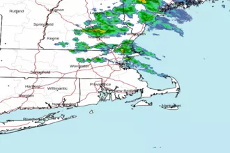 Boston MA Radar
 Northeast Radar
 East Coast Satellite