High Island to Freeport, TX 20 - 60 NM Marine Forecast
| Tonight...Southeast Winds Around 20 Knots, Increasing To 20 To 25 Knots Late. Seas 6 To 8 Feet With Occasional Seas Up To 10 Feet. |
| Saturday...Southeast Winds 20 To 25 Knots. Gusts To 35 Knots Late In The Morning. Seas 7 To 10 Feet With Occasional Seas Up To 13 Feet. |
| Saturday Night...Southeast Winds Around 25 Knots. Gusts To 35 Knots Until Early Morning. Seas 9 To 11 Feet With Occasional Seas Up To 14 Feet. |
| Sunday...Southeast Winds 20 To 25 Knots With Gusts Up To 35 Knots. Seas 10 To 11 Feet With Occasional Seas Up To 14 Feet, Subsiding To 8 To 11 Feet With Occasional Seas Up To 14 Feet In The Afternoon. |
| Sunday Night...Southeast Winds 15 To 20 Knots. Seas 6 To 9 Feet With Occasional Seas Up To 11 Feet. |
| Monday...Southeast Winds 10 To 15 Knots. Seas 5 To 7 Feet With Occasional Seas Up To 9 Feet. A Chance Of Showers. A Chance Of Thunderstorms In The Afternoon. |
| Monday Night...Southeast Winds Around 15 Knots. Seas 5 To 6 Feet With Occasional Seas Up To 8 Feet. A Chance Of Showers In The Evening. |
| Tuesday...Southeast Winds 10 To 15 Knots. Seas 4 To 6 Feet With Occasional Seas Up To 8 Feet. |
| Tuesday Night...Southeast Winds Around 15 Knots. Seas 4 To 5 Feet. |
| Wednesday...Southeast Winds Around 15 Knots. Seas 4 To 5 Feet. |
| Wednesday Night...Southeast Winds Around 15 Knots. Seas 4 To 5 Feet. Winds And Seas Higher In And Near Thunderstorms. |
| Area Forecast Discussion National Weather Service Houston/Galveston TX 630pm CDT Fri April 26 2024 Long Term (Sunday through next Thursday) Issued at 331pm CDT Fri April 26 2024 There are a number of features we will need to watch for Sunday and Monday. The first is the aforementioned frontal boundary that will slowly creep into our neck of the woods from the west on Sunday. The other is a mid/upper trough currently digging southward over western CONUS. We will also need to monitor smaller disturbances embedded in the flow the aloft that could further enhance lift. By Sunday, the trough is expected to take on a negative tilt, with its axis roughly extending from eastern Colorado down to central Texas. Mid/upper south-southwest to southwest shear will increase through the day on Sunday as a result. Meanwhile in the low levels, deepening low pressure over the central plains coupled with continued high pressure over eastern CONUS will steepen the LL gradient and enhanced deep moist LL onshore flow (sfc-850mb). You will feel this via a strong breeze and plentiful humidity. The confluence of these features are expected to result in scattered showers and thunderstorms on starting late morning / early afternoon on Sunday, continuing into the morning and possibly the afternoon on Monday. The Weather Prediction Center has put most of our region under a Marginal Risk (Level 1 of 4) of excessive rainfall while our northern counties are under a Slight Risk (Level 2 of 4). An isolated strong to severe thunderstorm cannot be ruled out in our northern counties on Sunday. Both the mid/upper trough and surface low pressure system pull northeastward and gradually lose their influence over the area on Monday. Despite the loss of larger scale forcings, continued high PWATs (Precipitable Waters) and the presence of weak mid/upper disturbances may suffice for isolated to scattered showers and thunderstorms on Tuesday and Wednesday. Global models indicate a more well defined mid/upper shortave could bring a better chance of showers/thunderstorms on Thursday. However, the best lift may remain north and west of our region. Regarding temperatures, the forecast is pretty warm and humid with Marine Issued at 433pm CDT Fri April 26 2024 Strong onshore flow will continue through the weekend along with enhanced seas. Small Craft Advisories are in effect through Sunday morning. Minor coastal flooding cannot be ruled out Saturday morning of in the bays, particularly upper portions of bays. Scattered showers and thunderstorms are possible on Sunday and Monday. Onshore winds will gradually decrease late Sunday into Monday. However, there will likely be a lag in the decreasing seas. Therefore, it is possible that advisories will need to be extended into Monday for areas offshore. Moderate onshore flow is expected to persist through much of the upcoming week. NOAA Houston/Galveston TX Office: Watches - Warnings - Advisories TX...High Rip Current Risk until 9pm CDT this evening for TXZ436>439. GM...Small Craft Advisory until 7am CDT Sunday for GMZ330-335-350- 355-370-375. |
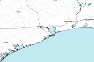
 Houston/Galveston TX Radar
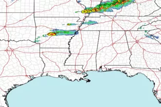
 Gulf Radar