Galveston Bay Marine Forecast
| Today...South Winds 10 To 15 Knots. Bay Waters Slightly Choppy. |
| Tonight...Southeast Winds 10 To 15 Knots. Bay Waters Slightly Choppy. |
| Tuesday...South Winds 10 To 15 Knots With Gusts Up To 20 Knots. Bay Waters Slightly Choppy. |
| Tuesday Night...South Winds 10 To 15 Knots. Bay Waters Slightly Choppy. |
| Wednesday...South Winds Around 10 Knots, Increasing To 10 To 15 Knots In The Afternoon. Bay Waters Smooth, Increasing To Slightly Choppy In The Afternoon. |
| Wednesday Night...South Winds 10 To 15 Knots, Becoming Southeast Around 10 Knots After Midnight. Bay Waters Slightly Choppy, Diminishing To Smooth After Midnight. |
| Thursday...East Winds Around 10 Knots, Increasing To 10 To 15 Knots In The Afternoon. Bay Waters Smooth, Increasing To Slightly Choppy In The Afternoon. A Chance Of Showers And Thunderstorms In The Afternoon. |
| Thursday Night...East Winds 15 To 20 Knots. Bay Waters Choppy. A Chance Of Showers After Midnight. |
| Friday...East Winds Around 20 Knots, Becoming Southeast 20 To 25 Knots In The Afternoon. Bay Waters Choppy, Increasing To Rough In The Afternoon. A Chance Of Thunderstorms. A Chance Of Showers In The Morning, Then Showers Likely In The Afternoon. |
| Friday Night...Northeast Winds 20 To 25 Knots. Bay Waters Rough. Showers Likely, Mainly In The Evening. Winds And Waves Higher In And Near Thunderstorms. |
| Area Forecast Discussion National Weather Service Houston/Galveston TX 500am CDT Monday April 27 2026 Issued at 1126pm CDT Sunday April 26 2026 A shortwave trough is expected to fill northeast through the Plains, sending a cold front towards SE Texas. As mentioned over the last several days, this front will more than likely slow and eventually stall out. CAMs are pretty well aligned with these surface features, showing a dry line stalled out around Central TX (spanning SW to NE), with the aforementioned cold front stalled near the Red River Valley (Running mostly W to E). Closer to our area, CAMs are showing sparse convection with low rain chance. This is, again courtesy of some decent capping beginning around 850mb, with warmer & drier air from the southwest. And just as we've been saying these last several days, the broader environment across the region is still fairly potent for severe weather. SFC CAPE is still forecast to be around 1700-3500 J/KG with 6km shear around 35-45 knots. Decent instability and organization for any storms, if they can manage to pull together. I sound like such a broken record to keep mentioning this over the last several days, but unfortunately we continue to find ourself in this pattern I would call "Non-Zero SVR Threat." There is a fairly strong chance we don't see much of any showers & storms in the afternoon, like previous days. However, if any storms can pull together (whether it be from the sea breeze, a passing shortwave, or some kind of outflow from the norther half of the state), then we could see an isolated severe storm, with mainly strong winds and large hail. On Tuesday Subtropical high pressure builds in from the south. This should establish a mostly zonal flow pattern aloft, allowing several shortwave impulses to pass over the region throughout the next several days. CAMs are still bear on convection, but overall it appears that rain chances should rise throughout the next several days. With those rising rain chances for Tuesday, we'll still have this rather potent environment with SFC CAPE around 1500-3500 J/KG or so with 6km shear around 35-45 knots. Forecast soundings bear a strong resemblance to that of Monday, though 00z CAM guidance does suggest a weaker CAP with steep midlevel lapse rates of 8.0-8.6 DegC/KM. Even if the CAMs aren't showing much yet, I'd still say the severe weather threat for Tuesday is a tad higher than simply "non-zero." Presently, Storm Prediction Center has a marginal risk bordering our northern counties, on Tuesday. Wouldn't be entirely shocked if this risk was eventually nudged southward into our northern tier of counties at some point. Either way, its another afternoon of closely watching the radar to see if anything probability of precipitation up. Rain chances continue to rise into Wednesday as a weak cold front pushes into SE Texas. This front will stall out somewhere over the area, though on the whole this should spell slightly cooler conditions through Thursday. On Friday, a stronger mid/upper level shortwave trough will begin to fill through the southern Plains. This should bring widespread showers and scattered storms throughout the day, along with sending a stronger cold front our way late Friday night. Breezy conditions and cooler weather follow on Saturday, with lingering rain chances throughout the day, tapering off into Sunday morning. 03 Marine Issued at 1126pm CDT Sunday April 26 2026 Light to moderate southeasterly winds will continue through the next several days. Elevated water levels around 2.5 to 3.0 feet above MLLW are still expected at each high tide cycle early this week. A slight increase in winds and seas are expected beginning around Tuesday next week. Isolated showers and thunderstorms will be possible each day with higher rain chances Wednesday though the end of the next work week. A modest cold front should bring moderate to strong offshore winds Friday night into next weekend, likely warranting at least small craft advisories. 03 NOAA Houston/Galveston TX Office: Watches - Warnings - Advisories TX...None. GM...None. |
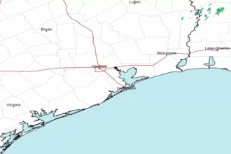
 Houston/Galveston TX Radar
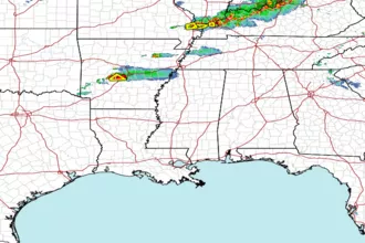
 Gulf Radar