Massachusetts Bay and Ipswich Bay Marine Forecast
| Overnight...Sw Winds 5 To 10 Kt. Seas Around 2 Ft. Wave Detail: Sw 2 Ft At 3 Seconds And Ne 1 Ft At 3 Seconds. |
| Sat...Sw Winds 5 To 10 Kt, Becoming Se In The Afternoon. Seas Around 2 Ft. Wave Detail: Sw 1 Ft At 3 Seconds And E 1 Ft At 3 Seconds. |
| Sat Night...S Winds 5 To 10 Kt, Becoming Sw After Midnight. Seas Around 2 Ft. Wave Detail: E 2 Ft At 9 Seconds And W 1 Ft At 2 Seconds. |
| Sun...Sw Winds 5 To 10 Kt, Becoming S 10 To 15 Kt In The Afternoon. Seas Around 2 Ft. Wave Detail: S 2 Ft At 3 Seconds And E 2 Ft At 9 Seconds. |
| Sun Night...Sw Winds 10 To 15 Kt, Becoming W After Midnight. Seas Around 2 Ft. Wave Detail: Sw 2 Ft At 3 Seconds And E 2 Ft At 10 Seconds. |
| Mon...N Winds Around 10 Kt, Becoming Ne In The Afternoon. Seas Around 2 Ft. Wave Detail: N 2 Ft At 3 Seconds And E 2 Ft At 9 Seconds. |
| Mon Night...Se Winds 5 To 10 Kt. Seas Around 2 Ft. |
| Tue And Tue Night...Se Winds 10 To 15 Kt With Gusts Up To 20 Kt. Seas 2 To 3 Ft. A Chance Of Rain. |
| Wed And Wed Night...E Winds Around 10 Kt, Becoming Se. Seas 2 To 3 Ft. Seas Are Reported As Significant Wave Height, Which Is The Average Of The Highest Third Of The Waves. Individual Wave Heights May Be More Than Twice The Significant Wave Height. |
| Area Forecast Discussion National Weather Service Boston/Norton MA 1009pm EDT Fri April 26 2024 Synopsis High pressure over New England moves offshore tonight and remains offshore on Saturday. Another chilly night tonight but not as chilly as last night. Mostly sunny on Saturday, though increasing clouds with chances for light showers arrive early Sunday. Unsettled pattern sets up for Sunday into early next week, though the best chance for showers is around Tuesday or Wednesday. Temperatures turn quite mild for interior western New England Monday, but a backdoor cold front brings much cooler air to coastal areas. Near Term - Until 6am Saturday Morning Update: 10pm Forecast remains on track with no notable updates to the forecast. See prior discussion below. High pressure will continue to gradually shift ESE into the southern offshore waters tonight. Seabreezes should diminish around or shortly before sundown, setting the stage for another night of clear skies and light to calm winds. We should see good radiational cooling conditions develop again. Frost Advisories have been hoisted for several counties in CT, RI and eastern MA where the frost/freeze program is active; that being said, with temperatures running about 3-5 degrees warmer than yesterday, prospects for frost are a little more borderline than was the case last night. This was enough to hold Suffolk and eastern Norfolk Counties out of the Advisory, and it also could be more borderline in Hartford County and those counties around the Providence area but will be close enough to hoist for these locations. If you had planted early, even in areas outside where the Frost Advisory is in effect, take the necessary actions to protect your plants and crops from damage related to frost. Following MOS based approaches to lows, lows range from the upper 20s/around 30 in northwest MA, and around 33-36 for most everywhere, though upper 30s/around 40 in the Boston area. Short Term - 6am Saturday Morning Through Saturday Night 355pm Update: Saturday: High pressure continues to be anchored offshore on Sat, with a highly amplified upper level ridge begins to build into western New England. Expecting a good deal of sunshine again, with sea breezes again developing near the southern and eastern coasts as has been the case the last couple days. However will be seeing an increasing canopy of high clouds spreading in later in the day into western sections of SNE. With temps gradually warming each day, continued strong heating combined with an increased WSW wind away from the immediate coast, it has the look of one of those pre-greenup spring days where temps overachieve available guidance by a significant margin. Highs Saturday away from the coasts should punch well into the 60s and wouldn't rule out some locations in the CT and Merrimack Valleys reaching 70 degrees. Noticeably cooler near shore with highs only in the 50s where seabreezes will govern. Saturday Night: Clouds that had been moving in later Sat afternoon continue to lower, thicken and spread eastward through much of the night. This is in response to a burst of pretty strong warm and moist advection as upper ridge axis crests offshore. Some indication in guidance that lighter showers could develop in western MA/CT during the late- overnight to pre-dawn period, but think modeled Quantitative Precipitation Forecast is overdone as low levels initially struggle to saturate up with several days of preceding dry weather. In fact there's quite a reservoir of dry subcloud air shown on model soundings which even in western areas only saturates enough to support light showers around 09-12z Sun. Carried a 15-45% Probability of Precipitation mention for showers west of Providence, with highest chances near the Berkshires. This would be a relatively higher Probability of Precipitation but very low Quantitative Precipitation Forecast scenario though. With increasing overcast and warming temps aloft, lows project to be considerably warmer than prior nigheights with no chance for frost. Lows should only dip into the low to mid 40s, and a few of the urban centers may stay around the mid/upper 40s. Long Term - Sunday Through Friday Key Points... * Low chance for isolated showers Sunday and Monday. More widespread rain possible mid week * Warming trend through much of next week, but a back door cold front will keep eastern SNE cooler then western SNE. Sunday and Monday The center of the high pressure drops south to the Carolinas, but the upper level ridge axis continues to stretch north in SNE. Being at the top of the ridge axis, weak vorticity impulses, along with weak mid level warm air advection will bring mid to high clouds and low chances for isolated showers both Sunday and Monday. High temperatures Sunday and Monday will be very dependent on a back door cold front working in. Guidance continues to struggle with how far inland the back door cold front will penetrate Sunday, and again on Monday. What will likely occur is that eastern SNE will see high temperatures in the low to mid 60s, while western SNE will see mid to upper 70s, with a chance at low 80s. Tuesday through Friday Upper level ridge axis begins to break down Tuesday into Wednesday as a weakening shortwave trough moves through the region. Details on exact timing and coverage of precipitation remains very uncertain with weak upper level forcing and large spread in the guidance. LREF probs for 0.25 inches of rain remain low, less then 30% each day through Friday. The temperature forecast remains very uncertain during this time period as another upper level ridge builds in to our west allowing another surface high pressure to build over the Gulf of Maine. This could bring continued onshore flow to the region along with continued back door cold fronts. Ensembles are still showing significant amount of spread with the 25th to 75th percentile for high temperatures ranging from the upper 50s to upper 70s across the region. Marine Forecaster Confidence Levels: Low - less than 30 percent. Medium - 30 to 60 percent. High - greater than 60 percent. Tonight through Saturday Night: High confidence. Pleasant boating weather conditions for mariners through most of Saturday, and while that should generally be the case into Saturday evening as well, there is a low chance for showers on the southern waters late Sat night into pre-dawn Sunday. Light southerly winds tonight and into early on Sat. SW winds increase a bit to around 10-15 kt on Sat on all waters, though will become ESE on the eastern nearshore waters Sat late-morning to early evening. Seas mainly 3ft or less all waters. Outlook /Sunday through Wednesday/... Sunday through Sunday Night: Winds less than 25 kt. Slight chance of rain showers. Monday: Winds less than 25 kt. Monday Night through Tuesday: Winds less than 25 kt. Slight chance of rain showers. Tuesday Night through Wednesday: Winds less than 25 kt. Seas locally approaching 5 ft. Slight chance of rain. NOAA Boston MA Office: Watches - Warnings - Advisories CT...Frost Advisory from 2am to 8am EDT Saturday for CTZ002>004. MA...Frost Advisory from 2am to 8am EDT Saturday for MAZ007-014- 017>024. RI...Frost Advisory from 2am to 8am EDT Saturday for RIZ001>007. Marine None. |
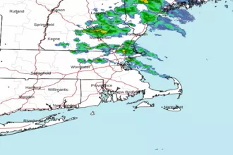 Boston MA Radar
 Northeast Radar
 East Coast Satellite