Matagorda Bay Marine Forecast
| Tonight...Southeast Winds 15 To 20 Knots. Bay Waters Choppy. |
| Friday...South Winds 15 To 25 Knots. Bay Waters Choppy. |
| Friday Night...Southeast Winds 15 To 25 Knots. Bay Waters Choppy. |
| Saturday...Southeast Winds Around 20 Knots, Increasing To 20 To 25 Knots Late. Bay Waters Choppy, Becoming Rough Late. |
| Saturday Night...Southeast Winds 20 To 25 Knots. Bay Waters Rough. |
| Sunday...Southeast Winds 20 To 25 Knots, Diminishing To Around 20 Knots In The Afternoon. Bay Waters Rough, Becoming Choppy In The Afternoon. A Chance Of Showers And Thunderstorms In The Afternoon. |
| Sunday Night...Southeast Winds 20 To 25 Knots, Diminishing To Around 15 Knots After Midnight. Bay Waters Rough, Becoming Slightly Choppy After Midnight. A Chance Of Showers And Thunderstorms In The Evening. |
| Monday...Southeast Winds 10 To 15 Knots. Bay Waters Slightly Choppy. A Chance Of Showers And Thunderstorms In The Afternoon. |
| Monday Night...Southeast Winds 10 To 15 Knots. Bay Waters Slightly Choppy. A Chance Of Showers And Thunderstorms In The Evening. |
| Tuesday...Southeast Winds 10 To 15 Knots. Bay Waters Slightly Choppy. |
| Tuesday Night...Southeast Winds 10 To 15 Knots. Bay Waters Slightly Choppy. Winds And Waves Higher In And Near Thunderstorms. |
| Area Forecast Discussion National Weather Service Houston/Galveston TX 604pm CDT Thu April 25 2024 .SHORT TERM... (This evening through Friday Night) Issued at 257pm CDT Thu April 25 2024 If you've been outside this afternoon, then I'm sure you've noticed that it's a bit breezy out there. Latest surface analysis shows surface low pressure beginning to develop on the lee side of the Rockies, and the 12Z UA obs plot shows a LLJ developing out in Central Texas earlier this morning. This LLJ will steadily slide eastward and will make it over the Brazos Valley by later this afternoon. It'll start out as 25-35 kts this afternoon, then increasing to 35-45 kts by tonight. This combined with the tightening pressure gradient from the developing surface low will lead to elevated winds prevailing throughout the short term period. The main ridge axis will shift off to the east later this afternoon as an upper level trough transitions from the Four Corners region to the Central Plains. Embedded shortwaves within the ridge will attempt to develop some isolated showers, but it'll have a VERY tough time doing so with a capping inversion aloft persisting. The best chances of this occuring will be west of I-45 through this afternoon. High temperatures today will reach the low to mid 80s. Still expecting low temperatures tonight to drop into the low 70s due to increasing low-level clouds and elevated winds persisting. Southwesterly flow aloft is firmly established by Friday as the upper level trough evolves to have an embedded upper level low. Surface low pressure drifts northeastward on Friday causing the associated frontal boundary to become quasi-stationary well to our west. With increasing PVA and elevated PW values (Precipitable Water values) in the 1.4"-1.7" range north of I-10 (90th percentile: ~1.61"), some showers/storms are possible to develop along the tail-end of a convective line advancing ahead of the front. Anything along this line will have to battle a capping inversion to survive, but this cap is weaker over the Brazos Valley. There is plenty of instability in place along with steep 700-500mb lapse rates, so if anything manages to survive long enough in our area there is potential for a storm or two to maintain/become strong to severe. As a result, there is a marginal risk of severe weather (level 1 out of 5) for northern portions of the Brazos Valley/Piney s for Friday. With PW values (Precipitable Water values) exceeding the 90th percentile, there is also a marginal risk of excessive rainfall (level 1 out of 4) on Friday as well for portions of the Brazos Valley/Piney s. This is all under the assumption that storms can maintain themselves long enough in at least a slightly capped environment...which is why it's a marginal risk. As far as temperatures go, expect another day with high temperatures in the low to mid 80s with low temperatures in the low to mid 70s. This will be another night where we may approach record high minimum temperatures in some spots. Batiste Long Term (Saturday through next Wednesday) Issued at 257pm CDT Thu April 25 2024 With a weak surface boundary continuing to sit just to our north (and thereby keeping rainfall out of the area for the time being), the main story of Saturday will be the potential for some of the warmest conditions we've seen across the area in many months. Robust onshore flow will provide both steady WAA (Warm Air Advection - the movement of warm air) and low-level moisture transport, helping to drive a further increase in high temperatures to the mid/upper 80s while dew points sit just above 70. Resultant WBGT values will reach around 80, which is mitigated somewhat by elevated cloud cover and strong winds brought on by a very tight pressure gradient given a deep surface low to the NE. Many locations may in fact reach Wind Advisory criteria during the day on Saturday, with winds reaching around 25 mph with gusts at times reaching in excess of 30 mph. Rainfall chances increase on Sunday as a midlevel low pushes into the Central Plains while the surface boundary drifts back to the south. Scattered showers and storms will become more widespread by the afternoon, and while there remains a limited chance of a stronger storm, severe weather chances remain best well to the north of the area. Associated widespread cloud cover will diminish highs slightly with most values in the low/mid 80s. Overnight lows remain in the lower 70s through the duration of the weekend. The weak boundary will remain stalled over the area through mid- week, with passing shortwaves bringing a chance of showers and storms each day through at least Wednesday. Highs should generally remain in the mid 80s by this time with lows in the lower 70s. Marine Issued at 257pm CDT Thu April 25 2024 Elevated winds will build further heading into the weekend, with sustained winds increasing from around 20 knots tonight to up to 25- 30 knots on Saturday. As this occurs, seas may reach as high as 10 feet at times, and an extended Small Craft Advisory is likely to be required with conditions offshore remaining poor into the early part of next week. Rainfall chances return by late Sunday, becoming more isolated on Monday. Winds and seas will both diminish heading into the early part of next week, remaining generally out of the southeast. Hydrology Issued at 257pm CDT Thu April 25 2024 Only one River Flood Warning remains in effect along the Trinity River. The Trinity River at Moss Bluff (MBFT2) remains in minor flood stage and is forecast to crest some time today. This site is forecast to remain in minor flood stage through Monday. The Trinity River at Riverside (RVRT2) and at Liberty (LBYT2) will remain in action stage until further notice. Additional rounds of rainfall are expected over the next week or so with the highest totals occuring to the northeast of Southeast Texas. With some of the locally heavy rainfall expected to occur along the Upper Trinity River, the subsequent runoff may lead to an even longer period of action stage to minor river flooding along this basin. You can monitor current and forecast conditions at this weblink: water.weather.gov/ahps2/forecasts.php?wfo=HGX Batiste NOAA Houston/Galveston TX Office: Watches - Warnings - Advisories TX...None. GM...Small Craft Should Exercise Caution through Friday evening for GMZ330-335. Small Craft Advisory from 10pm this evening to 7pm CDT Friday for GMZ350-355-370-375. |
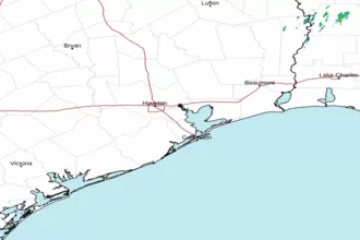
 Houston/Galveston TX Radar
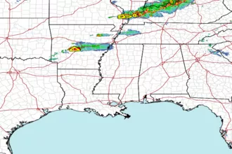
 Gulf Radar