Murrells Inlet to South Santee River SC Marine Forecast
| Overnight...E Winds 10 To 15 Kt. Gusts Up To 20 Kt. Seas 2 To 4 Ft. Wave Detail: E 3 Ft At 11 Seconds And E 2 Ft At 4 Seconds. |
| Fri...E Winds 15 To 20 Kt With Gusts Up To 25 Kt. Seas 3 To 4 Ft. Wave Detail: Se 4 Ft At 5 Seconds. |
| Fri Night...E Winds 15 To 20 Kt With Gusts Up To 25 Kt. Seas 3 To 4 Ft. Wave Detail: E 4 Ft At 5 Seconds. |
| Sat...E Winds 15 Kt With Gusts Up To 20 Kt. Seas 3 To 4 Ft. Wave Detail: E 4 Ft At 5 Seconds. |
| Sat Night...E Winds 10 To 15 Kt. Gusts Up To 20 Kt In The Evening. Seas 3 To 4 Ft. Wave Detail: Se 3 Ft At 7 Seconds. |
| Sun...E Winds 5 To 10 Kt. Seas 3 To 4 Ft. |
| Sun Night...S Winds 5 To 10 Kt. Seas 2 To 3 Ft. |
| Mon...Sw Winds 5 To 10 Kt. Seas 2 To 3 Ft. |
| Mon Night...Sw Winds 10 Kt. Seas 2 To 3 Ft. |
| Tue...Sw Winds 5 To 10 Kt, Increasing To 10 To 15 Kt In The Afternoon. Seas 2 To 3 Ft. |
| Tue Night...Sw Winds 10 To 15 Kt. Seas 2 To 3 Ft. |
| Area Forecast Discussion National Weather Service Wilmington NC 950pm EDT Thu April 25 2024 Synopsis High pressure will build in from the north through Saturday with dry weather expected. A warming trend will develop early next week as the high shifts to off the southeast US coast. Sea breeze has pushed well inland (almost west of the CWA (County Warning Area) at this point) and weak convection that develop north of Pender/Bladen counties has weakened. Clear skies for much of the area right now, but low level moisture will lead to development of mostly cloudy to cloudy skies after midnight. Northeast winds will keep fog from being a concern and, along with clouds, help keep lows near to slightly above climo. Minimal adjustments needed for evening update. Near Term - Through Friday Benign weather through Friday as surface high pressure ridges in from the north and NW flow persists aloft. Just enough moisture for some cumulus this afternoon. but rain is kept out of the forecast except for Pender county (only 20% chance). Some low clouds expected tonight especially near the coast with moister weak onshore flow. Temps tonight right at climatological norms for late April...lows in the mid 50s. Continued dry into Friday with partly cloudy skies and light easterly flow which means slightly cooler temps than today...highs in the low/mid 70s most areas. Short Term - Friday Night Through Saturday Night Mid-upper ridge in place heading into this weekend. Surface high pressure centered well to the northeast Friday night shifts off the Mid-Atlantic coast Saturday, with a weak coastal trough off our coast Saturday morning. Increased clouds Friday night into Saturday in response to coastal trough and weak impulses aloft. Onshore flow, from the surface up to 850mb, will keep high temps Saturday slightly below normal in the upper 70s and low temps near normal in the mid 50s. Long Term - Sunday Through Thursday Deep ridging remains in place, with center of surface high pressure shifting to off our coast Sunday and lingering off the Southeast coast through early next week. The shift of low level winds to southerly and then southwesterly will kick off a warming trend and push temps above normal for next week. Area remains dry through Tuesday with decent subsidence aloft. Upper ridge begins to weaken late Tuesday as a series of shortwaves move across the US/Canada border. Combination of warm temps, sea breeze, increased dewpoints, weakened subsidence, and an inland surface trough mid week, we could see afternoon popcorn convection Wednesday and Thursday. A cold front approaches the area on Thursday, though too far out for models to agree on timing, strength, etc of front. Marine Through Friday...Sub-SCA (Small Craft Advisory) conditions continue with surface high pressure off to the north. An uptick in the ENE flow is expected starting this evening, but only up to 15-20 kt, continuing through the day Friday. This will allow the 2-3 ft seas today to build to 3-4 ft for Friday, mainly driven by increasing easterly 5-6 second waves. Friday Night through Tuesday...Benign marine conditions continue through early next week. Onshore flow Friday night through Saturday night shifts to southerly Sunday as surface high pressure becomes centered east of NC. Winds become southwesterly for the start of the work week as the center of the offshore high pressure moves further southward. With a warming trend kicking in late this weekend, will certainly see sea breeze influence near the coasts each afternoon. Seas 3-4 ft Friday night through Saturday night lowers to 2-3 ft Sunday through Tuesday as northeasterly component weakens, being replaced by an easterly fresh swell and weak wind chop early next week. NOAA Wilmington NC Office: Watches - Warnings - Advisories NC...None. SC...None. Marine None. |
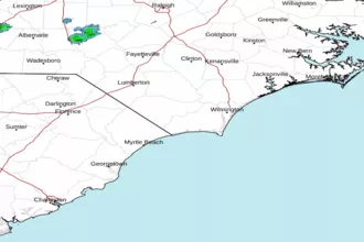
 Wilmington NC Radar
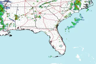
 Southeast Radar