Apalachicola to Destin FL out 20 NM Marine Forecast
| Rest Of Today...South Winds 10 To 15 Knots. Seas Around 2 Feet. Wave Detail: South 2 Feet At 4 Seconds And South 1 Foot At 7 Seconds. Protected Waters A Moderate Chop. |
| Tonight...South Winds 10 To 15 Knots, Increasing To 15 To 20 Knots After Midnight. Seas 2 To 3 Feet. Wave Detail: South 3 Feet At 5 Seconds. Protected Waters Choppy. A Chance Of Showers After Midnight. |
| Thursday...West Winds 20 To 25 Knots. Seas 3 To 5 Feet, Occasionally To 6 Feet, Building To 5 To 7 Feet, Occasionally To 9 Feet In The Afternoon. Wave Detail: West 4 Feet At 5 Seconds, Becoming West 7 Feet At 7 Seconds. Protected Waters Rough. A Chance Of Showers, Mainly In The Morning. |
| Thursday Night...Northwest Winds 20 To 25 Knots. Seas 5 To 8 Feet, Occasionally To 10 Feet. Wave Detail: West 7 Feet At 7 Seconds. Protected Waters Rough. |
| Friday...North Winds 15 To 20 Knots, Diminishing To 5 To 10 Knots In The Afternoon. Seas 3 To 5 Feet, Occasionally To 6 Feet. Wave Detail: Northwest 5 Feet At 7 Seconds And Northwest 1 Foot At 4 Seconds. Protected Waters Choppy. |
| Friday Night...West Winds 5 To 10 Knots. Seas 2 To 3 Feet. Wave Detail: West 2 Feet At 7 Seconds And North 1 Foot At 4 Seconds. Protected Waters A Light Chop. |
| Saturday...Northwest Winds Around 5 Knots, Becoming Southwest In The Afternoon. Waves 1 Foot Or Less. Protected Waters Smooth. |
| Saturday Night...South Winds Around 5 Knots. Waves 1 Foot Or Less. Protected Waters Smooth. |
| Sunday...Southeast Winds 5 To 10 Knots. Waves 1 Foot Or Less. Protected Waters A Light Chop. |
| Sunday Night...South Winds Around 10 Knots. Seas Around 2 Feet. Protected Waters A Light Chop. A Slight Chance Of Showers And Thunderstorms After Midnight. Winds And Waves Higher In And Near Thunderstorms. |
| Area Forecast Discussion National Weather Service Tallahassee FL 859am EDT Sat April 4 2026 ...New .KEY MESSAGES... Issued at 858am EDT Sat April 4 2026 - Showers and thunderstorms will accompany a cold front as it crosses the region on Sunday. A few of the storms may be strong. Beneficial rain will affect much of the region, but forecast rainfall amounts below 1 inch will offer no drought improvement. - A prolonged period of high rip current risk will continue at all local beaches through this evening. Swim near a lifeguard, and heed the advice of beach flags. Issued at 858am EDT Sat April 4 2026 No changes are needed to the forecast this morning. .SHORT TERM... (Today and Tonight) Issued at 1239am EDT Sat April 4 2026 Satellite-derived Precipitable Water (PW) imagery currently shows a bullseye of moister PW values (Precipitable Water values) in the 1.5-1.6 inch range over our Eastern Time Zone counties. Meanwhile, a nose of drier mid- level air is currently located east of Florida. Southeasterly flow in the 1000-700 mb layer will bring the moister bullseye to an area extending from Marianna FL northward up the Chattahoochee River. So that is where another round of air mass thunderstorms will most heavily focus this afternoon. Meanwhile, the drier air currently east of Florida will arrive by mid-afternoon over the southeast Big Bend up to near Valdosta, so that is where afternoon thunder is least favored. Long Term (Sunday through Friday) Issued at 1239am EDT Sat April 4 2026 A cold front will push south across the region during the day on Sunday. It should readily bring a scattering a showers, thunderstorms, and trailing stratiform rain to area along and west of the Flint and Apalachicola Rivers. East and southeast of there, upper level support will quickly exit and start to orphan the front, so convective coverage and rain chances will decrease as you head into south-central Georgia and the FL Big Bend late Sunday and Sunday evening. Behind the front on Monday, a cooler and drier low-level air mass will overspread the area. The fly in the ointment is that the subtropical jet stream will become more active on Monday and Tuesday, when two separate shortwave will zip east across the Gulf. Mainly for our Florida and far south Georgia counties, this could provided the lift needed to squeeze some light rain out of a thick mid-level cloud deck. By Wednesday, the southern stream will mainly be enhancing rain further south over the Gulf and the FL Peninsula, but our continuation of 20-30 probability of precipitation over our FL counties accounts for uncertainty with the northern extent of rain in a Day 5 forecast. Larger scale lift from the southern jet stream will move out east of Florida on Thursday, leaving us more confidently high and dry through Friday. Building 500 mb heigheights on Friday will further cap the air mass. Low-level easterly flow will really pick up on Wednesday, as the southern periphery of strong high pressure over the Great Lakes region bridges south across the tri-state area. Ensemble mean 925 mb winds suggest gusts of 25-30 mph are likely, with winds peaking on Thursday. Meanwhile, the Gulf waters are likely to see a few days worth of solid Small Craft Advisory conditions. Marine Issued at 1239am EDT Sat April 4 2026 Moderate southeast breezes will weaken and become light to gentle from Saturday night through most of Sunday. A cold front will settle south across the waters on Sunday evening, followed by fresh and possibly strong north to northeast breezes through Monday morning. Winds will clock around easterly by early Tuesday, as high pressure moves off the North Carolina coast. The southern periphery of strong high pressure will bridge south across the waters late Tuesday, freshening the easterly breezes. Small Craft Advisory conditions are likely on Wednesday. Fire Weather Issued at 1239am EDT Sat April 4 2026 Another round of summer-like thunderstorms will develop this afternoon, most heavily favoring southeast Alabama, the inland Panhandle, and far southwest Georgia. A cold front will pass south across the districts on Sunday afternoon. This will act as a focus for more thunderstorms, though the front will encounter weaker support for storms by the time its gets south across the Big Bend region late Sunday afternoon. A drier air mass will spread across the districts on Sunday night and Monday. Where stronger transport winds and full sunshine can overlap across inland areas, high dispersion would be expected on Sunday and Monday. Areas of morning fog are likely on Saturday and Sunday mornings, mainly over the inland Florida Panhandle, southeast Alabama, and far southwest Georgia. Hydrology Issued at 1239am EDT Sat April 4 2026 Flooding is not expected for the next 7 days. Brief heavy downpours this afternoon between the Flint Valley on the east and U.S. 231 in Alabama on the west could lead to short- lived runoff issues in urbanized locales. NOAA Tallahassee FL Office: Watches - Warnings - Advisories FL...High Rip Current Risk through late tonight for FLZ108-112-114- 115. GA...None. AL...None. GM...None. |
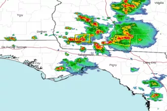 Tallahassee FL Radar
 Gulf Radar