Boston Harbor Marine Forecast
| Today...W Winds 10 To 15 Kt, Becoming Nw This Afternoon. Gusts Up To 25 Kt. Waves Around 2 Ft. |
| Tonight...N Winds 10 To 15 Kt With Gusts Up To 20 Kt, Diminishing To 5 To 10 Kt After Midnight. Waves Around 2 Ft In The Evening, Then 1 Foot Or Less. |
| Fri...N Winds 5 To 10 Kt, Becoming E In The Afternoon. Waves 1 Foot Or Less. |
| Fri Night...Se Winds 5 To 10 Kt, Becoming Ne After Midnight. Waves 1 Foot Or Less. |
| Sat...Ne Winds 5 To 10 Kt, Becoming E In The Afternoon. Waves 1 Foot Or Less. |
| Sat Night...Se Winds 5 To 10 Kt, Becoming W After Midnight. Waves 1 Foot Or Less. |
| Sun Through Mon Night...Ne Winds 5 To 10 Kt. Waves Around 2 Ft. Seas Are Reported As Significant Wave Height, Which Is The Average Of The Highest Third Of The Waves. Individual Wave Heights May Be More Than Twice The Significant Wave Height. |
| Area Forecast Discussion National Weather Service Boston/Norton MA 309am EDT Thu April 23 2026 .WHAT HAS CHANGED... Bumped up wind gusts for late this morning into the afternoon. No other significant changes were needed. .KEY MESSAGES... - Decreasing clouds early this morning, then turning dry with northwesterly breezes. - Dry weather then largely prevails late this week into mid next week, with a possible limited exception being this weekend in far western New England. Cooler than normal temperatures with onshore flow, too. KEY MESSAGE 1...Decreasing clouds early this morning, then turning dry with northwesterly breezes. Overcast conditions carrying over from the evening/overnight still continue early this morning, although recent trends show the western and northwestern edge of the low cloud deck is beginning to erode. This cloud cover should have a short shelf-life, as a cold front now nearing the northwest NY/VT/Quebec border is expected to move through Southern New England during the mid morning to noontime period. Though it was looking like this feature could bring some isolated showers, that now looks unlikely. Instead, it will bring rapid clearing/full sun and a deepening mixed layer which will allow for dewpoints crashing through the 20s and northwesterly breezes. Gusts up to 30 mph through the afternoon in most locations, with full sun. With highs in the mid 50s to lower 60s today, relative humidities are expected to tumble down to around 25-30 percent. Although the combo of gusty northwest winds and this dry air are signals for fire weather concerns, feedback from state forestry partners suggests fuels are not especially receptive to burning in light of the recent cool temperatures and spotty showers, so we've refrained from fire weather headlines. Gusty northwest winds begin to slacken some by evening, with winds becoming light NW and should allow for a pretty chilly night in the 30s, which will be the first of several rather cool nigheights on tap. KEY MESSAGE 2...Dry weather then largely prevails late this week into mid next week, with a possible limited exception being this weekend in far western New England. Cooler than normal temperatures with onshore flow, too. Expansive surface ridge of high pressure from Quebec then governs our weather pattern for late this week into mid next week, to go along with cyclonic flow aloft associated with the western periphery of a closed upper level circulation over ME and Atlantic Canada. This upper circulation is associated with an anomalously cool airmass (e.g. 925 mb temps around 0 to +4C / 850 mb temps around -1 to -5C). This will keep temperatures on the cooler end of late-April normals; strong diurnal ranges leading to cool nights, to go along with onshore flow near the coasts. Could have some scattered lower clouds in eastern MA on Friday, but most of the time is by-and-large mostly clear and dry. Highs in the mid to upper 40s near the immediate eastern coast and into the mid 50s Fri thru the weekend, with good radiational cooling leading to chilly nigheights in the 30s. It looks like it will take until closer to mid next week before temperatures resemble late-April normals. A possible exception to precipitation chances is later Saturday into Sunday in far western MA and western CT. Coarser-resolution global guidance shows a NW-to-SE oriented precipitation shield, associated with a closed low north of the upper Midwest, which could spread clouds and precipitation into the Berkshires and portions of northern CT. Some ensemble members even develop a weak low pressure along it as it moves into the waters on Sunday. NBM Probability of Precipitation shows lower chances for showers into those aforementioned areas; think its eastern extent is pretty overdone though given the dry airmass (PWATs (Precipitable Waters) as low as 0.3") and mid-level squeeze-play suppressive-confluent flow owing to the nearby closed low to our northeast. Any precipitation would be more in the from a raw plain rain in this period, but cloud cover is a better shot than measurable precipitation is. Marine Forecaster Confidence Levels... Low - less than 30 percent. Moderate - 30 to 60 percent. High - greater than 60 percent. High confidence through this weekend. Winds and seas should remain below small craft advisory thresholds through the weekend. A cold front will flip winds today to NW with gusts possibly near 20 kt in the nearshore waters, but better mixing potential over land than over the cooler waters. Seas 4 ft or less on all waters; there is a low chance of some 5 footers in ENE flow over the southern waters on Sunday. Outlook /Friday through Monday/... Friday through Friday Night: Winds less than 25 kt. Saturday: Winds less than 25 kt. Slight chance of rain showers. Saturday Night: Winds less than 25 kt. Chance of rain showers. Sunday through Monday: Winds less than 25 kt. Slight chance of rain showers. NOAA Boston MA Office: Watches - Warnings - Advisories CT...None. MA...None. RI...None. Marine None. |
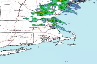
 Boston MA Radar
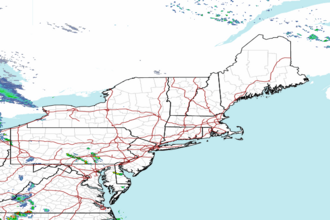
 Northeast Radar
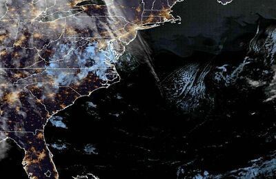
 East Coast Satellite