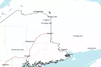
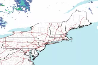
Eastport ME to Schoodic Point ME out 25 NM Marine Forecast
| Today...Nw Winds 15 To 20 Kt, Diminishing To 10 To 15 Kt Late. Gusts Up To 30 Kt. Seas 2 To 4 Ft. Wave Detail: N 3 Ft At 4 Seconds And Se 1 Foot At 12 Seconds. Light Freezing Spray This Morning. |
| Tonight...Nw Winds 10 To 15 Kt, Becoming S 5 To 10 Kt After Midnight. Seas 2 To 3 Ft. Wave Detail: N 2 Ft At 4 Seconds And S 1 Foot At 9 Seconds. A Chance Of Rain After Midnight. |
| Mon...S Winds 15 To 20 Kt, Becoming Se 20 To 25 Kt In The Afternoon. Gusts Up To 35 Kt. Seas 2 To 3 Ft, Building To 3 To 5 Ft In The Afternoon. Wave Detail: S 3 Ft At 8 Seconds And Se 2 Ft At 4 Seconds, Becoming S 5 Ft At 7 Seconds And Se 1 Foot At 4 Seconds. Rain. Vsby 1 Nm Or Less, Increasing To 1 To 3 Nm In The Afternoon. |
| Mon Night...S Winds 20 To 25 Kt, Becoming Sw 25 To 30 Kt After Midnight. Gusts Up To 40 Kt. Seas 5 To 7 Ft, Building To 7 To 10 Ft After Midnight. Wave Detail: S 7 Ft At 7 Seconds, Becoming S 10 Ft At 8 Seconds. Rain, Mainly In The Evening With Vsby 1 To 3 Nm. |
| Tue...W Winds 25 To 30 Kt With Gusts Up To 45 Kt. Seas 9 To 13 Ft. Wave Detail: Sw 12 Ft At 10 Seconds. A Chance Of Snow. Vsby 1 To 3 Nm. |
| Tue Night...W Winds 25 To 30 Kt With Gusts Up To 45 Kt. Seas 9 To 13 Ft, Subsiding To 8 To 11 Ft After Midnight. Wave Detail: Sw 12 Ft At 10 Seconds, Becoming Sw 11 Ft At 10 Seconds. A Chance Of Snow In The Evening. |
| Wed...W Winds 20 To 25 Kt, Diminishing To 15 To 20 Kt In The Afternoon. Seas 7 To 10 Ft. |
| Wed Night...W Winds 20 To 25 Kt. Seas 6 To 8 Ft. Snow Likely. Vsby 1 Nm Or Less. |
| Thu...Nw Winds 15 To 20 Kt. Seas 5 To 8 Ft. Snow Likely, Mainly In The Morning With Vsby 1 To 3 Nm. |
| Thu Night...Nw Winds 15 To 20 Kt, Becoming N 10 To 15 Kt After Midnight. Seas 3 To 5 Ft. A Chance Of Snow. |
| Area Forecast Discussion National Weather Service Caribou ME 633am EST Sunday Dec 28 2025 Synopsis High pressure over Quebec will build south across the region today. Low pressure crosses the region Monday then lifts north of the region Monday night into Tuesday, remaining north of the region Wednesday through Friday. Near Term - Through Monday Key Messages: * Wintry mix on Monday to create dangerous travel conditions * Uncertainty still remains on location and amounts for greatest ice amounts Discussion: An occluded low will approach from the west Sunday night, pulling through our forecast area Monday through Monday night. As this system crosses the CWA, a triple point low will develop and bisect our region, tracking along a line roughly from Greenville through Houlton. The development of a triple point low will aid in maintaining CAD across the north, and lifting a warm front through the area such that all wintry precipitation types will be possible. Low SLRs, combined with sleet, freezing rain, and plain rain will create a heavy layer of wintry accumulation. Ice, sleet, and slush from melting snow will create slick surfaces and lead to dangerous travel conditions, particularly across the northern half of the CWA. There still remains uncertainty in amounts of each precipitation type as well as locations, as slight shifts in the temperature profile could spell a completely different story for impacts. Ice accumulation will likely remain below a quarter inch over most of the area, but there could be a tenth of an inch of accumulation along a band somewhere across the north, depending on the exact track and speed of the triple point low. Based on forecast profiles and the height of the warm nose (around 850 mb), sleet may end up being a greater threat in the north, with pure sleet amounts approaching at least one inch. With how far north the warm air is intruding, snow amounts will be on the lighter side, generally less than 4 inches. Coastal Downeast has the greatest chance of remaining all rain, though it is possible a dry slot stemming from the triple point low could create a pause in rain through Monday afternoon that may cut current rain amount projections in half should this dry slot come to fruition. There is also question as to how long a low level dry layer will linger at storm onset through the area. If this dry layer takes longer to saturate than guidance currently suggests (and is often the case in patterns such as this one with very cold air prior to the storm) then precipitation start times will be later, potentially not starting until Monday afternoon. A stronger dry layer would also introduce additional evaporational cooling that currently is not captured by guidance, and may shift precip types colder at onset, leading to more snow and sleet than freezing rain and plain rain. Downeast, terrain allows for warmer, moisture air to more quickly rush into the region, however a snow pack currently lingers in this area and may help keep the near surface layer cold enough to support more freezing rain than is currently in the forecast. Short Term - Monday Night Through Tuesday Night Key Messages: *Wintry mix continues Monday night, ending on Tuesday *Gusty winds Tuesday into Tuesday night Key Message 1... Triple point low pressure system continues to swing through New England, with snow prominent in the far north, a wintry mix prominent from Van Buren to just south of Houlton, and rain prominent in the interior Downeast and coastal regions. As the associated front passes through Maine and colder air begins to work in behind the frontal system, wintry mix transitions over to snow in the north, and rain is confined to the immediate Downeast coastline. Overnight, potential for 4 inches of additional snowfall in the Crown of Maine, and roughly 1 to 3 inches in northern Maine and portions of the central Highlands. North and Crown of Maine could see a quarter to half an inch of sleet overnight. Highest totals for ice accumulation are anticipated in northeast Maine overnight, around 0.1 to 0.2 inches of accumulation. The rest of northern Maine could see a trace to 0.1 inches of ice. Precipitation chances decrease of front moves into New Brunswick. Temperatures quickly drop into the lower 20s in the north, and mid-20s Downeast. This could cause any residual moisture from recent rainfall to freeze over, causing some slick spots, so exercise caution when traveling. Exact snow/sleet/ice totals with this system are subject to change based on the storm track, as a northerly track will result in more sleet in the north, while a southerly track will wrap in more cold air, leading to larger snow totals. So continue to monitor the forecast for updates. Key Message 2... Pressure gradient force associated with passing low pressure system resulting in wind gusts 25-30 mph possible Tuesday into Tuesday night. Winds generally from the west. Gusts stay elevated until gradient relaxes on Wednesday. Long Term - Wednesday Through Saturday Key Messages... *Cold temperatures through the weekend *Potential for system late next week Key Messages 1... Behind the aforementioned frontal system Monday into Tuesday, a few shortwave disturbances could move through Maine, bringing a slight chance for some light snow showers in the north. Cold temperatures linger Wednesday through the weekend, with daytime highs staying in the low teens in the north, and the teens to 20s Downeast. Overnight lows around or below zero in the north, and generally in the low teens Downeast. Wind chills in the negative teens overnight could be possible late this week in the north. Key Message 2... Next chance for some significant precipitation will be early this upcoming weekend, as a low pressure system from Central Canada moves south closer to western Maine. The EURO model shows the primary low swing just north of Maine, with little to no precipitation, but the GFS (Global Forecast System) has a coastal low develop off of the parent low in Canada, bringing a chance for precipitation throughout the state. Kept precipitation chances around a slight chance to chance, until models get in better agreement. Marine Near Term: Gusts 25 to 30 kts continue over the coastal waters this morning, gradually tapering off through the day today. Seas that are topping out at around 5 ft will also decrease today as well, and conditions should fall below SCA (Small Craft Advisory) levels this afternoon. Light freezing spray will continue through this morning as well, before temperatures warm enough to reduce this threat this afternoon. Light winds return tonight before SE winds increase through the day on Monday with a low pressure system moving through the area, approaching gale strength towards the end of the day on Monday. The low pressure system will likely bring all rain over the waters on Monday and rain could limit visibility. Short Term: Gale Watch in effect for late Monday night into Tuesday night. Light freezing rain Tuesday through Tuesday night. Rain over the waters on Monday night, and snow on Tuesday. Seas gradually rise up to 12 ft by Tuesday. Winds from the S/SE on Monday night, shifting to the W by Tuesday. NOAA Caribou ME Office - Watches - Warnings - Advisories ME...Winter Storm Watch from Monday morning through late Monday night for MEZ001-002. Winter Storm Watch from Monday morning through late Monday night for MEZ003>006-010-011-031-032. Marine Small Craft Advisory until 2pm EST this afternoon for ANZ050- 051. Gale Watch from late Monday night through Wednesday morning for ANZ050>052. |