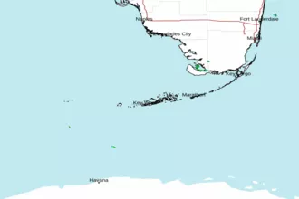
Gulf of Mexico including Dry Tortugas and Rebecca Shoal Channel Marine Forecast
| Today...Northeast Winds 5 To 10 Knots, Becoming Variable Near 5 Knots Early This Afternoon, Then Becoming Northwest To North Late. Seas Around 1 Foot. Wave Detail: North To Northeast 1 Foot At 4 Seconds. |
| Tonight...Northwest To North Winds Near 5 Knots, Becoming Northeast To East After Midnight. Seas Around 1 Foot. Wave Detail: North 1 Foot At 4 Seconds. |
| Wednesday...Southeast Winds Near 5 Knots. Seas Around 1 Foot. Wave Detail: Northwest To North 1 Foot At 4 Seconds. |
| Wednesday Night...Southeast Winds Increasing To Near 10 Knots. Seas Around 1 Foot. |
| Thursday...Southeast To South Winds 5 To 10 Knots, Becoming South In The Afternoon. Seas Around 1 Foot. |
| Thursday Night...Variable Winds Near 5 Knots, Becoming East To Southeast 5 To 10 Knots After Midnight. Seas 1 Foot Or Less. |
| Friday...Southeast To South Winds 5 To 10 Knots. Seas 1 Foot Or Less. |
| Friday Night...North To Northeast Winds Near 5 Knots, Becoming Southeast. Seas 1 Foot Or Less. A Slight Chance Of Showers. |
| Saturday...Southeast To South Winds Near 5 Knots. Seas Around 1 Foot. |
| Saturday Night...Northeast Winds Near 5 Knots, Becoming East To Southeast. Seas Around 1 Foot. A Slight Chance Of Showers. |
GMZ005 Synopsis Issued: 428 AM EDT Tue May 05 2026
Synopsis...
Winds Across Our Coastal Waters Remain Chaotic As A Weak Troughing Persists From Off The South Florida Atlantic Coast And Through The Florida Straits. Isolated Showers This Morning Should Finally End Later Today. The Poorly Defined Wind Field Will Persist Until An Atlantic Ridge Can Become Better Established Across The Florida Peninsula On Wednesday. At Which Point Winds Will Become A Climatologically Appropriate Light To Gentle East To Southeasterly Breeze. Deep Layered Will Dominate From Mid Week Through The Remainder Of The Work Week. This Along With Very Weak Forcing Will Keep Rain Chances Out Until At Least Saturday Where Southeasterly Breezes Strengthen To Gentle To Moderate, Bringing In Increased Boundary Layer Moisture And Opening The Door To Maritime Showers. The Approximate Shoreward Edge Of The Gulf Stream As Of April 28... 16 Nm South Of Dry Tortugas Light...On Loggerhead Key. 10 Nm South Of Cosgrove Shoal Light...Off The Marquesas Keys. 9 Nm South Of Sand Key Light...Off Key West. 9 Nm South Of Looe Key...Off Big Pine Key. 12 Nm Southeast Of Sombrero Key Light...Off Marathon. 10 Nm Southeast Of Alligator Reef Light...Off Islamorada. 6 Nm Southeast Of Molasses Reef Light...Off Key Largo. 6 Nm Southeast Of Carysfort Reef Light...Off Ocean Reef. Gulf Stream Information Courtesy Of The National Weather Service In Key West Based On Products From Nasa Sport And Rtofs.
...
 Key West FL Radar
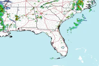
 Southeast Radar