Narragansett Bay Marine Forecast
| Today...S Winds 5 To 10 Kt, Increasing To 10 To 15 Kt This Afternoon. Waves Around 2 Ft. Patchy Fog This Morning With Vsby 1 Nm Or Less. |
| Tonight...S Winds 10 To 15 Kt, Becoming Sw 5 To 10 Kt After Midnight. Waves Around 2 Ft. Patchy Fog After Midnight. |
| Fri...Sw Winds Around 5 Kt, Becoming Nw In The Afternoon. Waves Around 2 Ft. A Chance Of Showers In The Afternoon. |
| Fri Night...Ne Winds 5 To 10 Kt. Waves Around 2 Ft. A Chance Of Rain In The Evening. |
| Sat...Ne Winds 5 To 10 Kt. Waves Around 2 Ft. |
| Sat Night...Se Winds 5 To 10 Kt. Waves Around 2 Ft. |
| Sun And Sun Night...Sw Winds 10 To 15 Kt, Becoming W. Gusts Up To 20 Kt. Waves Around 2 Ft. Showers Likely. |
| Mon And Mon Night...Nw Winds 10 To 15 Kt With Gusts Up To 20 Kt. Waves Around 2 Ft. Seas Are Reported As Significant Wave Height, Which Is The Average Of The Highest Third Of The Waves. Individual Wave Heights May Be More Than Twice The Significant Wave Height. |
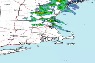
| Area Forecast Discussion National Weather Service Boston/Norton MA 237am EDT Thu April 16 2026 .WHAT HAS CHANGED... No significant changes. .KEY MESSAGES... - Backdoor front returns once again, making it cooler near the coast with continued warmth inland through Friday. Next chance for showers and thunderstorms tonight. - Strong cold front moves through on Sunday bringing showers, perhaps ending as brief snow showers but of no impact. Blustery and anomalously cool temperatures for early to mid next week. KEY MESSAGE 1...Backdoor front returns once again, making it cooler near the coast with continued warmth inland through Friday. Next chance for showers and thunderstorms tonight. Unseasonably warm temperatures aloft persist through the latter half of this week, and a stronger shortwave approaches later tonight. The backdoor front that has been lingering around the region will dip back down again today, cooling the coast and ushering in more onshore flow. This front may make it as far inland as Worcester today, with temperatures further inland remaining much warmer. Highs in the low to mid 80s are possible once more out in the CT Valley, parts of RI, and western MA. Closer to the coast, highs will likely top out in the 50s, increasing up to the low 70s as you move inland. This backdoor front should exit the region as its associated low moves offshore through the day Friday, and flow shifts more W initially as a separate front pushes through the region, then shifts more onshore for the afternoon/evening. With regards to the approaching shortwave, rain showers with embedded thunderstorms are possible once again tonight after sunset. The latest forecast soundings have not changed much, still indicating 0-6 km bulk shear at and above 40 knots, and mid-level lapse rates around 6 C/km. The greatest instability remains over western MA and CT with MLCAPE values around 1000-1500 J/kg with a window of surface-based CAPE in the late afternoon/early evening possibly overcoming CIN. Generally, though, most instability will be more elevated. So, the severe risk remains low, especially with LCL heigheights remaining above 1000 km. This area is still under a Marginal (level 1 out of 5) risk for severe weather today, so remain weather aware this evening. KEY MESSAGE 2... Strong cold front moves through on Sunday bringing showers, perhaps ending as brief snow showers but of no impact. Blustery and anomalously cool temperatures for early to mid next week. A strong cold front will be working its way through the Northeast on Sunday, acting on a narrow but moist (PWATs (Precipitable Waters) around 1.2-1.4") warm sector. Showers, perhaps with a rumble or two of thunder, are likely with the front, which moves through during the daytime hours. The main story is what lies behind it: an anomalously cool airmass with 925 mb temps dropping to near 0C and 850 mb temps 0 to -5C by Sunday night. Global models show the potential for backside snow showers as the front moves offshore; the airmass is just that cold where it is possible, but it remains to be seen if there is enough lingering precipitation as the colder air surges in behind the front to allow for snowflakes to mix in. No impacts with those snow showers were they to develop though. While dry, Monday looks blustery and anomalously cool for mid-April, with 925 mb temps around 0 to -2C, with northwest winds around 10-15 mph and gusts 25-30 mph. High temps in/around the high terrain in the low to mid 40s, with mid to upper 40s for eastern MA and RI. Winds decrease later in the day with clear skies, light winds setting stage for a pretty chilly night with subfreezing lows in most areas away from the cities. Anomalously cold air then begins to briefly recover starting Tuesday, though some indication for another weak disturbance in NW flow to reinforce another shot of cool air around midweek. Marine Forecaster Confidence Levels... Low - less than 30 percent. Moderate - 30 to 60 percent. High - greater than 60 percent. High confidence through the weekend. Backdoor front meandering over southern New England through Friam will maintain light winds and calm seas, though there will be wind shifts from SW to NE from time to time on eastern MA waters along with showers and embedded thunderstorms. Brief periods of marginal Small Craft Advisory seas possible late tonight/early Friam over the southern outer waters, though not expected to be widespread. Passage of stronger cold Front Sunday should bring SCA (Small Craft Advisory) conditions to at least outer waters Sunday into Mon. Outlook /Friday Night through Monday/... Friday Night: Winds less than 25 kt. Seas locally approaching 5 ft. Saturday through Saturday Night: Winds less than 25 kt. Sunday: Winds less than 25 kt. Seas locally approaching 5 ft. Rain showers likely. Sunday Night: Low risk for Small Craft Advisory winds with gusts up to 25 kt. Areas of seas approaching 5 ft. Chance of rain showers. Monday: Winds less than 25 kt. Areas of seas approaching 5 ft. Slight chance of rain showers, slight chance of snow showers. NOAA Boston MA Office: Watches - Warnings - Advisories CT...None. MA...None. RI...None. Marine None. |
 Boston MA Radar
 Northeast Radar
 East Coast Satellite