Strait of Georgia - north of Nanaimo Marine Forecast
| Winds... Wind Southeast 15 To 25 Knots Except Southwest 25 Near Qualicum Beach. Wind Becoming Southeast 5 To 15 This Evening Then Increasing To Southeast 15 To 20 After Midnight. Wind Diminishing To Southeast 5 To 15 Near Noon Friday Then Becoming Light Friday Evening. |
| Skies... Tonight , A Few Showers Ending After Midnight Then Cloudy With 60 Percent Chance Of Drizzle Or Showers. Risk Of A Thunderstorm This Evening And After Midnight. Friday , Cloudy. 60 Percent Chance Of Drizzle Or Showers Changing To 40 Percent Chance Of Showers Near Noon. Risk Of A Thunderstorm In The Afternoon. |
| Saturday... Winds Light Increasing To Northwest 10 To 20 Knots Late In The Day. |
| Sunday... Winds Northwest 10 To 20 Knots. |
| Monday... Winds Northwest 10 To 20 Knots Diminishing To Light. |
Marine Weather Statement For The Pacific Waters
Issued By Environment Canada 3:22pm PDT Thursday 16 July 2026.
Ahead Of The Ridge Of High Pressure Offshore, Strong Northwesterly Winds Continue Over Most Of The Marine Regions. Northwest Winds Will Reach Marginal Gale Force Later This Evening Over South Hecate And West Coast Haida Gwaii South.
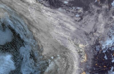
A Low Southeast Of Explorer Will Approach The South Coast Tonight And Bring A Risk Of Thunderstorms And Occasionally Gusty Winds To The Region.
Technical Marine Synopsis For The Pacific Waters
Issued By Environment Canada 4:00pm PDT Thursday 16 July 2026 For Tonight And Friday. The Next Scheduled Synopsis Will Be Issued At 9:30pm PDT.
Systems Position. At 4:00pm PDT Today Quasi-Stationary Ridge Located West Of Bowie.
At 4:00pm PDT Today Low Located Southeast Of Explorer. By 10:00am PDT Friday Departing Low Located Over Vancouver Island.
 Pacific Satellite