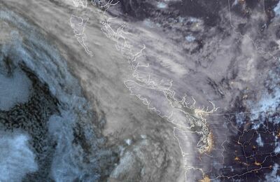
Strait of Georgia - south of Nanaimo Marine Forecast
| Winds... Wind Light Except Northeast 10 Knots South Of Tsawwassen. Wind Becoming Northwest 5 To 15 Late This Morning Then Increasing To Northwest 15 To 20 Late This Afternoon. Wind Diminishing To Northwest 5 To 15 Late This Evening Then Becoming Light Sunday Afternoon. Wind Becoming Southeast 5 To 15 Sunday Evening. |
| Monday... Winds Southeast 5 To 15 Knots. |
| Tuesday... Winds Northwest 5 To 15 Knots Becoming Variable 5 To 10. |
| Wednesday... Winds Northwest 5 To 15 Knots. |
Marine Weather Statement For The Pacific Waters
Issued By Environment Canada 3:48am PDT Saturday 25 April 2026.
Strong Northerly Winds Will Prevail Over Northern And Central Waters And Explorer Through The Weekend As A Ridge Of High Pressure Remains Nearly Stationary West Of Bowie. Winds Have Reached Marginal Northwesterly Gales Over Hecate Strait And Off Southwest Haida Gwaii And Will Continue Into Sunday. Marginal Gales Are Forecast To Develop Of The West Coast Of Vancouver Island Late Sunday Evening.
Technical Marine Synopsis For The Pacific Waters
Issued By Environment Canada 4:00am PDT Saturday 25 April 2026 For Today Tonight And Sunday. The Next Scheduled Synopsis Will Be Issued At 10:30am PDT.
Systems Position. At 4:00am PDT Today Quasi-Stationary High Located On A Line Northeast-Southwest Over Western Bowie.
At 4:00am PDT Today Quasi-Stationary Trough Located From The Central Coast To The Lower Mainland.
 Pacific Satellite