Albemarle Sound Marine Forecast
| Rest Of Tonight...S Winds Around 10 Kt. Waves 1 Ft Or Less. |
| Sun...Sw Winds 5 To 10 Kt. Waves 1 Ft Or Less. |
| Sun Night...Sw Winds 10 To 15 Kt. Waves Around 2 Ft. |
| Mon...W Winds 10 To 15 Kt. Waves Around 2 Ft In The Morning, Then 1 Ft. |
| Mon Night...Sw Winds Around 10 Kt. Waves Around 2 Ft. |
| Tue...Sw Winds 5 To 10 Kt. Waves 1 Ft Or Less, Then Around 2 Ft In The Afternoon. |
| Tue Night...Sw Winds 10 To 15 Kt. Waves Around 2 Ft. |
| Wed...W Winds 5 To 10 Kt, Becoming N In The Afternoon. Waves Around 2 Ft In The Morning, Then 1 Ft. |
| Wed Night...Ne Winds 5 To 10 Kt. Waves 1 Ft Or Less. |
| Thu...Ne Winds 5 To 10 Kt. Waves 1 Ft Or Less. |
| Thu Night...E Winds 5 To 10 Kt. Waves 1 Ft Or Less. |
| Area Forecast Discussion National Weather Service Wakefield VA 124am EDT Sunday April 28 2024 Synopsis High pressure offshore moves south early next week with a ridge building over the area. Well above normal temperatures are expected next week. A weak cold front crosses the area Tuesday night. High pressure returns by Wednesday. Precipitation chances increase late next week into next weekend as another cold front approaches the area. Near Term - Until 6am This Morning As of 125am EDT Sunday... High pressure lingers offshore tonight, gradually drifting S. SCT-BKN cloud cover remains across the area with clouds gradually thinning late tonight. Some patchy fog has been noted across mainly Louisa County. This fog lingers overnight before dissipating shortly after sunrise with VIS locally dropping to 1SM or less. Otherwise, cannot rule out a brief shower on the MD Eastern Shore late tonight into the early morning hours as a very weak perturbation clips the NE half of the FA. Temps as of 120am ranged from the lower 50s to around 60F with morning lows in the 50s expected (low-mid 50s for most). .SHORT TERM /6am THIS MORNING THROUGH TUESDAY NIGHT/... As of 245pm EDT Saturday... A ridge builds over the area early next week with a significant warmup expected as winds become SW. Dry with (slowly) increasing humidity. Highs in the upper 70s to mid 80s Sunday with upper 80s in most areas on Mon/Tue. Guidance has come up a couple of degrees with respect to high temperatures early next week, and a few 90F readings are likely on both Monday and Tuesday (now the NBM 50th percentile shows 90F at RIC on Mon). Lows in the upper 50s-lower 60s Sunday and Monday night. A weak cold front slowly approaches from the west on Tue, with isolated to widely scattered showers/thunderstorms initially developing to our west during the afternoon. Isolated convection potentially moves across the area during the evening through the first part of Tuesday night before weakening. Will hold Probability of Precipitation no higher than 30% given the lack of coverage and the fact that some of the models don't have any Quantitative Precipitation Forecast in the FA from Tue-Tuesday night. Long Term - Wednesday Through Saturday As of 245pm EDT Saturday... The ridge lingers over the E CONUS through much of the rest of next week. At the surface, weak high pressure settles to our NE on Wed/Thu in the wake of the weak front, with mainly warm/dry weather expected (although it will be a bit cooler near the coast on both days with the flow becoming onshore). Forecast highs are in the low- mid 80s inland with 70s closer to the coast. Precipitation chances increase late next week through at least Sat as the upper ridge breaks down and a shortwave tracks from the upper Midwest to southern Ontario/Quebec. Several shortwaves move through the area during this time, which will result in multiple chances for showers/storms. However, global models disagree with timing for each of these subtle features. Also, another cold front may cross the area next weekend, and there's quite a bit of uncertainty regarding if/when it does so. As such, have maintained NBM Probability of Precipitation (which gives 30-40% Probability of Precipitation on both Fri/Sat...highest during the aftn/evening). Highs mainly in the 80s on Fri with a slight cool down possible by next weekend. Marine As of 310pm EDT Saturday... Late this afternoon. strong high pressure was centered just off the northern Mid Atlantic coast. Winds were SE 5-15 kt over the waters, with a few gusts up to 20 kt. Seas were 3-4 ft and waves were 1-3 ft. SE winds 5-15 kt will become S tonight, as high pressure shifts farther S to off the Mid Atlantic coast. The high will then drift to off the SE coast for Sunday through Tue. With this movement, winds become S or SW (still at 5-15 kt) through the period. During this period, seas will be 2-4 ft and waves 1-2 ft. A front will drop across the waters late Tuesday night into Wed, with winds turning to the W then NNW. Winds will then turn back to the E or SE for Wednesday evening into Thu. NOAA Wakefield VA Office: Watches - Warnings - Advisories MD...None. NC...None. VA...None. Marine None. |
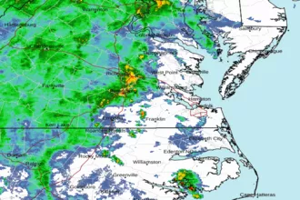 Wakefield Norfolk VA Radar
 Northeast Radar
 East Coast Satellite