Alligator River Marine Forecast
| Tonight...Ne Winds 10 To 15 Kt, Becoming S 5 To 10 Kt After Midnight. Waves Moderate Chop, Then Light Chop. |
| Wed...Sw Winds Around 5 Kt. Waves Flat. |
| Wed Night...Sw Winds 5 To 10 Kt. Waves Light Chop. |
| Thu...Sw Winds 5 To 10 Kt, Becoming S In The Afternoon. Waves Light Chop. |
| Thu Night...S Winds 5 To 10 Kt. Waves Light Chop. |
| Fri...Sw Winds Around 10 Kt, Becoming Se In The Afternoon. Waves Light Chop. |
| Fri Night...S Winds 5 To 10 Kt. Waves Light Chop. |
| Sat...S Winds 5 To 10 Kt, Increasing To 10 To 15 Kt In The Afternoon. Waves Light Chop, Increasing To A Moderate Chop In The Afternoon. |
| Sat Night...Sw Winds 10 To 15 Kt. Waves A Moderate Chop. A Chance Of Showers And Tstms. |
| Sun...Sw Winds 10 To 15 Kt. Waves A Moderate Chop. A Chance Of Tstms. A Chance Of Showers In The Morning, Then Showers Likely In The Afternoon. |
| Sun Night...Sw Winds 5 To 10 Kt. Waves Light Chop. A Chance Of Tstms. Showers Likely, Mainly In The Evening. Winds And Waves Higher In And Near Tstms. |
| Area Forecast Discussion National Weather Service Wakefield VA 341pm EDT Tuesday July 14 2026 .WHAT HAS CHANGED... Heat Advisories have been issued across portions of east- central VA and the eastern shore. .KEY MESSAGES... 1) Hot conditions with moderate humidity levels prevail for the remainder of the week, along with mainly dry WX. 2) Increasing thunderstorm chances this weekend, with very warm and humid conditions. As of 330pm EDT Tuesday... KEY MESSAGE 1...Hot conditions with moderate humidity levels prevail for the remainder of the week, along with with mainly dry WX. The latest WX analysis indicates a strong, anomalous upper level ridge (H5 heigheights ~600 dm!) centered across southern Minnesota with an upper level trough displaced well north to the east of Hudson Bay (and weak upper troughing over the south-central CONUS). At the surface, high pressure is located over the region, with surface low pressure over eastern Canada. Overall, a fairly pleasant afternoon for mid-July with temps in the primarily in the mid to upper 80s and dew pts in the 60s under a mainly sunny sky. Skies remain mostly clear tonight as the surface high slowly slides offshore. Early morning lows Wednesday will drop into the 60s inland, with some lower 70s along the immediate coastline as well as the eastern shore. The upper level ridge expands E-SE into the local area on Wednesday, allowing heigheights to rise, bringing increasing temperatures area- wide. Humidity levels look to stay moderate keeping afternoon heat indices from rising much above ambient air temperatures. With the core of the ridge centered across northern areas Wed, the hottest temperatures (and heat indices) will be over east central VA and the Maryland eastern shore. Dew pts will tend to mix out into the upper 60s, but with highs around 100 F, still anticipate seeing a period with heat indices to ~105F, so a Heat Advisory has been issued from Caroline Co. east across the northern Neck and into the MD eastern shore. Also included Accomack VA. With a cold front and low pressure to the north, a W-SW low level flow should push hot temperatures to the Atlantic coast (i.e Ocean City and Wallops to 95-100 degrees). Areas to the south will be somewhat cooler (and with dew pts into the 60s), heat indices should average in the upper 90s to low 100s. Thursday will probably be the hottest day, with upper 90s to around 100F fairly widespread (a little cooler in the mid 90s over Se VA and NE NC). Current forecast suggests that Heat Advisories will probably need to be expanded to the south (though with some uncertainty depending on how dew pts mix out). Convection should remain suppressed away from the area through most of Thursday, though will have slight chance (~20%) Probability of Precipitation Thursday evening across the MD eastern shore as a weak surface front potentially drops south before washing out. On Friday, temperatures will likely be a little cooler (at least along the coast and the eastern shore). Additional Heat Advisories may be needed across southern VA and NE NC however. A low chance for showers/storms moves in from the NW Friday evening. KEY MESSAGE 2...Increasing thunderstorm chances this weekend, with very warm and humid conditions. The ridge continues to gradually break down over the weekend, as upper troughing re-establishes itself over the northern Mid- Atlantic and northeast CONUS. A series of shortwaves will track across the area from Saturday through Monday ahead of the next front approaching from the north. There is increasing model consensus that this weakening front may linger across the area into Monday. While considerable uncertainty remains regarding the exact timing and coverage of storms, the upper flow turning WNW-NW over a hot, and increasing humid moisture- pooled boundary layer sets up a climatologically-favored pattern for locally heavy rainfall and downbursts. Low- level frontal forcing appears weak, typical of mid- July, but moisture pooling along the slow- moving boundary beneath steep mid-level lapse rates favor a hot, muggy, high DCAPE setup capable of producing isolated to scattered damaging wind gusts each day this weekend, potentially lingering into Monday. Areal coverage of these storms will ultimately depend on shortwave timing, which is quite uncertain at this time range. Obviously, this threat will be monitored in the coming days. High temperatures will be slightly cooler, but with high dew pts (especially across SE VA and NE NC), may see heat indices ~105 F through Sunday if not Monday. Marine As of 300pm EDT Tuesday... - Benign marine conditions are expected into late week with high pressure focused near the area. An elongated area of high pressure remains in the vicinity of the local waters this afternoon. Wind speeds are light areawide, but the direction varies from the E-NE across the lower bay and ocean S of Cape Charles to the S-SW further N. Winds will shift to the S for all areas by this evening as the high pressure system gradually slides south of the area. SW winds may increase to 10-15 kt for a time tonight with a few gusts to 20 kt possible, although no SCAs (Small Craft Advisories) are anticipated at this time. Seas have also continued to trend lower from earlier this morning with a general 2-3 ft, except 3-4 ft in the NC waters. The high pressure will remain near the area through Thursday, allowing for sub-SCA (Small Craft Advisory) conditions to prevail with S- SW winds. A weak frontal passage remains possible Thursday into Friday, which should shift winds to the E-NE Friday. Southerly flow could approach SCA (Small Craft Advisory) thresholds Saturday night into Sunday morning ahead of a frontal system. Seas will generally be around 2 ft to end the week, increasing to 3-4 ft as S winds increase later Saturday. A high risk of rip currents remains in place for the NC beaches through this evening, with moderate elsewhere. A low risk is likely Thursday and Friday. Climate As of 300pm EDT Tuesday... - Record Highs: - Wednesday 7/15 Thu 7/16 Fri 7/17 - RIC: 100 (1995) 101 (1980) 100 (1980) - ORF: 101 (1995) 102 (1879) 100 (1887) - SBY: 100 (1995) 99 (1915) 99 (2012) - ECG: 97 (1997) 98 (1995) 99 (1942) - Record High Mins: - Thu 7/16 Fri 7/17 - RIC: 77 (1983) 77 (2025) - ORF: 80 (1995) 80 (2024) - SBY: 78 (2024) 80 (1983) - ECG: 79 (2012) 80 (2019) NOAA Wakefield VA Office: Watches - Warnings - Advisories MD... Heat Advisory from 11am to 8pm EDT Wednesday for MDZ021>025. NC...None. VA... Heat Advisory from 11am to 8pm EDT Wednesday for VAZ064- 075>078-085-099-517-519>522. Marine None. |
 Newport NC Radar
 Southeast Radar
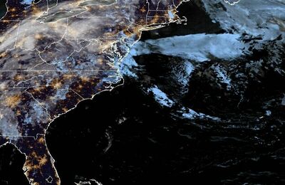 East Coast Satellite