Great Egg Inlet to Cape May NJ out 20 NM Marine Forecast
| Tonight...S Winds 10 To 15 Kt With Gusts Up To 20 Kt, Becoming Ne With Gusts Up To 20 Kt After Midnight. Seas 3 To 4 Ft. Wave Detail: S 4 Ft At 7 Seconds. A Slight Chance Of Showers Early This Evening, Then Showers With A Chance Of Tstms Late This Evening And Early Morning. A Chance Of Showers With A Slight Chance Of Tstms Late. |
| Thu...Ne Winds 10 To 15 Kt With Gusts Up To 25 Kt. Seas 3 To 4 Ft. Wave Detail: Se 4 Ft At 6 Seconds. A Chance Of Showers In The Morning. |
| Thu Night...E Winds 10 To 15 Kt With Gusts Up To 25 Kt. Seas 3 To 4 Ft. Wave Detail: Ne 4 Ft At 7 Seconds. |
| Fri...S Winds 10 To 15 Kt, Increasing To 15 To 20 Kt In The Afternoon. Seas 3 To 4 Ft. Wave Detail: S 4 Ft At 7 Seconds. |
| Fri Night...Sw Winds 15 To 20 Kt With Gusts Up To 25 Kt. Seas 3 To 4 Ft. Wave Detail: S 4 Ft At 6 Seconds. |
| Sat...Sw Winds 10 To 15 Kt With Gusts Up To 20 Kt. Seas 3 To 4 Ft. Wave Detail: S 4 Ft At 6 Seconds. |
| Sat Night...S Winds 15 To 20 Kt, Increasing To 20 To 25 Kt After Midnight. Seas 4 To 6 Ft. |
| Sun...Sw Winds 20 To 25 Kt. Seas 5 To 7 Ft. A Chance Of Showers In The Morning, Then Showers In The Afternoon. |
| Sun Night...W Winds 10 To 15 Kt, Becoming Nw After Midnight. Seas 4 To 6 Ft, Subsiding To 3 To 4 Ft After Midnight. Showers, Mainly In The Evening. |
| Mon...Nw Winds 10 To 15 Kt. Seas 2 To 4 Ft. |
| Mon Night...W Winds 5 To 10 Kt. Seas 2 To 3 Ft. Winds And Seas Higher In And Near Tstms. |
| Area Forecast Discussion National Weather Service Mount Holly NJ 731pm EDT Wednesday April 1 2026 .WHAT HAS CHANGED... The main severe thunderstorm risk is mainly across portions of Delmarva to far southern New Jersey. .KEY MESSAGES... 1. A cold front crosses the region through this evening. Showers and some thunderstorms will accompany the front, with some severe thunderstorm risk this evening. 2. A warm front lifts north through the region Thursday night into Friday, and then a strong cold front passes through this weekend with colder temperatures for the start of the new work week. KEY MESSAGE 1...A cold front crosses the region through this evening. Showers and some thunderstorms will accompany the front, with some severe thunderstorm risk this evening. The region remains embedded within modestly enhanced southwesterly flow aloft. A belt of 50 kt 500 mb winds will shift eastward over the region this evening. At the surface, a cold front continues to settle southward. It will cross the region this evening before stalling near Delmarva on Thursday. MLCAPE of 500-1000 J/kg from near Philadelphia southward with the highest values in Delmarva. 0-6 km Bulk Shear values of 30-40 kt are in place. Some convection sliding across Delmarva has shown some strengthening. The greatest DCAPE is across parts of Delmarva to far southern New Jersey. A few stronger convective cores could be severe this evening with locally damaging winds the main threat. The severe risk is highest over Delmarva to far southern NJ due to the overlap of the greatest instability and also DCAPE. The severe threat diminishes significantly north of the southward advancing cold front. Some lingering showers should then occur through much of the night in the wake of the front. Low temperatures are expected to be in the 40s for most of the region, with 50s in Delmarva where the front will move through the latest. A much colder airmass is anticipated to settle southward overnight and especially on Thursday in the wake of the front, though if the front stalls over southern portions of the area a tight temperature gradient will exist near it. Highs are generally expected to be in the 40s to mid 50s across most of eastern PA and NJ, with 60s in portions of Delaware and the Eastern Shore of Maryland depending on where exactly the front sets up. KEY MESSAGE 2...A warm front lifts north through the region Thursday night into Friday, and then a strong cold front passes through this weekend with colder temperatures for the start of the new work week. Strong low pressure over the Midwest Thursday evening will lift to the northeast into the Upper Great Lakes and the southeast portion of the Province of Ontario Thursday night and Friday morning. This will pull the stationary boundary south of the area north as a warm front, and this warm front should clear the northern zones by midday Friday or so. Some light rain is possible with its passage, and with increasing low level moisture, there may be some patchy fog. The low over southern Canada passes through eastern Canada Friday and Friday night. Strong warm air advection will be underway for Friday and Saturday with temperatures returning to well above normal levels. Highs will top off in the 70s to low 80s both days. A new area of low pressure organizes and develops over the Midwest Friday and Friday night. This low lifts towards the Great Lakes and southern central Canada Saturday and Saturday night. Another warm front lifts north through the region, and this may touch off some showers and perhaps a thunderstorm Saturday afternoon and Saturday night. As low pressure continues to track to the north and east, passing through southern Canada, it will drag a strong cold front through the region on Sunday. Widespread showers, perhaps a few thunderstorms, will develop with its passage. The showers should knock temperatures down by some 10 degrees or so compared to Saturday, as highs will be in the 60s to around 70. Strong cold air advection develops behind the passage of the front Sunday night. Highs will only be in the mid to upper 50s for most of the area, and in the upper 40s in the southern Poconos, Monday and Tuesday. These temperatures are several degrees below normal for this time of the year. Marine Small Craft Advisory for the northern to central Atlantic coastal waters of New Jersey through Thursday evening. Seas are still elevated across the northern waters but are slowly subsiding this evening, then a wind shift out of the north and northeast occurs through tonight and increases with some gusts up to 30 knots and seas building again. Some thunderstorms could bring gusty winds and reduced visibilities this evening. Outlook... Thursday night...SCA (Small Craft Advisory) conditions likely, mostly for elevated seas on the New Jersey ocean waters. Sub-SCA (Small Craft Advisory) conditions elsewhere. Friday through Friday night...A period of SCA (Small Craft Advisory) conditions possible Friday afternoon and evening as winds ramp up and seas build to around 5 feet. Saturday through Saturday night...Sub-SCA (Small Craft Advisory) conditions Saturday, then SCA (Small Craft Advisory) conditions likely Saturday night Sunday through Sunday night...SCA (Small Craft Advisory) conditions likely with a brief period of gale force winds possible Sunday afternoon. Winds diminish to sub-SCA (Small Craft Advisory) levels Sunday night, but seas remain elevated. Visibility restrictions in showers expected. Monday...Sub-SCA (Small Craft Advisory) conditions likely. NOAA Mount Holly NJ Office: Watches - Warnings - Advisories PA...None. NJ...None. DE...None. MD...None. Marine Small Craft Advisory until midnight EDT Thursday night for ANZ450>452. |
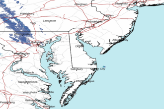
 Dover DE Radar
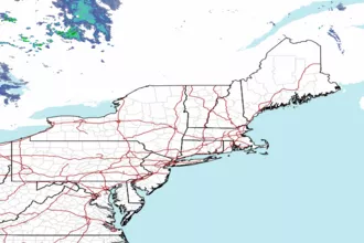
 Northeast Radar