Laguna Madre from the Port of Brownsville to the Arroyo Colorado Marine Forecast
| Rest Of Today...Southeast Winds 15 To 20 Knots Increasing To 20 To 25 Knots With Gusts Up To 35 Knots This Afternoon. Choppy On The Bay Becoming Rough This Afternoon. A Slight Chance Of Showers Late This Morning. |
| Tonight...Southeast Winds 15 To 20 Knots. Gusts To 35 Knots In The Evening. Choppy On The Bay. |
| Saturday...Southeast Winds 15 To 20 Knots Increasing To 20 To 25 Knots In The Afternoon. Gusts To 35 Knots. Choppy On The Bay Becoming Rough In The Afternoon. |
| Saturday Night...Southeast Winds 20 To 25 Knots Decreasing To 15 To 20 Knots After Midnight. Gusts To 35 Knots. Rough On The Bay Becoming Choppy After Midnight. |
| Sunday...Southeast Winds 15 To 20 Knots. Gusts To 30 Knots In The Morning. Choppy On The Bay. A Slight Chance Of Showers And Thunderstorms In The Afternoon. |
| Sunday Night...Southeast Winds 15 To 20 Knots With Gusts Up To 30 Knots Decreasing To 10 To 15 Knots After Midnight. Choppy On The Bay Becoming A Moderate Chop After Midnight. |
| Monday...Southeast Winds 10 To 15 Knots. A Moderate Chop On The Bay. A Slight Chance Of Showers And Thunderstorms In The Afternoon. |
| Monday Night...Southeast Winds 10 To 15 Knots. A Moderate Chop On The Bay. A Slight Chance Of Showers And Thunderstorms. |
| Tuesday...Southeast Winds 10 To 15 Knots. A Moderate Chop On The Bay. A Slight Chance Of Showers And Thunderstorms. |
| Tuesday Night...Southeast Winds 10 To 15 Knots. A Moderate Chop On The Bay. Winds And Waves Higher In And Near Thunderstorms. |
| Area Forecast Discussion ...UPDATED National Weather Service Brownsville TX 1137am CDT Fri April 26 2024 Long Term (Saturday night through Thursday) Issued at 344am CDT Fri April 26 2024 The tight pressure gradient continues to remain a factor in the long term forecast for Deep South Texas and the Rio Grande Valley at the start, but not expecting Wind Advisories to be needed as the current forecasted winds are in the range of 20-25 mph. As we move into the work week, an upper-level trough will into Northern Texas and move eastward, which will result in a zonal flow like pattern for a few days with a weak mid-level ridge sliding over the area by Wednesday. This mid-level ridge is not expected to stay over the area for long, as it will move eastward allowing for a zonal flow aloft to return to by the end of the work week. Meanwhile, at the surface, southerly to southeasterly flow is expected to continue, which will funnel more warm, humid air to the region. While the moisture advection does remain constant, the opportunities for rain appear do not look very promising. The greatest opportunity in the long term forecast period appears to be late Monday into Tuesday. A series of shortwaves will be moving through the upper levels that could help the development of convection along the Sierra Madre Mountains. Some of these showers and thunderstorms could make it to Deep South Texas and the Rio Grande Valley before they dissipate. However, rain chances remain in the range of 20 to 30 percent, as these types of showers and thunderstorms often do collapse once they move away from the mountains. Marine Issued at 344am CDT Fri April 26 2024 Today through Saturday: An already strong pressure gradient is expected to strengthen tonight as a series of low pressure areas extend from the South to the Central Plains. No let up in the strong southerly winds with seas continuing to build through Saturday. Small Craft advisories already in place to are likely to be extended tonight and Saturday. saturday Night through Thursday...Hazardous conditions to start off on Saturday night due the elevated winds and seas from the tight pressure gradient. Improvements in the marine conditions will start to occur on Sunday afternoon, but Small Craft Advisories might be needed through the weekend and into Monday. Light to moderate winds with moderate seas through Thursday, but there is a chance of Small Craft Exercise Caution for needed during the later part of the the period. NOAA Brownsville TX Office: Watches - Warnings - Advisories TX...Wind Advisory until 7pm CDT this evening for TXZ254-255-354-355. High Rip Current Risk through Sunday morning for TXZ451-454-455. GM...Small Craft Advisory until 1am CDT Sunday for GMZ130-132-135- 150-155-170-175. |
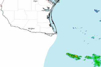 Brownsville TX Radar
 Gulf Radar