Little River Inlet to Murrells Inlet SC out 20 NM Marine Forecast
| Through 7 Pm...E Winds 15 Kt With Gusts Up To 20 Kt. Seas 3 To 4 Ft. Wave Detail: E 3 Ft At 5 Seconds And E 1 Foot At 10 Seconds. |
| Tonight...E Winds 15 To 20 Kt, Diminishing To 10 To 15 Kt Late. Seas 3 To 4 Ft. Wave Detail: E 4 Ft At 6 Seconds And E 1 Foot At 10 Seconds. |
| Sat...E Winds 10 To 15 Kt. Seas 3 To 4 Ft. Wave Detail: E 3 Ft At 5 Seconds And E 2 Ft At 8 Seconds. |
| Sat Night...E Winds 10 To 15 Kt, Diminishing To 5 To 10 Kt After Midnight. Seas 3 To 4 Ft. Wave Detail: E 3 Ft At 7 Seconds. |
| Sun...Se Winds 5 To 10 Kt. Seas 2 To 3 Ft. Wave Detail: E 3 Ft At 8 Seconds And E 2 Ft At 8 Seconds. |
| Sun Night...S Winds 5 To 10 Kt. Seas 2 To 3 Ft. Wave Detail: S 2 Ft At 7 Seconds And E 2 Ft At 9 Seconds. |
| Mon...Sw Winds 5 To 10 Kt. Seas 2 To 3 Ft. |
| Mon Night...Sw Winds 10 To 15 Kt. Seas 2 To 3 Ft. |
| Tue...Sw Winds 5 To 10 Kt, Becoming S 10 To 15 Kt In The Afternoon. Seas 2 To 3 Ft. |
| Tue Night...Sw Winds 10 To 15 Kt. Seas 2 To 3 Ft. |
| Wed...Sw Winds 10 To 15 Kt. Seas 2 To 3 Ft. |
| Wed Night...Sw Winds 10 To 15 Kt. Seas 2 To 3 Ft. |
| Area Forecast Discussion National Weather Service Wilmington NC 357pm EDT Fri April 26 2024 Synopsis High pressure will build in from the north through Saturday with dry weather expected. A warming trend will develop early next week as the center of the high shifts to off the southeast US coast. A cold front will approach the area late next week, increasing rain chances. Near Term - Through Saturday Surface high pressure centered over New England will shift slowly eastward through the period while maintaining a ridge of high pressure southward along the East Coast. Aloft, mid-level ridging will shift eastward and bring its axis overhead by the end of the period. This will keep a dry forecast in play with variable cloudiness as areas of enhanced moisture and subtle lift pass through at different levels of the atmosphere. With easterly low- level flow persisting on the south side of the aforementioned surface high, expect temperatures to remain near-normal to slightly cooler than normal for this time of year, with tonight's lows in the mid-upper 50s and Saturday's highs in the mid-upper 70s. A notable warmup awaits from Sunday onward. Short Term - Saturday Night Through Monday Night The center of high pressure will shift from our north to off the SC/NC coasts by Sunday night, with high pressure aloft through the end of the period. Dry conditions in store with mid/high level clouds overnight Sat clearing out through Sunday AM, transitioning to some lower clouds during the afternoon due to flow around the shifting high. Could see a similar situation Monday but with less potent cloud cover, the thicker clouds to our west. Highs near 80 Sunday warming into the mid 80s Mon. Lows in the mid to upper 50s. Long Term - Tuesday Through Friday A shortwave trough will push through late Tues into Wednesday as the surface high is pushed out to sea where it will linger but further offshore. Low shower/storm chances are possible Wednesday and Thurs due to daytime instability and PWATs (Precipitable Waters) 1-1.5". Rain chances will increase towards the end of the period with another shortwave moving through Thurs night and an approaching cold front for Fri. Otherwise, temperatures will be on the rise as 850mb temps hover around 15-17C paired with mostly sunny skies. A shortwave ridge building in Thurs ahead of the trough/cold front will likely make it the warmest day of the period area-wide with highs near 90. Marine Through Saturday... With high pressure well to the north, ENE flow this afternoon will veer to E tonight and continue through Saturday, with speeds of mainly 10-15 kts with gusts up to around 20 kts. 2-4 ft seas will be primarily driven by easterly wind waves with a period of 5 seconds. Saturday Night through Wednesday...E winds will become S by Sunday then SW later in the say due to offshore high pressure centering off the SC/NC coasts. SW winds will become more S during the afternoons through the end of the period wind speeds 10-15 kts. Seas 3-4 ft will become more 2-3 ft as the high moves further offshore Tues. NOAA Wilmington NC Office: Watches - Warnings - Advisories NC...None. SC...None. Marine None. |
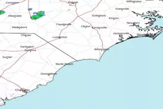
 Wilmington NC Radar
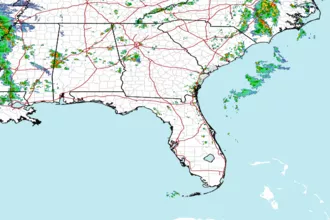
 Southeast Radar