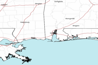
Pensacola FL to Pascagoula MS out 20 NM Marine Forecast
| Tonight...South Winds 5 To 10 Knots. Seas 1 Foot Or Less. Dominant Wave Period 4 Seconds. Patchy Fog After Midnight. |
| Friday...Southeast Winds 5 To 10 Knots, Increasing To 10 To 15 Knots In The Afternoon. Seas Around 2 Feet. Dominant Wave Period 4 Seconds. Patchy Fog In The Morning. |
| Friday Night...Southeast Winds 5 To 10 Knots, Increasing To 10 To 15 Knots With Gusts Up To 20 Knots After Midnight. Seas 2 To 3 Feet. Dominant Wave Period 5 Seconds. |
| Saturday...Southeast Winds 15 To 20 Knots With Gusts Up To 25 Knots. Seas 3 To 5 Feet. Dominant Wave Period 6 Seconds. |
| Saturday Night...Southeast Winds 15 To 20 Knots With Gusts Up To 25 Knots. Seas 4 To 6 Feet. Dominant Wave Period 7 Seconds. |
| Sunday...Southeast Winds 20 To 25 Knots, Diminishing To 15 To 20 Knots In The Afternoon. Seas 5 To 7 Feet. Dominant Wave Period 7 Seconds. |
| Sunday Night...Southeast Winds 20 To 25 Knots, Diminishing To 10 To 15 Knots After Midnight. Seas 5 To 7 Feet. Dominant Wave Period 8 Seconds. |
| Monday...Southeast Winds 10 To 15 Knots. Seas 4 To 6 Feet. Dominant Wave Period 8 Seconds. |
| Monday Night...Southeast Winds 10 To 15 Knots. Seas 3 To 5 Feet. Dominant Wave Period 7 Seconds. |
| Tuesday...Southeast Winds 5 To 10 Knots. Seas 3 To 4 Feet. Dominant Wave Period 7 Seconds. |
| Tuesday Night...Southeast Winds 5 To 10 Knots. Seas 2 To 3 Feet. Dominant Wave Period 6 Seconds. |
| Area Forecast Discussion National Weather Service Mobile AL 644pm CDT Thu April 25 2024 /issued 332pm CDT Thu April 25 2024/ ..New NEAR TERM, SHORT TERM, LONG TER Marine Near Term (Now through Friday) Issued at 332pm CDT Thu April 25 2024 Upper ridging will slowly build eastward during the overnight hours as the axis of an upper level trough swings into the Plains. At the surface, southerly flow will persist, filtering in warm and moist air. Current conditions across the forecast area are on the warm side, as temps have risen into the lower to mid 80s under partly cloudy skies. Skies will remain partly cloudy over the most part tonight and winds are expected to become calm, leading to radiational cooling for our overnight hours. This will allow temps to fall into the upper 50s to lower 60s by daybreak. The upper ridge will strengthen a bit on Friday morning before it begins to exit the area as the trough to our west slides eastward. Seasonably warm temperatures are expected again on Friday, as highs warm into the lower to mid 80s. /73 SHORT THROUGH Long Term (Friday night through Wednesday) Issued at 419am CDT Thu April 25 2024 Dry and seasonably warm conditions will persist through the weekend as upper ridging and surface high pressure maintain their hold on the sensible weather pattern. The aforementioned trough to our west will pivot northward before it becomes absorbed in the ridging aloft. Another closed low and trough will then swing into the Plains again and the upper ridge will strengthen over the southeast. Temps through the weekend will rise into the lower 80s during the day and fall into the lower to mid 60s during the overnight hours. The closed low over the plains will open as it moves to the northeast at the start of the upcoming work week. The ridge will maintain its hold through at least Monday, with another dry and seasonal day is on tap. The upper ridge will continue to push to the east through the day on Tuesday, as the weakening trough moves into the Mississippi Valley. The trough will continue to weaken through the day and flow aloft will become more zonal by Tuesday afternoon. There may be enough forcing to lend isolated thunderstorms Monday night into Tuesday, with the better chances during the afternoon hours on Tuesday. Confidence is not overly high on the coverage and for now will cap Probability of Precipitation to 30%. Another ridge begins to build eastward on Wednesday, with dry conditions expected to return. /73 Marine Issued at 332pm CDT Thu April 25 2024 Onshore flow will persist and then strengthen late Friday and especially this weekend. Winds may become sustained between 15-25 kt over the marine area through much of the weekend. Seas may build to 5-8 ft over the Gulf waters Saturday night into Sunday. Small Craft Advisories will likely become necessary this weekend. /73 NOAA Mobile AL Office: Watches - Warnings - Advisories AL...None. FL...None. MS...None. GM...None. |
 Mobile AL Radar
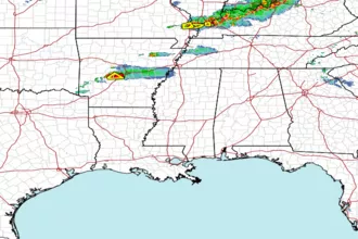
 Gulf Radar