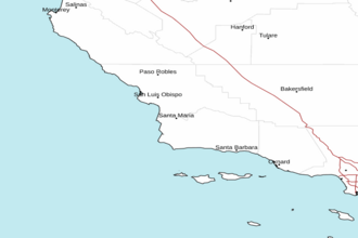
Point Pinos to Point Piedras Blancas out 10 NM Marine Forecast
| Today...Nw Winds 25 To 35 Knots With Gusts Up To 45 Knots. Wind Waves 5 To 7 Ft...Building To 8 To 10 Ft This Afternoon. Nw Swell 2 To 4 Ft At 12 Seconds. |
| Tonight...Nw Winds 20 To 30 Knots With Gusts Up To 45 Knots. Wind Waves 9 To 11 Ft. Nw Swell 2 To 3 Ft At 11 Seconds. |
| Tue...Nw Winds 20 To 30 Knots With Gusts Up To 45 Knots. Wind Waves 10 To 12 Ft. Nw Swell 2 To 3 Ft At 11 Seconds. |
| Tue Night...Nw Winds 20 To 30 Knots With Gusts Up To 45 Knots. Wind Waves 9 To 11 Ft. Nw Swell 2 To 4 Ft At 12 Seconds. |
| Wed...Nw Winds 20 To 30 Knots With Gusts Up To 40 Knots. Wind Waves 7 To 9 Ft. Nw Swell 2 To 4 Ft At 12 Seconds. |
| Wed Night...Nw Winds 20 To 30 Knots With Gusts Up To 40 Knots. Wind Waves 7 To 9 Ft. Nw Swell 2 To 3 Ft At 11 Seconds. |
| Thu...Nw Winds 15 To 20 Knots With Gusts Up To 25 Knots. Wind Waves 5 To 7 Ft. Nw Swell Around 2 Ft. |
| Fri...Nw Winds 15 To 20 Knots With Gusts Up To 25 Knots. Wind Waves 3 To 4 Ft. Nw Swell 3 To 5 Ft. |
| Area Forecast Discussion National Weather Service San Francisco CA 432am PDT Monday April 29 2024 .SHORT TERM... (Today and tonight) Issued at 1202am PDT Monday April 29 2024 A relatively benign weather pattern persists featuring quasi-zonal flow across California with weak troughing across the Pacific Northwest states. This will bring a weak/dissipating cold front through the Bay Area with little fanfare, as the primary weather concern remains steady onshore winds. Conditions will be rather breezy along the coast yet again, with peak gusts in the 30-40 mph range. This will have a cooling effect on temperatures there, while inland readings warm during the afternoon. High temperatures will range from the upper 50s on the beaches to the mid 70s in the warmest inland valleys. Look for patchy coastal stratus development once again overnight with lows in the 40s. Long Term (Tuesday through Sunday) Issued at 1202am PDT Monday April 29 2024 A subtle ridge over California continues through the work week, with an upper level low passing through the Great Basin. The story of the week will be clear skies and warmer weather with interior valleys seeing highs in the low 80s and the coasts seeing highs in the mid 60s to lower 70s. The upcoming weekend sees a pattern change with an upper level low coming into the Pacific Northwest on Friday, bringing a weak front through California. The chance of rain on Saturday and Sunday, currently up to 20-30% Probability of Precipitation, has expanded throughout the forecast region, although rain amounts remain light with the higher elevations receiving up to a tenth of an inch of rain. Cluster and ensemble model output also suggest a deeper upper level low coming into the Pacific Northwest during the first week of May, and CPC products continue to suggest cooler temperatures and increased rain chances into the second week of May. Marine (Today through Saturday) Issued at 432am PDT Monday April 29 2024 High pressure over the Eastern Pacific and low pressure inland will maintain strong northerly winds over the coastal waters and bays today. Winds will be strongest over the outer waters and along the Big Sur coast. The strong winds will produce fresh steep wind waves and hazardous conditions. Winds continue to increase during the first half of the week lasting through Thursday. Moderate period northwesterly swell will continue to move through the waters through Thursday causing wave heigheights up to 12 feet. NOAA San Francisco Bay Area Office: Watches - Warnings - Advisories CA...None. PZ...Small Craft Advisory from 3pm this afternoon to 3am PDT Tuesday for SF Bay N of Bay Bridge. Small Craft Advisory until 3am PDT Tuesday for Mry Bay-Pigeon Pt to Pt Pinos 0-10 nm-Pt Reyes to Pigeon Pt 0-10 nm. Small Craft Advisory until 9am PDT this morning for Pigeon Pt to Pt Pinos 10-60 NM-Pt Arena to Pt Reyes 0-10 nm-Pt Arena to Pt Reyes 10-60 NM. Gale Warning from 9am this morning to 3am PDT Tuesday for Pigeon Pt to Pt Pinos 10-60 NM-Pt Arena to Pt Reyes 0-10 nm- Pt Arena to Pt Reyes 10-60 NM. Gale Warning until 3am PDT Tuesday for Pt Pinos to Pt Piedras Blancas 0-10 nm. |
 Vandenberg AFB Radar
 Pacific Southwest Radar