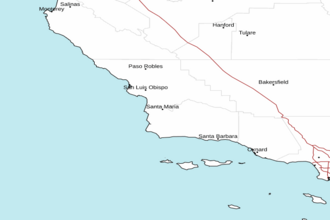
Point Piedras Blancas to Point Sal out 10 NM Marine Forecast
| Today...Nw Wind 5 To 10 Kt, Becoming 10 To 15 Kt With Gusts To 20 Kt This Afternoon. Seas 5 To 7 Ft. Wave Detail: Nw 5 Ft At 8 Seconds And Nw 6 Ft At 12 Seconds. Patchy Fog This Morning. |
| Tonight...Nw Wind 10 To 15 Kt With Gusts To 20 Kt, Becoming 5 To 10 Kt After Midnight. Seas 5 To 7 Ft. Wave Detail: Nw 6 Ft At 7 Seconds And Nw 3 Ft At 13 Seconds. Patchy Fog. |
| Sat...Light Winds, Becoming Nw 10 To 15 Kt In The Afternoon. Seas 4 To 6 Ft. Wave Detail: Nw 2 Ft At 8 Seconds And W 5 Ft At 11 Seconds. Patchy Fog In The Morning. |
| Sat Night...Nw Wind 10 To 15 Kt In The Evening, Becoming Light. Seas 4 To 6 Ft. Wave Detail: Nw 4 Ft At 7 Seconds And Nw 5 Ft At 12 Seconds. Patchy Fog. |
| Sun...Light Winds, Becoming W 10 To 15 Kt In The Afternoon. Seas 4 To 5 Ft. Wave Detail: Nw 3 Ft At 6 Seconds And Nw 4 Ft At 12 Seconds. Patchy Fog In The Morning. |
| Sun Night...W Wind 10 To 15 Kt In The Evening, Becoming Light. Seas 4 To 6 Ft. Wave Detail: Nw 5 Ft At 13 Seconds. |
| Mon...Light Winds, Becoming W 5 To 10 Kt In The Afternoon. Seas 4 To 6 Ft. Wave Detail: Nw 2 Ft At 5 Seconds, W 5 Ft At 15 Seconds And S 2 Ft At 15 Seconds. A Slight Chance Of Showers. |
| Mon Night...W Wind 5 To 10 Kt In The Evening, Becoming Light. Seas 4 To 6 Ft. Wave Detail: W 3 Ft At 6 Seconds, Nw 4 Ft At 14 Seconds And S 2 Ft At 14 Seconds. |
| Tue...Light Winds, Becoming W 10 To 15 Kt In The Afternoon. Seas 4 To 5 Ft. Wave Detail: Nw 3 Ft At 6 Seconds, W 4 Ft At 13 Seconds And S 2 Ft At 15 Seconds. |
| Tue Night...Nw Wind 10 To 15 Kt With Gusts To 20 Kt, Becoming 5 To 10 Kt After Midnight. Seas 4 To 5 Ft. Wave Detail: Nw 4 Ft At 5 Seconds, W 3 Ft At 12 Seconds And S 2 Ft At 15 Seconds. |
| Area Forecast Discussion National Weather Service Los Angeles/Oxnard CA 428am PDT Fri May 1 2026 Synopsis 01/103 AM. Quiet weather with near seasonal temperatures will prevail the rest of the week. Breezy west to northwest winds will occur across portions of the area at times. Light rain showers are possible late Sunday into Monday. Dry and warmer conditions can be expected through next week. Short Term - Today through Sunday 01/102 AM. Overall, 00Z models in good synoptic agreement through the short term period. At upper levels, weak ridge will develop over the area today, but will weaken Saturday/Sunday as a low drops south down the California coast. At the surface, moderate onshore flow is expected. Forecast-wise, no significant issues through the short term period. With the moderate onshore pressure gradients and lower H5 thicknesses, marine layer stratus/fog is expected to become more widespread each night/morning, pushing well into the coastal valleys by Sunday morning. The stratus/fog should dissipate nicely each day. Other than the marine layer stratus, will just expect an increase in high level clouds with partly cloudy skies for most areas by Saturday and Sunday. As for winds, northerly winds have begun to diminish across the western half of the Santa Ynez Range. So, the WIND ADVISORIES were allowed to expire. Otherwise, the moderate onshore gradients will continue to generate gusty southwesterly winds across interior sections each afternoon/evening. At this time, the strongest winds look to be on Sunday with the possibility of advisory-level winds across the LA mountains and Antelope Valley foothills. As for temperatures, will expect near persistence temperatures today across the area. However, on Saturday, there will be a couple degrees of cooling then much more significant cooling can be expected on Sunday. In fact on Sunday, most areas will be the mid 60s to lower 70s. Long Term - Monday through Thursday 01/102 AM. For the extended, 00Z models continue to exhibit good synoptic agreement. At upper levels, low will move across Central California on Monday then a ridge will develop over the area Tuesday through Thursday. At the surface, moderate onshore flow will continue. Forecast-wise, main "concern" in the extended period will be Monday as the upper low moves inland across Central California. With this passage, there will be some low chances of measurable precipitation (10-20%) with the best chances across the Central Coast. This low will be rather moisture-starved, so rainfall amounts, if any, will be only a few hundredths of an inch for most areas. However, the northwest corner of San Luis Obispo county could squeeze out around 0.10-0.20 inches as a worst case scenario. On Monday morning, there will be a decent chances of some patchy drizzle as the marine inversion deepens dramatically. For Tuesday through Thursday, mostly clear and dry conditions are expected although there may be some continued coastal stratus and fog during the night/morning hours. With the ridge building overhead, a area-wide warming trend is expected. In fact by Thursday, temperatures will be topping out in the mid 70s to mid 80s. Marine 01/103 AM. For the Outer Waters, high confidence in current forecast. Small Craft Advisory (SCA) level winds will diminish early this morning below SCA (Small Craft Advisory) levels. For the balance of today through Tuesday, winds and seas are expected to remain below SCA (Small Craft Advisory) levels. For the Inner Waters north of Point Sal, high confidence in current forecast. Today through Tuesday, winds and seas are expected to remain below SCA (Small Craft Advisory) levels. For the Inner Waters south of Point Conception, high confidence in current forecast. Today through Sunday, winds and seas are expected to remain below SCA (Small Craft Advisory) levels. For Tuesday and Wednesday, winds and seas are expected to continue to remain below SCA levels, but there is a 20% chance of SCA (Small Craft Advisory) level winds in the afternoon and evening hours. NOAA Los Angeles/Oxnard CA Office: Watches - Warnings - Advisories CA...NONE. PZ...NONE. |
 Vandenberg AFB Radar
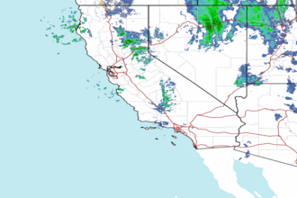
 Pacific Southwest Radar