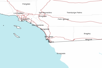
San Mateo Point CA to the Mexican Border and out 30 NM Marine Forecast
| Tonight...Wind Variable Less Than 10 Knots...Becoming South 10 Knots After Midnight. Wind Waves Around 2 Feet Or Less. Swell West 2 To 4 Feet At 9 Seconds. |
| Monday...Wind Variable Less Than 10 Knots...Becoming West To 10 Knots In The Afternoon. Wind Waves Around 2 Feet Or Less. Swell West 3 To 4 Feet At 9 Seconds. |
| Monday Night...Wind West To 10 Knots...Becoming South 10 Knots With Gusts To 15 Knots After Midnight. Wind Waves Around 2 Feet Or Less. Swell West 3 To 4 Feet At 10 Seconds. |
| Tuesday...Wind South 10 Knots. Wind Waves Around 2 Feet Or Less. Swell West 3 To 4 Feet At 11 Seconds. |
| Tuesday Night...Wind South 10 To 15 Knots. Wind Waves Around 2 Feet Or Less. Swell West 3 To 4 Feet At 11 Seconds. |
| Wednesday...Wind Southeast 10 Knots...Becoming Southwest In The Afternoon. Wind Waves Around 2 Feet Or Less. Swell West 3 To 4 Feet. |
| Wednesday Night...Wind Variable Less Than 10 Knots. Wind Waves Around 2 Feet Or Less. Swell West 2 To 4 Feet. |
| Thursday...Wind Variable Less Than 10 Knots...Becoming West 10 Knots In The Afternoon. Wind Waves Around 2 Feet Or Less. Swell West 2 To 3 Feet At 10 Seconds. |
| Thursday Night...Wind Northwest 10 Knots With Gusts To 15 Knots In The Evening...Becoming Variable Less Than 10 Knots. Wind Waves Around 2 Feet Or Less. Swell West 2 To 3 Feet At 10 Seconds. |
| Friday...Wind Variable Less Than 10 Knots...Becoming West 10 Knots In The Afternoon. Wind Waves Around 2 Feet Or Less. Swell West 2 Feet At 10 Seconds. |
| Friday Night...Wind Northwest 10 Knots In The Evening...Becoming Variable Less Than 10 Knots. Wind Waves Around 2 Feet Or Less. Swell West 2 Feet At 10 Seconds. |
| Area Forecast Discussion National Weather Service San Diego CA 930pm PDT Sunday April 28 2024 Synopsis Warm and dry conditions will continue through much of this week. Marine layer low clouds and fog will likely be confined to the coast and the western coastal valleys. The mountains and deserts will experience breezy winds from the west each afternoon and evening. There is a chance of weak Santa Ana winds Thursday, followed by cooler weather with gusty west winds next weekend. For Extreme Southwestern California Including Orange... San Diego...Western Riverside and Southwestern San Bernardino Counties Update... Mostly clear skies prevail with patchy low clouds over the southern San Diego County coastal waters extending south into the Baja California coastal waters where they are more abundant. HRRR/HREF have patchy low clouds near the coast late tongiht and early Monday, with up to 80% of HREF solutions showing more than 50% cloud cover along the immediate coast of San Diego County early Monday morning. With the weak marine inversion, they should clear quickly. There is about 1 deg C warming at 850 MB Monday vs. Sunday, so that should translate well to about 2 deg F warming with quite a few lower 80s in the Inland Empire and even a stray 80+ temperature in the San Diego County valleys and inland Orange County. An eddy could develop Monday night/Tuesday morning for increasing coastal low clouds. After a trough moves through Wednesday, there will be weak offshore flow, though the best MSLP gradients will likely stay closer to the Nevada border versus over the San Bernardino/San Gabriel Mountains. There is still a lot of uncertainty among ensemble members for next weekend, but some cooling and increased west winds is the most likely scenario, with precipitation quite unlikely at this time. From previous discussion... Monday and Tuesday will see this warming trend continue, with highs climbing generally 1 to 3 degrees each day. With this warming trend, the marine layer will become more shallow with low clouds and fog becoming more and more confined to the immediate coast and the western coastal valleys each morning. There will be a coastal eddy at times, which will likely help to keep the marine layer from eroding entirely. Early this week, a 500mb trough will move across the Northwestern US and Western Canada. The amplitude of this trough will not be strong enough to bring significant changes to sensible weather in SoCal, but will be strong enough to maintain a slightly stronger pressure gradient across our region. This will generally favor gusty winds in the mountains and deserts each afternoon and evening, fairly typical for this time of year. Peak gusts each day today through Tuesday will generally be in the 20-40 mph range, strongest over ridgelines, below passes, and through wind-prone canyons. Wednesday will see a slightly stronger 500mb trough move across the Western US, which will bring a bit of cooling as well as slightly stronger winds and a deeper marine layer. It will not be a significant or abrupt cooldown as temperatures are still expected to remain near to slightly above average for early May. What may be of bigger impact is the potential for offshore flow/Santa Anas behind the trough passage on Thursday. At the moment, this looks to be a weak Santa Ana event that will be most noticeable immediately below mountain passes and in the coastal mountain foothills, with gusts generally at or below 30 mph. The forecast then becomes a bit murky for the weekend. Global ensembles are in some agreement on the approach of another weak trough, but the timing and amplitude of said trough remain uncertain. Regardless, a switch to some cooler and breezier weather with a deepening marine layer looks fairly likely for next weekend, queuing up the “May Gray” we are all so used to. Marine No hazardous marine conditions through Wednesday. Skywarn Skywarn activation is not requested. However weather spotters are encouraged to report significant weather conditions. NOAA San Diego CA Office: Watches - Warnings - Advisories CA...None. PZ...None. |
 San Diego Radar
 Pacific Southwest Radar