Parris Island, SC Weather Forecast
Marine Forecast: Edisto Beach to Savannah
Parris Island, South Carolina
Lat: 32.35N, Lon: 80.68W
Overcast
Temp: 68°F
- Humidity:
- 96%
- Winds:
- 3 MPH VRB
- Gusts:
- N/A MPH
- Barometer:
- 29.99 in.
- Dewpoint:
- 67°F
- Heat index:
- 68°F
- Sunrise:
- 6:36 AM EDT
- Sunset:
- 8:01 PM EDT
- Moonrise:
- 6:26 PM EDT
- Moonset:
- 5:15 AM EDT
| Today...Sunny. Highs in the upper 80s, except in the upper 70s near the coast. Southwest winds 10 to 15 mph. |
| Tonight...Mostly clear. Lows in the lower 60s. South winds 10 to 15 mph. |
| Friday...Sunny. Highs in the lower 90s, except in the upper 80s near the coast. Southwest winds 5 to 10 mph. |
| Friday Night...Mostly clear. Lows in the mid 60s. South winds 5 to 10 mph. |
| Saturday...Mostly sunny. Highs in the lower 90s, except in the upper 80s near the coast. South winds 5 to 10 mph. |
| Saturday Night...Mostly cloudy. Lows in the upper 60s. |
| Sunday...Partly sunny. Highs in the lower 80s. |
| Sunday Night...Mostly cloudy. Lows in the lower 50s. |
| Monday...Sunny. Highs in the lower 70s. |
| Monday Night...Mostly clear. Lows in the lower 50s. |
| Tuesday...Mostly sunny. Highs in the mid 70s. |
| Tuesday Night...Partly cloudy. Lows in the upper 50s. |
| Wednesday...Mostly sunny. Highs in the upper 70s. |
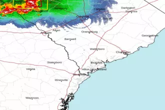
 Charleston SC Radar
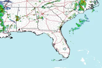
 Southeast Radar