Calcasieu Lake Marine Forecast
| Today...South Winds 5 To 10 Knots, Increasing To 10 To 15 Knots With Gusts Up To 20 Knots This Afternoon. Lake Waters Choppy. |
| Tonight...South Winds 10 To 15 Knots With Gusts Up To 20 Knots. Lake Waters Choppy. |
| Tuesday...South Winds 10 To 15 Knots With Gusts Up To 25 Knots. Lake Waters Choppy. |
| Tuesday Night...South Winds 10 To 15 Knots With Gusts Up To 20 Knots. Lake Waters Choppy. |
| Wednesday...South Winds 10 To 15 Knots With Gusts Up To 25 Knots. Lake Waters Choppy. A Slight Chance Of Showers And Thunderstorms. |
| Wednesday Night...South Winds 10 To 15 Knots. Lake Waters Choppy. A Slight Chance Of Showers And Thunderstorms In The Evening, Then A Chance Of Showers And Thunderstorms After Midnight. |
| Thursday...Northwest Winds Around 10 Knots, Becoming Northeast In The Afternoon. Lake Waters Light Chop. A Chance Of Thunderstorms. Showers Likely, Mainly In The Morning. |
| Thursday Night...Northeast Winds 10 To 15 Knots. Lake Waters Choppy. A Chance Of Showers. A Chance Of Thunderstorms, Mainly In The Evening. |
| Friday...Northeast Winds 10 To 15 Knots, Diminishing To 5 To 10 Knots In The Afternoon. Lake Waters Choppy. A Chance Of Showers. |
| Friday Night...East Winds 5 To 10 Knots. Lake Waters Light Chop. A Slight Chance Of Showers And Thunderstorms. Winds And Waves Higher In And Near Thunderstorms. |
| Area Forecast Discussion National Weather Service Lake Charles LA 616am CDT Monday May 4 2026 (Today through Sunday) Issued at 1222am CDT Monday May 4 2026 High pressure remains overhead this morning yielding mostly clear skies and calm winds across the region. The center of the high will work east of the region over the next eight hours or so allowing southerly winds to develop after sunrise. With these southerly winds will come increasing humidity through the day as dewpoints will climb from the lower 50s this morning to the lower 60s by this evening. Thereturn flow will be slow enough to keep afternoon highs in the upper 70s to lower 80s today for one more day of picture perfect weather. The atmospheric column will become increasingly saturated Tuesday as a weak upper level disturbance with better moisture transits the region resulting in a significant increase in cloud cover and a much more muggy feeling on the ground. Another upper level trough digging south across the central conus is forecast to push another noticeable cold front through the region Thursday morning. Guidance has consistently pushed back the frontal passage by about 6-12 hours compared to this time yesterday while further increasing the moisture pooling along the gulf coast ahead of it. This will support heavy rain producing thunderstorms and WPC has introduced a marginal risk of excessive rainfall across central Louisiana. Strong instability and wind shear from southwesterly flow aloft will have the potential to support some severe storms from late Wednesday afternoon into Wednesday night although details regarding the exact timing and probabilities of severe storms will continue to be ironed out over the next couple of days. A cooler, drier airmass will push into the region behind the front, but this one will not be nearly as "clean" as another upper level low moving across northern Mexico and southern Texas will interact with the moisture aloft to maintain overcast skies and produce more showers and thunderstorms Friday into Saturday. There remains a high degree of uncertainty regarding the evolution of this feature so don't cancel late week or weekend plans just yet. Marine Issued at 1222am CDT Monday May 4 2026 Onshore winds will become reestablished today between 10-15 knots where they'll remain until Thursday morning. A cold front is expected to move through the coastal waters Thursday morning accompanied by showers and thunderstorms that are likely to continue following the frontal passage through at least Friday morning. Breezy offshore flow between 15-20 knots will develop behind the front Thursday into Friday before turning onshore again next weekend. Fire Weather Issued at 1222am CDT Monday May 4 2026 Dewpoints will gradually increase today and tomorrow on light southerly winds. Precipitation chances return Wednesday afternoon ahead of an approaching cold front that will push through the region early Thursday morning. A few of these storms will have the potential to become severe. Winds will turn northerly behind the frontal passage Thursday morning. Precipitation chances will remain elevated Thursday and Friday as upper level moisture associated with the front interacts with a second upper level low moving across south Texas. NOAA Lake Charles LA Office: Watches - Warnings - Advisories LA...None. TX...None. GM...None. |
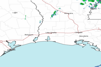 Lake Charles LA Radar
 Gulf Radar