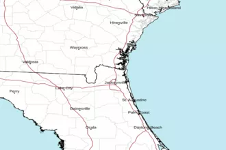
Fernandina Beach to St. Augustine, FL Out 20 NM Marine Forecast
| Tonight...North Northwest Winds 15 To 20 Knots, Diminishing To 10 To 15 Knots After Midnight. Seas 5 To 7 Feet, Occasionally To 8 Feet, Decreasing To 4 To 6 Feet. Wave Detail: Northeast 5 Feet At 8 Seconds And North 2 Feet At 5 Seconds. Intracoastal Waters Choppy. |
| Wednesday...North Winds 5 To 10 Knots, Becoming South 10 To 15 Knots In The Afternoon. Seas 4 To 6 Feet, Occasionally To 8 Feet. Wave Detail: Northeast 5 Feet At 8 Seconds And East 5 Feet At 14 Seconds. Intracoastal Waters A Moderate Chop. |
| Wednesday Night...Southwest Winds 15 To 20 Knots, Becoming West 20 To 25 Knots After Midnight. Seas 5 To 7 Feet, Occasionally To 9 Feet. Wave Detail: East 6 Feet At 12 Seconds And West 4 Feet At 4 Seconds. Intracoastal Waters Rough. |
| Thursday...West Winds 15 To 20 Knots. Seas 4 To 6 Feet, Occasionally To 8 Feet. Wave Detail: East 5 Feet At 11 Seconds And West 4 Feet At 4 Seconds. Intracoastal Waters Choppy. |
| Thursday Night...Northwest Winds 15 To 20 Knots. Seas 4 To 6 Feet, Occasionally To 8 Feet. Wave Detail: Northwest 4 Feet At 4 Seconds And East 3 Feet At 11 Seconds. Intracoastal Waters Choppy. |
| Friday And Friday Night...Northwest Winds 10 To 15 Knots. Seas 3 To 5 Feet, Occasionally To 6 Feet. Wave Detail: North 4 Feet At 5 Seconds And East 3 Feet At 12 Seconds. Intracoastal Waters A Moderate Chop. |
| Saturday...North Winds 10 To 15 Knots. Seas 2 To 3 Feet. Intracoastal Waters A Moderate Chop. |
| Sunday...North Winds 10 To 15 Knots. Seas 2 To 3 Feet. Intracoastal Waters A Moderate Chop. |
| Area Forecast Discussion National Weather Service Jacksonville FL 142pm EDT Tuesday Oct 28 2025 Near Term Issued at 1239pm EDT Tuesday Oct 28 2025 Low pressure with trailing front will continue to move away to the northeast through Tonight. Low stratus will remain into the evening, and begin to break overnight, as high pressure ridges down the southeastern US coast. Temperatures will be a little below normal Tonight, with readings generally falling into the 50s. A few lows in the upper 40s will be possible over inland SE GA. .SHORT TERM... (Wednesday through Thursday night) Issued at 1239pm EDT Tuesday Oct 28 2025 A cold front, extending from a low center over Tennessee and Kentucky, will move into far inland counties Wednesday afternoon, then track across area Wednesday night as the low moves off toward the northeast. Ahead of the front, a partly sunny day is expected, with isolated to scattered showers accompanying the front itself. Highs Wednesday will recover to near normal, due to a southerly flow ahead of boundary. Temperatures will fall off Wednesday night due to cold advection behind front. Lows ranging from the middle 40s inland to the lower 50s north central FL and along the coast. High pressure will build to the west, as the low tracks further to the northeast Thursday. The gradient between these two features will lead to elevated winds during the day Thursday. Mainly clear skies forecast for Thursday into Thursday night. Highs Thursday, and lows Thursday night will be well below normal due to cold advection on a northwest flow. Long Term (Friday through next Tuesday) Issued at 1239pm EDT Tuesday Oct 28 2025 High pressure will build overhead Friday, and linger through Saturday. The high will move north of area Sunday, as an inverted trough develops to the south. This low pressure trough will lift across area Monday bringing low end precipitation chances. At this time these chances are too low to mention in forecast, but this may change in future forecast cycles. Longer range models diverge on how fast this area lifts out, so will keep precipitation chances out for now on Tuesday as well. Temperatures will be below normal this period. The coldest night this period will be Friday night when inland lows could dip into the upper 30s. If winds drop to calm however, could not rule out mid 30s in a few inland locations with a light frost. Marine Issued at 1239pm EDT Tuesday Oct 28 2025 Weak high pressure ridge will be in place across area waters through Wednesday. On Wednesday night, Hurricane Melissa will lift north out of the Caribbean, and into the western Atlantic, while a cold front move east across local area. Melissa is expected to stay well to the east Thursday, as high pressure builds into region from the west. This high will build overhead Friday into Saturday. A trough of low pressure will affect the area Sunday into the early part of next week. Rip Currents High through Wednesday NOAA Jacksonville FL Office: Watches - Warnings - Advisories FL...High Rip Current Risk through late Wednesday night for FLZ124- 125-138-233-333. Coastal Flood Advisory until 1am EDT Thursday for FLZ132-137- 325-633. GA...High Rip Current Risk through late Wednesday night for GAZ154- 166. AM...Small Craft Advisory until 10pm EDT this evening for AMZ450-452- 454. Small Craft Advisory from 6pm Wednesday to 5am EDT Friday for AMZ450-452-454. Small Craft Advisory until 5am EDT Friday for AMZ470-472-474. |
 Jacksonville Radar
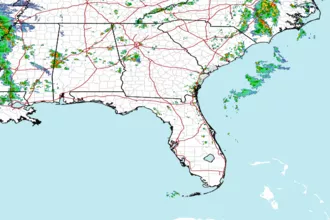
 Southeast Radar