Massachusetts Bay and Ipswich Bay Marine Forecast
| This Afternoon...Ne Winds 5 To 10 Kt. Seas 1 Foot Or Less, Then Around 2 Ft. Wave Detail: Nw 1 Foot At 2 Seconds And Ne 1 Foot At 2 Seconds, Becoming Ne 1 Foot At 3 Seconds And Se 1 Foot At 7 Seconds. |
| Tonight...E Winds 5 To 10 Kt. Seas 2 To 3 Ft. Wave Detail: E 3 Ft At 11 Seconds And Ne 2 Ft At 4 Seconds. |
| Tue...Ne Winds 5 To 10 Kt. Seas 2 To 4 Ft. Wave Detail: E 4 Ft At 8 Seconds And S 4 Ft At 11 Seconds. |
| Tue Night...Ne Winds Around 10 Kt. Seas 4 To 6 Ft. Wave Detail: E 5 Ft At 8 Seconds And N 1 Foot At 3 Seconds. |
| Wed...Ne Winds Around 10 Kt. Seas 4 To 6 Ft. Wave Detail: E 6 Ft At 10 Seconds And Ne 2 Ft At 7 Seconds. |
| Wed Night...E Winds 10 To 15 Kt. Seas 3 To 5 Ft. Wave Detail: E 5 Ft At 9 Seconds And Se 2 Ft At 5 Seconds. A Chance Of Showers In The Evening, Then Showers Likely After Midnight. |
| Thu And Thu Night...E Winds Around 15 Kt, Becoming N. Seas 3 To 5 Ft. Showers. |
| Fri...W Winds 15 To 20 Kt. Seas 3 To 4 Ft. A Chance Of Showers. |
| Fri Night...W Winds 15 To 20 Kt. Seas 3 To 4 Ft. Seas Are Reported As Significant Wave Height, Which Is The Average Of The Highest Third Of The Waves. Individual Wave Heights May Be More Than Twice The Significant Wave Height. |
| Area Forecast Discussion National Weather Service Boston/Norton MA 724am EDT Monday April 27 2026 .WHAT HAS CHANGED... Added small craft advisories for the northern waters Tuesday, while extending the existing small craft advisories through Tuesday night. .KEY MESSAGES... - Sunny and dry weather early this week. Above normal temperatures for western/interior New England, but remaining quite a bit cooler near the coast with seabreezes. - Unsettled weather around Wednesday night and Thursday with a welcomed soaking rain looking likely. - Remains unsettled Friday into the weekend with partly to mostly cloudy weather, cooler than normal temperatures and pop-up showers. KEY MESSAGE 1...Sunny and dry weather early this week. Above normal temperatures for western/interior New England, but remaining quite a bit cooler near the coast with seabreezes. High pressure ridging in from coastal ME/NH is leading to clear skies, light to calm winds and a cool evening for most of Southern New England, and will remain in place the next couple days. Some residual cloud cover from distant coastal low will be gradually peeling off toward the southeast through the morning hours. This sets the stage for a couple of stellar couple days for us today and tomorrow to open up the workweek. Both days are generally similar - with full sun, deep blue skies with onshore flow and seabreezes for the east coast (and potentially the south coast too), to go along with good radiational cooling both nights. Away from the coast highs should reach into the 60s, with some lower 70s in the CT Valley, but near the coasts, highs will be kept in the lower to mid 50s. PBL flow is next to nil with strong confidence in seabreeze development, and it may penetrate quite a ways inland and bring some modest cooling this afternoon to I-495. Really nice couple days for outdoor activities. Lows each night in the mid 30s to low 40s. The one potential fly in the ointment comes either late Tuesday or Tuesday night. Moisture from the offshore low looks to rotate back westward, with guidance varying on when that might occur, which could bring low clouds and possible drizzle to east coastal MA when it does set in. The timing will probably be tough to pin down over the next couple days but a best estimate looks to be sometime Tuesday night. Really not a significant impact though, aside from aviation. KEY MESSAGE 2...Unsettled weather around Wednesday night and Thursday with a welcomed soaking rain looking likely. The more active period of weather takes shape late Wednesday night and especially into Thursday. Overcast skies but mainly dry weather holds on for Wed, but by later Wednesday night into Thursday, a frontal occlusion with possible secondary low pressure development along it sweeps NNE through Southern New England. Pretty robust dynamics acting on a 1" PWAT (Precipitable Water) airmass should bring a welcomed soaking rain. Some of the details are still uncertain this far out, including if and how strong might a secondary low pressure developing on the front might be. That would affect rain amounts and also enhanced ESE winds. Did look briefly at coastal flooding as astro tides start to come up Thursday too, but it would take about a 2 ft surge to get most areas to minor coastal flooding for the evening high tides and an early look suggests values around 1-1.3 ft, thus likely falling short. Still, a good soaking rain with moderate to high probs of 24 hour rain of at least a half inch, and lower to moderate probs of 24 hour rains of at least an inch. KEY MESSAGE 3...Remains unsettled Friday into the weekend with partly to mostly cloudy weather, cooler than normal temperatures and pop-up showers. Beyond Thursday...weather pattern remains unsettled with cyclonic flow aloft governing the area, bringing a return to cooler than normal temperatures and at least some partial cloudiness to open the first couple days of May. The question is if we can generate any instability showers for Friday into the weekend underneath the trough. Earlier 12z guidance was hinting at this more bullishly, but the recent 00z guidance has backed off and shunts most of the moisture off towards northern New England. If showers were to develop, they wouldn't necessarily be washouts but could produce some graupel given the anomalously cold airmass for early May (850 mb temps -1 to -4C). Highs in the mid to upper 50s with a modest WNW wind. Marine Forecaster Confidence Levels... Low - less than 30 percent. Moderate - 30 to 60 percent. High - greater than 60 percent. Northeast winds will be strongest today over the southeast waters adjacent to Cape Cod, with gusts in the 25 kt range and seas building to around 4-6 ft. Otherwise, northeast winds and seas should remain below small craft advisory levels today. NE to N winds around 15-20 kt tonight into Tuesday, highest eastern/southeast waters. The main issue is that seas from a distant coastal low near the Maritimes will be building on most of the eastern and southern outer waters; this has prompted extending the existing ocean waters SCAs (Small Craft Advisories) through Tuesday night while adding the northern outer waters. Seas building to around 6-9 ft by Tuesday night. Outlook /Tuesday through Friday/... Tuesday: Winds less than 25 kt. Areas of rough seas. Tuesday Night through Wednesday: Winds less than 25 kt. Areas of rough seas. Slight chance of rain showers. Wednesday Night: Winds less than 25 kt. Local rough seas. Chance of rain showers. Thursday: Winds less than 25 kt. Local rough seas. Rain showers, slight chance of thunderstorms. Thursday Night: Low risk for Small Craft Advisory winds with gusts up to 25 kt. Seas up to 5 ft. Chance of rain showers. Friday: Low risk for Small Craft Advisory winds with gusts up to 25 kt. Seas up to 5 ft. Slight chance of rain showers. NOAA Boston MA Office: Watches - Warnings - Advisories CT...None. MA...None. RI...None. Marine Small Craft Advisory until 8pm EDT this evening for ANZ232. Small Craft Advisory from 2am Tuesday to 2am EDT Wednesday for ANZ250. Small Craft Advisory until 2am EDT Wednesday for ANZ254>256. |
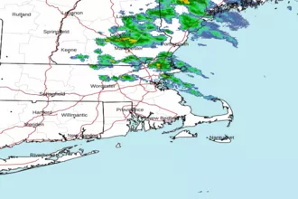 Boston MA Radar
 Northeast Radar
 East Coast Satellite