Nantucket Sound Marine Forecast
| This Afternoon...Ne Winds 10 To 15 Kt With Gusts Up To 20 Kt. Seas Around 2 Ft. Wave Detail: Nw 1 Foot At 2 Seconds And Ne 1 Foot At 3 Seconds. |
| Tonight...E Winds 5 To 10 Kt, Becoming Ne After Midnight. Seas 1 Foot Or Less. Wave Detail: Ne 1 Foot At 3 Seconds And Nw 1 Foot At 3 Seconds. |
| Sat...Ne Winds 5 To 10 Kt. Seas Around 2 Ft. Wave Detail: Ne 1 Foot At 2 Seconds And Nw 1 Foot At 5 Seconds. |
| Sat Night...E Winds Around 5 Kt. Seas Around 2 Ft. Wave Detail: E 2 Ft At 9 Seconds And E 1 Foot At 3 Seconds. |
| Sun And Sun Night...Ne Winds 10 To 15 Kt. Seas Around 2 Ft. Wave Detail: E 2 Ft At 11 Seconds And E 1 Foot At 4 Seconds. A Chance Of Showers. |
| Mon...Ne Winds 10 To 15 Kt With Gusts Up To 20 Kt. Seas Around 2 Ft. Wave Detail: Ne 2 Ft At 3 Seconds And Se 2 Ft At 6 Seconds. A Chance Of Showers. |
| Mon Night And Tue...Ne Winds 10 To 15 Kt With Gusts Up To 20 Kt. Seas Around 2 Ft. |
| Tue Night...Ne Winds 10 To 15 Kt. Seas 3 To 5 Ft. Seas Are Reported As Significant Wave Height, Which Is The Average Of The Highest Third Of The Waves. Individual Wave Heights May Be More Than Twice The Significant Wave Height. |
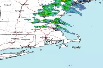
| Area Forecast Discussion National Weather Service Boston/Norton MA 110pm EDT Fri April 24 2026 .WHAT HAS CHANGED... No significant changes. .KEY MESSAGES... - Dry and cool this weekend overall but some light rain possible across CT and near South Coast. - Unsettled pattern develops for the middle and end of next week with showers from time to time. KEY MESSAGE 1...Dry and cool this weekend with onshore winds but some light rain can't be ruled out across CT and near South Coast. Blocky pattern persists into the weekend as we remain sandwiched between closed low over Maritimes and ridging over Great Lakes. Although mainly dry weather will prevail, closed low will eventually pull far enough away to allow a weak short wave and surface low to pass just south of New England, potentially bringing some light rain to portions of western MA, CT, and perhaps the South Coast as well later Saturday into Sunday. We're now getting into window of high-res guidance which shows a sharp cutoff on northern edge of precipitation shield, something to be expected when we have confluent flow aloft over our region and surface high pressure just to our north, allowing drier air at lower levels to move in despite onshore flow. Consensus shows best chances of seeing at least some light rain along and SW of a line from Pittsfield, MA to Hartford, CT and Newport, RI. We did note 12z 3km NAM brings it a little farther north, as does 12z GFS, both of which weaken surface ridge a bit more. If this trend continues we may have to expand chance Probability of Precipitation into these areas as well. Also of note is 12z NAM wants to close off the short wave near Cape Cod Monday, something it has shown for a couple of runs, but now it does so a little more offshore. Don't see a lot of support for this solution in ensemble cluster analysis which shows more of an open wave, but this could end up keeping at least clouds and stronger NE winds near Cape Cod and Islands should it come to pass, if not lingering showers. Of course it wouldn't be late April in southern New England without still having to assess precipitation type. Temperature profiles look marginal at best for some wet snow across the hills of northern CT which can be seen in 3km/12km NAM ptype forecasts, but it certainly can't be ruled out, especially if it occurs Saturday night. At this point we don't see any real accumulation other than perhaps a coating on grass in some locations. KEY MESSAGE 2...Unsettled pattern develops for the middle and end of next week with showers from time to time. High pressure will dominate early next week with dry weather and near average temperatures, though continued onshore flow will keep coastal areas on the cool side given ocean temperatures are still in the 40s. Pattern undergoes a change during mid to late week as upper ridge gives way to broad upper trough over Northeast, perhaps evolving into a closed low that stays in place for several days. Either way, this signals a change to a wetter pattern with clouds and periods of showers as a series of weak low pressure systems moves through the northern tier of states, but this does not have the look of any excessive rainfall. If the closed low solution ends up verifying, temperatures will run a bit cooler than what we have forecast right now (probably a bit below normal) but that is highly uncertain. Marine Forecaster Confidence Levels... Low - less than 30 percent. Moderate - 30 to 60 percent. High - greater than 60 percent. High confidence through this weekend. High pressure to our north will maintain light E/NE winds and calm seas through the weekend. Weak low pressure passing south of New England Sunday could bring marginal SCA (Small Craft Advisory) conditions to southern outer waters with winds nearing 25kt and seas 5 ft early next week. Outlook /Sunday through Wednesday/... Sunday: Winds less than 25 kt. Chance of rain showers, patchy fog. Sunday Night: Winds less than 25 kt. Chance of rain showers, patchy fog. Local visibility 1 nm or less. Monday through Tuesday: Winds less than 25 kt. Widespread fog, slight chance of rain showers. Local visibility 1 nm or less. Tuesday Night: Winds less than 25 kt. Areas of rough seas. Widespread fog, slight chance of rain showers. Areas of visibility 1 nm or less. Wednesday: Winds less than 25 kt. Areas of rough seas. Widespread fog, chance of rain showers. Local visibility 1 nm or less. NOAA Boston MA Office: Watches - Warnings - Advisories CT...None. MA...None. RI...None. Marine None. |
 Boston MA Radar
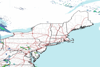
 Northeast Radar
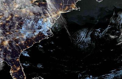
 East Coast Satellite