San Francisco Bay north of the Bay Bridge, including San Pablo Bay, Suisun Bay, and West Delta, CA Marine Forecast
| Tonight...N Wind 5 To 10 Kt, Becoming E After Midnight. |
| Sat...Ne Wind 5 To 10 Kt. |
| Sat Night...Nw Wind Around 5 Kt. |
| Sun...N Wind Around 5 Kt. |
| Sun Night...W Wind 5 To 10 Kt. |
| Mon...W Wind 5 To 10 Kt. |
| Mon Night...W Wind 5 To 10 Kt. |
| Tue...Sw Wind 5 To 10 Kt. |
| Tue Night...W Wind 10 To 15 Kt, Becoming Sw 5 To 10 Kt After Midnight. A Chance Of Rain After Midnight. |
| Wed...Sw Wind 5 To 10 Kt. A Chance Of Rain. |
| Wed Night...W Wind 10 To 15 Kt, Becoming Sw 5 To 10 Kt After Midnight. |
| Area Forecast Discussion National Weather Service San Francisco CA 944pm PDT Fri April 3 2026 .SHORT TERM... Issued at 942pm PDT Fri April 3 2026 (Tonight through Sunday) The breezier winds of the day and eased and the ridge pattern is building. Winds remain weak through much of the weekend because of the ridge, with the overall surface pattern being light but widespread offshore flow. Overnight lows will be around 5 to 10 degrees warmer than previous nights, with some high-level clouds helping to prevent extra radiational cooling. Saturday's forecast has shifted slightly cooler in the most recent model updates. While highs will still be near records, the potential for record breaking temperatures have reduced. It seems like models are picking up on the higher-level cloud cover limiting the mid-day warming along with a reduction of the offshore winds. Sunday sees clearing conditions, leading to that afternoon being the warmest of the forecast. Predicted highs look similar to previous forecast runs, with good chances for record high temperatures to fall. Long Term Issued at 942pm PDT Fri April 3 2026 (Sunday night through next Friday) Luckily, this ridge pattern exits into the workweek preventing any threats of long lasting heat. The jet stream turns to more of a zonal flow by Monday, allowing for better onshore winds and a reforming marine layer. Coastal and Valley fog and status look to return Monday morning as a result of this pattern change. These factors will lead to notably cooler conditions, with a 5 to 10 degree drop in highs. However these temperatures will still be above average for this time of year. Temperatures slowly cool into the mid and late week as the onshore flow increases ahead of building trough and low pressure. Models are in fair agreement that rain returns to the area in the mid-week as this low moves along the coast. The models differ in the late-week path of this low, with some showing rain chances lingering into the weekend itself as the low loses momentum. The official forecast still has the low and its showers exiting Thursday night, but this will be something that could change in following forecast updates. What stays the same is that this still looks to be good chances for widespread light rain. Most areas will struggle to get past a few hundredths of an inch, while the highest amounts in the area (the Santa Lucias) are predicted stay below a half an inch. Marine (Tonight through next Thursday) Issued at 942pm PDT Fri April 3 2026 Winds and seas will gradually abate through the night and through the weekend. Light to moderate northerly breezes prevail this weekend and into next week. A low pressure system over the Pacific will approach the coastal waters and bays by the middle of next week bringing a chance of rain, strong breezes, and moderate to rough seas. Climate Issued at 110pm PDT Fri April 3 2026 The following are the record high temperatures at the long term stations for April 4th and April 5th. Location April 4th April 5th Santa Rosa 88 in 1961 90 in 1939 Kentfield 85 in 1957 88 in 1924 San Rafael 86 in 1960 87 in 1957 Napa 86 in 1985, 1960 86 in 1989, 1957 Richmond 89 in 2011 83 in 1989 Livermore 87 in 1959 84 in 1989, 1916 San Francisco 84 in 1985 88 in 1989 SFO Airport 82 in 1985 84 in 1989 Redwood City 86 in 1960 87 in 1989 Half Moon Bay 77 in 2011 74 in 2016 Oakland Museum 85 in 1985 85 in 1989 San Jose 87 in 1960 89 in 1989 Salinas Airport 86 in 1989, 1960, 1952 95 in 1989 NOAA San Francisco Bay Area Office: Watches - Warnings - Advisories CA...None. PZ...Small Craft Advisory until 3am PDT Saturday for Pt Arena to Pt Reyes 10-60 NM. x.com/nwsbayarea |
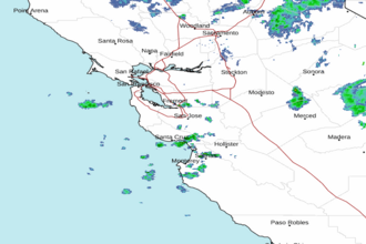 San Francisco Radar
 Southwest Radar