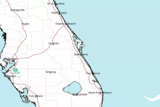
Volusia-Brevard County Line to Sebastian Inlet 20 - 60 NM Marine Forecast
| Today...East Winds Around 10 Knots. Seas 3 To 4 Feet. Wave Detail: East 4 Feet At 8 Seconds And North 1 Foot At 7 Seconds. A Slight Chance Of Showers This Morning. |
| Tonight...Southeast Winds Around 10 Knots. Seas 3 Feet. Wave Detail: East 3 Feet At 7 Seconds And North 1 Foot At 7 Seconds. |
| Wednesday...Southeast Winds 5 To 10 Knots. Seas 2 To 3 Feet. Wave Detail: East 3 Feet At 7 Seconds And North 1 Foot At 7 Seconds. |
| Wednesday Night...South Winds 10 To 15 Knots. Seas 3 Feet. Wave Detail: East 3 Feet At 7 Seconds And Southwest 1 Foot At 3 Seconds. |
| Thursday...South Winds 10 To 15 Knots. Seas 2 To 3 Feet. Wave Detail: East 3 Feet At 7 Seconds And South 2 Feet At 3 Seconds. |
| Thursday Night...South Winds Around 15 Knots, Becoming Southwest After Midnight. Seas 2 To 3 Feet. Wave Detail: South 2 Feet At 4 Seconds And East 2 Feet At 7 Seconds. |
| Friday...West Winds 5 To 10 Knots, Becoming East In The Afternoon. Seas 2 To 3 Feet. |
| Friday Night...Southeast Winds 10 To 15 Knots, Becoming South After Midnight. Seas 2 To 3 Feet. A Slight Chance Of Showers And Thunderstorms. |
| Saturday...Southwest Winds 10 To 15 Knots, Becoming Southeast 5 To 10 Knots In The Afternoon. Seas 2 To 3 Feet. A Chance Of Showers. A Slight Chance Of Thunderstorms In The Afternoon. |
| Saturday Night...Southeast Winds Around 10 Knots. Seas 2 To 3 Feet. A Chance Of Showers. A Chance Of Thunderstorms In The Evening, Then A Slight Chance Of Thunderstorms After Midnight. Winds And Seas Higher In And Near Thunderstorms. |
| Area Forecast Discussion National Weather Service Melbourne FL 300am EDT Tuesday May 5 2026 ...New KEY MESSAGES,ARINE, FIRE WEATHER,Climate .KEY MESSAGES... Issued at 300am EDT Tuesday May 5 2026 - Becoming increasingly hot and dry through midweek, with highs in the low to mid 90s nearing daily record values both Wednesday and Thursday. - Rain chances begin to rise Friday into the weekend as a front nears and stalls just north of the area, with highs remaining above normal. - Sensitive fire weather conditions across the interior today through Thursday. Issued at 300am EDT Tuesday May 5 2026 Today - Tonight Ridge axis of high pressure across the West Atlantic remains just north of the area. This will maintain an onshore flow, with winds out of the east today. Wind speeds will not be as breezy/gusty, but will still increase to 10-15 mph this afternoon as sea breeze pushes inland. Isolated to scattered showers will still be possible over the southern coastal waters today, and low level onshore flow may be able to transport a few of these showers onshore along the Treasure Coast, with additional isolated shower development possible across Okeechobee County as sea breeze pushes inland through the afternoon. Model guidance shows instability will be rather limited across this region (CAPE less than 500 J/kg), so lightning storm development looks quite low with this activity. Better potential for a storm or two will be across the Treasure Coast waters where greater instability will reside. Have rain chances around 20 percent across these southern portions of east central FL, and kept mentionable Probability of Precipitation out of the forecast to the north. Temperatures will be a little warmer than yesterday, with highs near normal for this time of year, ranging from the low 80s at the coast and mid to upper 80s inland. Dry conditions forecast into tonight, with lows falling the into the mid to upper 60s, with low 70s possible along the coast. Wednesday-Thursday...Low level flow veers to the S/SW as ridge axis shifts southward across the area, and mid level ridge over the Gulf expands over the Florida peninsula. This will lead to hotter than normal temperatures and dry conditions across the area. Highs will climb to the mid to upper 80s along the coast and low to mid 90s across the interior on Wednesday. As low level flow becomes more offshore delaying or preventing east coast sea breeze development, highs will reach the low to mid 90s area-wide on Thursday. Best potential for tied or broken high temperature records will be across interior sites on Wednesday, but most climate sites will have a decent chance of setting daily records on Thursday. Overnight lows will also remain above normal, in the upper 60s to low 70s for most locations. Friday-Monday...A weak front is forecast to move southward into North Florida into early Friday morning. Both the GFS (Global Forecast System) and ECMWF (European Centre for Medium-Range Weather Forecasts) now stall this boundary out near to just north of the area late week and into the weekend. This will allow temperatures to remain above normal across Central Florida, ranging from the upper 80s to low 90s and even some mid 90s continuing to be possible across the interior. Moisture will also gradually increase, with shower and storm chances returning. Probability of Precipitation currently are forecast to only reach around 20-30 percent near to north of Orlando into Friday afternoon, and then rise to 30-50 percent into the weekend and early next week. Best potential for isolated to scattered showers and storms will be during the afternoon/early evening hours each day. Marine Issued at 300am EDT Tuesday May 5 2026 Today - Tonight Boating conditions improve today. Ridge axis remains north of the area maintaining an onshore flow, but winds will not be as breezy, with speeds around 9-12 knots. Winds will be out of the east today and veer to the southeast into tonight. Seas also diminish falling to 3-4 feet today and 2-3 feet tonight. Isolated to scattered showers and a storm or two will continue to be possible, mainly south of Sebastian Inlet today. Wednesday-Saturday...Ridge axis shifts southward across the waters through midweek, and eventually south of the area by late week as a weak front moves into the Southeast United States. This front will then move into North Florida and stall out near to just north of the coastal waters Friday into Saturday. Boating conditions remain generally favorable through the period, with wind speeds 10-15 knots (or less at times). Winds will be out of the southeast on Wednesday and south/southeast on Thursday. Then into Friday and Saturday winds are forecast to be offshore in the morning before becoming onshore into the afternoon as sea breeze develops. Wave heigheights will remain around 2-3 feet. It will remain mostly dry through Thursday across the waters, and then shower and storm chances rise as front nears the area, especially into Saturday. Fire Weather Issued at 300am EDT Tuesday May 5 2026 Winds will be out of the east today, but will be less breezy with wind speeds around 10-15 mph in the afternoon. Isolated showers will be possible along the Treasure Coast and into Okeechobee County today (chance of rain 20%). Otherwise, it will be mostly dry today. Winds shift to the east-southeast Wednesday, with speeds around 10 mph. No Min RH concerns are forecast along the coast due to the onshore winds. However, sensitive fire weather conditions will exist inland, especially near to northwest of the I-4 corridor where RH values are forecast to drop to 35-40 percent during the afternoon both today and Wednesday. Dispersion values will range from good to very good both days. Temperatures will continue to climb, becoming hotter than normal and nearing daily record highs mid to late week, as max temps reach the the low to mid 90s. Fire weather conditions becoming even more sensitive into Thursday as hot and dry conditions are forecast to lead to critically low RH values in the low to mid 30s for portions of the interior, west of I-95, in the afternoon. Climate Issued at 300am EDT Tuesday May 5 2026 Record high temperatures at local climate sites Wednesday, May 6th and Thursday, May 7th: Site May 6 May 7 Daytona 95 (1955) 93 (1952) Leesburg 93 (2007) 94 (1984) Sanford 95 (1952) 94 (2009) Orlando 98 (1922) 98 (1915) Melbourne 94 (2022) 91 (1980) Vero Beach 95 (2022) 93 (1947) Fort Pierce 95 (2022) 95 (1906) NOAA Melbourne FL Office: Watches - Warnings - Advisories FL...None. AM...None. |
 Melbourne Radar
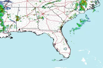
 Southeast Radar