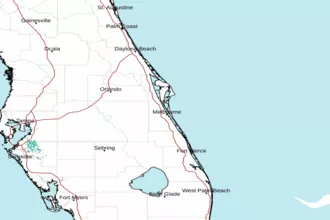
Volusia-Brevard County Line to Sebastian Inlet out 20 NM Marine Forecast
| Today...East Winds 5 To 10 Knots, Increasing To 10 To 15 Knots Late. Seas 3 Feet. Wave Detail: East 3 Feet At 8 Seconds. A Moderate Chop On The Intracoastal Waters. A Slight Chance Of Showers This Morning. |
| Tonight...Southeast Winds 5 To 10 Knots. Seas 2 To 3 Feet. Wave Detail: East 3 Feet At 8 Seconds. Mostly Smooth On The Intracoastal Waters. |
| Friday...Southeast Winds 5 To 10 Knots. Seas 2 To 3 Feet. Wave Detail: East 3 Feet At 9 Seconds. A Light Chop On The Intracoastal Waters. |
| Friday Night...Southeast Winds Around 10 Knots, Becoming South After Midnight. Seas 2 To 3 Feet. Wave Detail: East 3 Feet At 9 Seconds. Mostly Smooth On The Intracoastal Waters. |
| Saturday...South Winds 5 To 10 Knots, Becoming Southeast In The Afternoon. Seas 2 Feet. Wave Detail: East 2 Feet At 3 Seconds And East 2 Feet At 9 Seconds. A Light Chop On The Intracoastal Waters. A Slight Chance Of Showers And Thunderstorms In The Afternoon. |
| Saturday Night...South Winds Around 10 Knots, Becoming Southwest After Midnight. Seas 2 Feet. Wave Detail: Southeast 2 Feet At 4 Seconds And East 1 Foot At 8 Seconds. Mostly Smooth On The Intracoastal Waters. A Slight Chance Of Thunderstorms In The Evening. A Slight Chance Of Showers. |
| Sunday...Southwest Winds 5 To 10 Knots, Becoming Southeast In The Afternoon. Seas 1 To 2 Feet. A Light Chop On The Intracoastal Waters. A Slight Chance Of Showers In The Morning, Then A Chance Of Showers And Thunderstorms In The Afternoon. |
| Sunday Night...Southeast Winds 5 To 10 Knots. Seas 1 To 2 Feet. Mostly Smooth On The Intracoastal Waters. A Slight Chance Of Showers And Thunderstorms In The Evening. |
| Monday...East Winds 5 To 10 Knots. Seas 2 To 3 Feet. A Light Chop On The Intracoastal Waters. |
| Monday Night...Southeast Winds 10 To 15 Knots, Diminishing To 5 To 10 Knots After Midnight. Seas 2 To 3 Feet. A Light Chop On The Intracoastal Waters. Winds And Waves Higher In And Near Thunderstorms. |
| Area Forecast Discussion National Weather Service Melbourne FL 657am EDT Thu April 23 2026 Issued at 217am EDT Thu April 23 2026 Current - Tonight Continued dry and cooler over the interior early this morning with mins expected to bottom out in the M-U50s well inland and 60s to near 70F along the immediate coast. Light ERLY winds around 5 mph or less across the interior and up to 10 mph along the Space and Treasure coasts early in the period. The pressure gradient continues to relax as weak high pressure ridging continues to settle in across north-central FL. E/ESE winds will still approach 10-15 mph over the interior and around 15 mph along the coast with some higher afternoon gusts. Generally PSunny skies with the continued low-level onshore flow. Modest moisture will promote a 10-20pct shower chance across ECFL today. Will see a few onshore-moving sprinkles/showers, then some mainly afternoon precipitation chances into the interior. However, most will remain dry. There will be a late day/evening sea breeze collision favoring the western peninsula. Aloft, weak shortwave impulses will traverse the peninsula this afternoon and tonight. Max temps in the U70s to around 80F along the coast and L80s into the interior. For mins, U50s to L60s over the interior/Volusia coast, and L-M60s along the coast. Fri-Wed...Weak troughing aloft over the FL peninsula early in the period will slide eastward into Fri night, though we will retain NWRLY flow with embedded shortwaves passing across the area through the weekend and early next week as mid-level high pressure slowly builds over the SW Gulf and tries to expand north/east. Modest moisture exists across the region thru early Sat, then an increase in PWATs (Precipitable Waters) from late Sat into mid next week. With weak surface high pressure influence across/near central FL for much of this extended period, the pressure gradient remains light with daily sea breeze formation and march inland. Late day/early evening boundary collisions occur further eastward across the central peninsula each day. We continue to see ISOLD-SCT lightning storm chances Fri thru Mon, perhaps greatest threat on Sun. With the increasing dry conditions we will have to monitor for any new fire starts from cloud-to- ground lightning strikes. A warming trend ensues Fri into the extended with max values approaching L-M80s Fri, then M-U80s Sat-Mon, with U80s arriving at coastal locations Tue/Wednesday as daily sea breeze become more delayed. Potential 90F over the interior Sun, with L90s within reach over the interior Mon-Wed. For mins, generally 60s, almost areawide, with 70F within reach at the coast and perhaps Orlando Metro early next week. Marine Issued at 217am EDT Thu April 23 2026 Conditions gradually improve through Fri as the pressure gradient continues to relax as a weak low-level ridge axis settles across central FL. A light offshore wind component develops each night/early morning into the extended, with daily sea breezes "backing" winds ESE/SE 10-15 mph in the afternoons near the coast. Seas 3-4 ft today, becoming 2-3 ft Fri-early Sat, then 2 ft Sat aftn- Sunday night, returning to 2-3 ft Mon. isolated light sprinkles/showers, again today/tonight, with isolated widely scattered aftn/evening lightning storms returning Sat night-Sunday night. Fire Weather Issued at 217am EDT Thu April 23 2026 High pressure ridge axis will settle southward and reach central FL Friday then south Florida by Sunday. Onshore (E/SE) flow will continue to gradually weaken through Friday with fewer strong wind gusts. The sea breeze will enhance the onshore flow each afternoon, around 15 mph today and 10-15 mph Friday. Isolated Atlantic showers and sprinkles will cross portions of the coast again this morning. Additional isolated showers are forecast into the interior later today but most areas will remain dry. Min RH values of 35-40% are forecast over portions of the interior through Friday with RH values holding around 50% near the coast. Dispersions will be Generally Good to Very Good today and Fair to Generally Good Friday and Saturday. Isolated to scattered lightning storms are forecast Friday into the weekend, highest values inland from the coast and greatest overall chance on Sunday, surrounding late day/evening boundary collisions. With the increasing dry conditions, new fire starts will be a concern from potential lightning strikes. NOAA Melbourne FL Office: Watches - Warnings - Advisories FL...None. AM...None. |
 Melbourne Radar
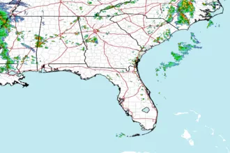
 Southeast Radar