New York Harbor Marine Forecast
| Today...Se Winds 5 To 10 Kt, Increasing To 10 To 15 Kt Late. Waves 1 Ft Or Less, Then 1 To 2 Ft This Afternoon. |
| Tonight...S Winds 5 To 10 Kt. Waves 1 To 2 Ft. |
| Sat...S Winds 5 To 10 Kt, Increasing To 10 To 15 Kt With Gusts Up To 25 Kt In The Afternoon. Waves 1 Ft Or Less, Then 1 To 2 Ft In The Afternoon. |
| Sat Night...S Winds 10 To 15 Kt With Gusts Up To 25 Kt. Waves 1 To 2 Ft. Slight Chance Of Showers In The Evening, Then Chance Of Showers After Midnight. |
| Sun...S Winds 5 To 10 Kt. Waves 1 To 2 Ft. Chance Of Showers In The Morning. |
| Sun Night...Sw Winds 5 To 10 Kt, Becoming W After Midnight. Waves 1 To 2 Ft. |
| Mon...Ne Winds 5 To 10 Kt. Waves 1 To 2 Ft. |
| Mon Night...Se Winds 5 To 10 Kt. Waves Around 2 Ft. |
| Tue...Se Winds 10 To 15 Kt. Waves Around 2 Ft. |
| Tue Night...S Winds 5 To 10 Kt. Waves Around 2 Ft. Chance Of Showers. |
| Area Forecast Discussion National Weather Service New York NY 1030am EDT Fri April 26 2024 Synopsis Strong high pressure remains over the region into Saturday, moving off shore as a warm front approaches. The warm front moves through the region late Saturday into early Sunday morning. A weakening cold front passes to the north Sunday as high pressure builds to the south. A cold front approaches Tuesday and moves across the region Tuesday night. A series of frontal systems may pass through the area late next week. Near Term - Until 6pm This Evening Northern stream upper trough over eastern Canada into the northeast moves slowly eastward through today as a building ridge approaches to the west. Meanwhile strong high pressure remains over the area. While the airmass will be modifying high temperatures will still be around 5 degrees below normal. Mid to upper 50s coast with developing hybrid synoptic/seabreeze S/SE flow, to lower 60s interior. Short Term - 6pm This Evening Through Sunday The building upper ridge approaches tonight with the axis moving into the region Saturday. With an Omega blocking pattern setting up the ridge will remain in the area through Sunday. With surface high pressure over the region tonight winds become light. However, the airmass continues to modify with weak warm advection that begins late today continuing into tonight. Some high cloudiness will also be moving into the ridge. Temperatures tonight remain above freezing, however, patchy to areas of frost are possible. Frost advisories may be issued later today for areas where more widespread frost is expected. A surface and upper low pass well to the west as the upper ridge remains Saturday as a surface warm front moves through the region late in the day and into Sunday morning. There will be some weak lift with the front, and limited moisture. There may be scattered showers with the frontal passage, and will have chance probabilities. Then later Sunday a cold front moves to the north and weakens with the ridge in place. Will keep Sunday dry at this time, however, a few showers may develop across the far north regions late in the day with some instability in the area. With the airmass continuing to modify temperatures will be near normal Saturday night and near to a few degrees above Sunday. Long Term - Sunday Night Through Thursday *Key Points* *Mainly dry conditions expected with a few chances of showers each afternoon Tuesday through Thursday. *Confidence is increasing in a warming trend with above normal temperatures likely through late next week. The warmest day of the period looks to be on Monday. There has not been much change to the forecast thinking with this update and have stuck close to the NBM with a few exceptions on the temperatures. Decent model agreement to start the period with an amplifying ridge and anomalously warm air mass (2-3 stdev above normal per NAEFS) in place and surface high pressure to the south. Dry conditions locally as a result, and with 850mb temperatures approaching 13-14C, low to mid 80s are a good bet for the interior on Monday. In fact, NBM probabilities of >80F have been on the increase the past few cycles, and are now as high as 80% from NYC north and west. Onshore flow will keep the coastal areas a good 10 degrees cooler, with SSTs still in the upper 40s to near 50. Record highs across the area are in the upper 80s and lower 90s (Central Park is 89F, from 1974) so we look to be below any records at this point. By Tuesday into Wednesday, the upper flow begins to flatten as the ridge axis moves east of the region. Clouds will be on the increase for Tuesday, which may help moderate temperates a bit as a weak front heads through the area. Showers and possibly a thunderstorm especially N/W of NYC for Tuesday afternoon, with some very marginal surface based instability. This trend continues for Wednesday and possibly on Thursday, as an upper low traversing the Great Lakes region sends upper energy through the northeast. Some elevated instability with a weak frontal passage on Wednesday. Shower chances continue in the afternoon, but have kept thunder mention out of the forecast for now. For late in the week, there is model agreement on an upper low ejecting out of the Northern Plains Thursday into Friday. This will keep the shower chances going Thursday afternoon into Friday, though have capped chances at slight for now. Under weak westerly flow, there is significant spread the high temperatures for Thursday. For instance, NBM interquartile range spreads from 72 to 86F for KEWR and 70 to 83 for KSWF with the deterministic forecast near the 50th percentile. For this update, have trended toward the NBM 75th percentile for highs on Thursday, given the usual NBM cool bias under westerly flow this time of year for NE NJ. If cloud cover progression can hold off until later on Thursday, the upper end of the NBM spread may be realized. Marine With high pressure in control into Saturday, and a warm front approaching late Saturday into early Sunday morning, winds and seas will remain below SCA (Small Craft Advisory) levels across the forecast waters. Warmer air moving over the colder ocean early next week could develop fog, but it is much too early for any specific details on timing and extent. Sub SCA (Small Craft Advisory) conditions on all waters through Tuesday under relatively weak flow. Hydrology No hydrologic concerns through the end of next week. NOAA New York NY Office: Watches - Warnings - Advisories CT...None. NY...None. NJ...None. Marine None. |
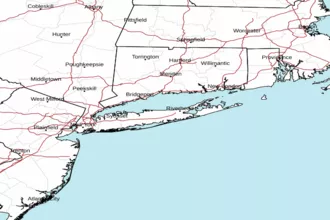
 New York Radar
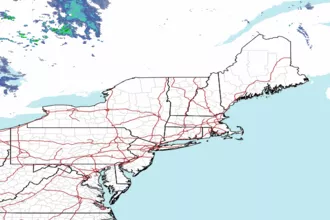
 Northeast Radar
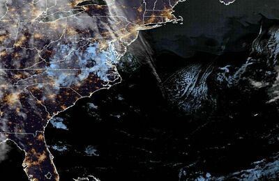
 East Coast Satellite