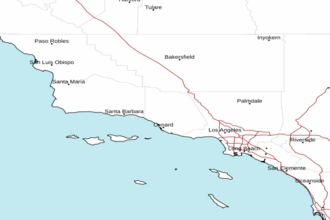
Point Sal to Santa Cruz Island CA including San Miguel and Santa Rosa Islands Marine Forecast
| Tonight...Nw Winds 25 To 35 Kt With Gusts To 40 Kt. Combined Seas 10 To 12 Ft Dominant Period 8 Seconds, Building To 12 To 14 Ft Dominant Period 9 Seconds After Midnight. Patchy Fog After Midnight. |
| Mon...Nw Winds 25 To 35 Kt With Gusts To 40 Kt. Combined Seas 11 To 13 Ft Dominant Period 10 Seconds. Patchy Fog In The Morning. |
| Mon Night...Nw Winds 20 To 30 Kt With Gusts To 40 Kt. Combined Seas 12 To 14 Ft Dominant Period 10 Seconds. Patchy Fog After Midnight. |
| Tue...Nw Winds 20 To 30 Kt With Gusts To 40 Kt. Combined Seas 11 To 13 Ft Dominant Period 10 Seconds. Patchy Fog In The Morning. |
| Tue Night...Nw Winds 25 To 30 Kt With Gusts To 40 Kt. Combined Seas 11 To 13 Ft Dominant Period 10 Seconds. Patchy Fog After Midnight. |
| Wed...Nw Winds 20 To 30 Kt. Combined Seas 10 To 13 Ft. Patchy Fog. |
| Thu...Nw Winds 10 To 20 Kt. Wind Waves 2 To 4 Ft. Nw Swell 7 To 10 Ft. |
| Area Forecast Discussion ...UPDATED National Weather Service Los Angeles/Oxnard CA 1139pm PDT Sunday April 28 2024 Synopsis 28/737 PM. Mostly clear skies and warmer temperatures will prevail across the region through this week, with just some coastal low clouds and fog possible at times night and morning hours early in the week and again late in the week. Gusty west to north winds will prevail over the mountains and deserts at least through Tuesday. Short Term - Sunday through Wednesday 28/735 PM. Satellite imagery showing mostly clear skies across the forecast area this evening, except patches of low clouds forming across the Central Coast. At upper levels, a northwest flow pattern will persist through Tuesday. This in combination with northerly offshore pressure gradients near the surface will continue to bring gusty northwest to north winds across portions of the forecast area through at least Tuesday. The wind advisory was extended until 3 pm Tuesday for the mountains, Antelope Valley and adjacent foothills. For southwest Santa Barbara county, the wind advisory remains in effect through 3 pm Monday, but could be extended. These areas should generally see wind gusts of 45 to 50 mph, except locally up to 55 mph across the I-5 corridor and western Antelope Valley foothills. As of 7 pm, already seeing some wind gusts of 48 mph at Gaviota and 46 mph at Refugio. The persistent strong northwest flow pattern across the outer coastal waters will continue to generate a weak eddy circulation the next few nights. As a result, there is increasing potential (60-70% chance) for low clouds to develop during the late night and morning hours across the LA county coast, with a small chance (20-30%) of reaching the Ventura county coast. Latest ACARS data still showing a weak inversion developing across the LA Basin, so may be difficult for a solid stratus field to develop overnight. Latest HREF probabilistic guidance also trending towards low clouds returning to coastal LA county overnight and again Monday night. Weak upper level ridging moved over Southern California today, bringing a warming and drying trend away from the coast. Little change in heigheights is expected Monday into Tuesday, but boundary layer temperatures continue to edge upward. As a result, could see a few more degrees of warming across interior next couple of days, with warmest valley and desert areas expected to climb into the lower 80s. Long Term - Thursday through Sunday 28/157 PM. The EC and GFS (Global Forecast System) mean ensembles and deterministic are in generally good agreement Thu thru Sat with broad but generally weak upper level trough.iness over the forecast area. By Sun, the deterministic models diverge quite a bit with the GFS forecasting a significant for early May storm system affecting the region with rain and high elevation mtn snow, while the EC has dry weather with rising H5 heigheights over the region. The GFS mean ensembles bring a 10%-20% chance of measurable rain to the area Sun, as only 4 out of 30 ensemble members show rain moving into the area at that time. For now we will go with a dry forecast for day 7. High pressure is forecast to move into NV on Thu morning and will set up offshore flow from both the N and E. A low end Santa Ana wind event will develop and keep any low clouds well offshore. Mostly clear skies are then expected to continue across the forecast area Thu night thru Sat, except for some night and morning low clouds and fog along the Central Coast Fri night into Sat morning. Increasing clouds are possible by Sun, and there may be some low clouds and fog along the coast into the adjacent vlys Sat night into Sunday morning. With the offshore flow Thu and even some into Fri, temps are expected to be warmest for the week, with inland coast, vlys and lower mtns expected to top out in the mid 70s to mid 80s. A smattering of upper 80s is possible on Thu for the warmest vlys. It will turn cooler next weekend, with highs 2-6 deg below normal for many areas by Sun. Marine 28/725 PM. A very long period of gale force winds is expected to continue thru at least Tuesday night for the outer waters. SCA (Small Craft Advisory) conds are expected Wednesday thru Thu, with a 30% chance of gales persisting into Wednesday evening. In the inner waters N of Pt. Sal, SCA (Small Craft Advisory) level winds are likely thru Tuesday night, especially in the afternoon/eve hours. There is a 50% chance of SCA (Small Craft Advisory) conds during the afternoon/eve hours Wed/Thu. Seas are expected to be near SCA (Small Craft Advisory) levels during the periods of weaker winds. There is a 25% chance of gale force winds during the afternoon/eve hours Monday into Tue. In the SBA Channel, SCA (Small Craft Advisory) level W-NW winds are expected across western portions during the afternoon thru late night hours thru Wed. Winds will likely remain below SCA (Small Craft Advisory) levels for eastern portions of the channel through the period. In the southern inner waters, there is a 20% chance of SCA (Small Craft Advisory) level W to NW winds across northwestern portions, mainly from Anacapa Island to Malibu during the late afternoon thru late evening hours thru Tue. Widespread strong to gale force winds will keep dangerous sea conditions across much of the coastal waters (particularly the outer waters) thru the middle of the week, with short-period, steep, and choppy waves. There may be dangerous breaking waves near west-facing harbors. Mariners should plan accordingly. NOAA Los Angeles/Oxnard CA Office: Watches - Warnings - Advisories CA...Wind Advisory remains in effect until 3pm PDT Monday for zones 349-351. Wind Advisory now in effect until 3pm PDT Tuesday for zones 377-378-381-383. PZ...Small Craft Advisory in effect until 3am PDT Wednesday for zone 645. Small Craft Advisory in effect until 3am PDT Monday for zone 650. Gale Warning in effect until 3am PDT Wednesday for zones 670-673-676. |
 Los Angeles Radar
 Pacific Southwest Radar