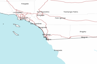
San Mateo Point to the Mexican Border from 30 to 60 nm out including San Clemente Island Marine Forecast
| Today...Wind Variable Less Than 10 Knots...Becoming Northwest 10 To 15 Knots This Afternoon. Wind Waves Around 2 Feet Or Less. Swell West 3 To 6 Feet At 9 Seconds. |
| Tonight...Wind Northwest 10 To 15 Knots...Becoming South After Midnight. Wind Waves Around 2 Feet Or Less. Swell West 4 To 6 Feet At 10 Seconds. |
| Tuesday...Wind Southeast 10 Knots...Becoming Southwest In The Afternoon. Wind Waves Around 2 Feet Or Less. Swell West 3 To 6 Feet At 11 Seconds. |
| Tuesday Night...Wind West 10 Knots...Becoming South With Gusts To 15 Knots After Midnight. Wind Waves Around 2 Feet Or Less. Swell West 3 To 6 Feet At 11 Seconds. |
| Wednesday...Wind Variable Less Than 10 Knots...Becoming West 10 Knots In The Afternoon. Wind Waves Around 2 Feet Or Less. Swell West 4 To 6 Feet At 11 Seconds. |
| Wednesday Night...Wind West 10 Knots In The Evening...Becoming Variable Less Than 10 Knots. Wind Waves Around 2 Feet Or Less. Swell West 3 To 5 Feet. |
| Thursday...Wind Variable Less Than 10 Knots. Wind Waves Around 2 Feet Or Less. Swell West 3 To 5 Feet. |
| Thursday Night...Wind Northwest 10 Knots With Gusts To 15 Knots In The Evening...Becoming Variable Less Than 10 Knots. Wind Waves Around 2 Feet Or Less. Swell West 3 To 4 Feet. |
| Friday...Wind Variable Less Than 10 Knots...Becoming West 10 Knots In The Afternoon. Wind Waves Around 2 Feet Or Less. Swell West 2 To 3 Feet. |
| Friday Night...Wind West 10 Knots. Gusts To 15 Knots In The Evening. Wind Waves Around 2 Feet Or Less. Swell Northwest 3 Feet. |
| Area Forecast Discussion National Weather Service San Diego CA 239am PDT Monday April 29 2024 Synopsis The upcoming week will be warm with dry weather across the region. The marine layer will stay relatively shallow, where low clouds and fog will be primarily closer to the coast and in some western valleys through the week. Breezy west winds will occur across mountain and desert regions each afternoon and night through Wednesday. Weak Santa Ana winds are likely to make an appearance for areas west of the mountains by Thursday. A cooling pattern will then occur for later in the week. For Extreme Southwestern California Including Orange... San Diego...Western Riverside and Southwestern San Bernardino Counties Short Term - Today Through Wednesday GOES geocolor imagery shows low clouds off the coast pushing northward toward the beaches this morning. Patchy low clouds and fog will impact coastal areas later this morning before clearing later this morning. Inland areas will remain clear and warm up nicely with highs near average. It's been just over a week since temperatures have reached 80 in the Inland Empire, so some areas will have a chance to break that streak today. Similar temperatures will occur on Tuesday. A trough looks to push by across the Pacific Northwest by Tuesday and Wednesday, which will help deepen the marine layer slightly, allowing low clouds to advance further inland by Wednesday morning. West winds will be breezy each day as weak troughing overhead remains in place. The San Gorgonio Pass and other passes through San Diego and Riverside Counties will see winds near 25-40 MPH at times each afternoon and night. The windiest day overall will be on Tuesday, as the high desert region has a 20-40 percent chance of seeing wind gusts over 30 MPH per latest NBM guidance. .LONG TERM (Thursday into the weekend)... The trough across the Pacific Northwest early in the week will begin to move out of the Rockies by Thursday. Model clusters do not have a very good handle on how amplified the trough will become, so the location of this feature is still in question. Depending on how far south it goes, will be how strong northerly winds aloft become. This will transition to slightly warmer conditions and Santa Ana winds by Thursday. NBM probabilities for winds over 25 MPH for areas west of the mountains are low to moderate, so incorporated higher resolution model data across the region for Thursday. Friday will be warm with calmer winds as the trough pushes east toward the Great Plains and more neutral flow has greater influence over the region. Model guidance starts to show another trough over the NE Pacific by the weekend, but stark differences in location. NBM paints a good picture for now, showing a further pronounced influence of this feature, leading to a cooling trend for the weekend. Marine No hazardous marine conditions through Friday. Skywarn Skywarn activation is not requested. However weather spotters are encouraged to report significant weather conditions. NOAA San Diego CA Office: Watches - Warnings - Advisories CA...None. PZ...None. |
 San Diego Radar
 Pacific Southwest Radar