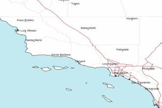
Santa Cruz Island to San Clemente Island to 60 NM offshore including San Nicolas and Santa Barbara Islands Marine Forecast
| Today...Nw Wind 10 To 20 Kt. Gusts To 25 Kt. Seas 4 To 6 Ft. Wave Detail: Nw 5 Ft At 7 Seconds And S 2 Ft At 14 Seconds. |
| Tonight...Nw Wind 15 To 25 Kt. Seas 6 To 8 Ft. Wave Detail: Nw 7 Ft At 8 Seconds And Nw 2 Ft At 14 Seconds. |
| Thu...Nw Wind 15 To 25 Kt. Seas 6 To 8 Ft. Wave Detail: Nw 7 Ft At 8 Seconds And Nw 3 Ft At 13 Seconds. |
| Thu Night...Nw Wind 20 To 30 Kt, Becoming 15 To 25 Kt After Midnight. Seas 7 To 10 Ft. Wave Detail: Nw 9 Ft At 8 Seconds. |
| Fri...Nw Wind 15 To 25 Kt, Becoming 10 To 20 Kt In The Afternoon. Seas 6 To 8 Ft, Subsiding To 4 To 6 Ft. Wave Detail: Nw 7 Ft At 10 Seconds. |
| Fri Night...Nw Wind 10 To 20 Kt. Seas 5 To 7 Ft. Wave Detail: Nw 5 Ft At 9 Seconds. |
| Sat...Nw Wind 10 To 15 Kt, Becoming W 5 To 10 Kt In The Afternoon. Seas 4 To 6 Ft. Wave Detail: Nw 5 Ft At 9 Seconds. |
| Sat Night...Nw Wind 10 To 15 Kt, Becoming 5 To 10 Kt After Midnight. Seas 4 To 6 Ft. Wave Detail: Nw 4 Ft At 7 Seconds And Nw 5 Ft At 10 Seconds. |
| Sun...Nw Wind 5 To 10 Kt. Seas 4 To 6 Ft. Wave Detail: Nw 5 Ft At 11 Seconds And S 2 Ft At 14 Seconds. |
| Sun Night...W Wind 10 To 15 Kt, Becoming 5 To 10 Kt After Midnight. Seas 4 To 6 Ft. Wave Detail: Nw 3 Ft At 7 Seconds And Nw 4 Ft At 13 Seconds. |
| Area Forecast Discussion National Weather Service Los Angeles/Oxnard CA 856am PDT Wednesday April 29 2026 Synopsis 28/1153 PM. Quiet weather with near seasonal temperatures will prevail this week. Breezy west to northwest winds will occur across portions of the area at times. Late season rain is possible early next week. Short Term - Today through Friday 29/855 AM. ***UPDATE*** Forecast excitement remains low today as temperatures are within a few degrees of normal under mostly clear skies. Most areas are running a few degrees warmer than yesterday at this time but expecting just minor increases at most by this afternoon. Onshore flow continues but it's light and afternoon breezes should be light as well. ***From Previous Discussion*** On Thursday an upper low that has been spinning harmlessly to the SW will sweep to the SE and pass south of San Diego. This passage will not affect our area much at all. There is a better chance for coastal low clouds in the morning as there should be an eddy. Max temps will mostly warm another 1 to 3 degrees xcp across the Central Coast where stronger onshore flow will bring an earlier seabreeze along with 2 or 3 degrees of cooling. A 576 dam ridge moves into the state on Friday. Onshore flow will remain and there will be a grip of morning low clouds across the csts and locally into the lower vlys. The onshore flow and marine layer will prevent a big warm up for the cst/vly areas (1-3 degrees) but interior will see 3 to 5 degrees of warming. There will be gusty winds across the Antelope Vly, the I-5 corridor and the western portion of the SBA south coast each late afternoon and evening with near advisory level gusts across the western portion of the SBA south coast. Long Term - Saturday through Tuesday 29/313 AM. On Saturday, ridging will continue in the morning but will push off to the east in the afternoon. The onshore flow will continue and this should enable the marine layer stratus to continue across most coast and some lower vlys. The lower hgts due to the movement of the upper high and moderate onshore flow will cool SLO and most of SBA county. VTA and LA county will not be affected as much and will warm an additional 1 to 3 degrees making Saturday the warmest of the next 7 for those two counties (vly highs in the lower to mid 80s). There continues to be decent agreement between the models (deterministic, AI and ensemble) for the Sunday and early next week forecast. A very large (for May) 557 dam upper low will move south about 100 miles west of the Bay Area on Sunday. SW flow will set up over the area. It will be dry, but there will be plenty of mid and high clouds and likely a whole host of morning low clouds. Max temps will cool 3 to 6 degrees. The low will move to the south and east starting Sunday night. It will track through SLO county and into Kern County Monday night through Tuesday morning. There is not that much moisuture or dynamics with this system and not many of the enseble members bring rain to the area. Right now there is no more than a 20 percent chance of rain for any given 6 hour period Monday through Tuesday. The upper low does pass directly over SLO county and the northern mtns so it is not out of the question that some weak convection could develop. Overall even if some rain does fall it does not look to be much. Max temps on Monday will nose dive 4 to 8 locally 10 degrees and will end up only in the mid 60s to lower 70s across the csts/vlys or 3 to 6 locally 8 degrees below normal. Max temps will likelu Marine 29/838 AM. Moderate to high confidence in Small Craft Advisory (SCA) W-NW winds across the outer waters through late tonight, and possibly into Friday, especially over the northern outer waters. Moderate confidence that conds will then remain near but below SCA (Small Craft Advisory) levels through Saturday, with winds likely decreasing further on Sunday. Along the Central Coast, SCA (Small Craft Advisory) winds are likely each afternoon and evening period through Thursday, followed by lighter winds through the weekend. For the Santa Barbara Channel, SCA (Small Craft Advisory) winds are possible this afternoon and evening (20%-30% chance) over the western portion of the channel. There is a higher chance of SCA (Small Craft Advisory) winds Thursday afternoon and night, followed by lighter winds through the weekend. Otherwise, typical winds expected elsewhere which includes gusty (but under SCA (Small Craft Advisory) winds) nearshore each afternoon. NOAA Los Angeles/Oxnard CA Office: Watches - Warnings - Advisories CA...NONE. PZ...Small Craft Advisory in effect until 3am PDT Friday for zones 670-673-676.. |
 Los Angeles Radar
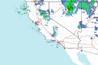
 Pacific Southwest Radar