Sandy Hook to Manasquan Inlet NJ out 20 NM Marine Forecast
| Rest Of Tonight...E Winds Around 5 Kt. Seas 2 To 3 Ft. Wave Detail: E 3 Ft At 8 Seconds. |
| Fri...E Winds 5 To 10 Kt, Becoming Se In The Afternoon. Seas Around 2 Ft. Wave Detail: E 2 Ft At 7 Seconds. |
| Fri Night...S Winds 5 To 10 Kt. Seas 2 To 3 Ft. Wave Detail: E 2 Ft At 7 Seconds. |
| Sat...Se Winds 5 To 10 Kt, Becoming S 10 To 15 Kt With Gusts Up To 20 Kt In The Afternoon. Seas 2 To 3 Ft. Wave Detail: Se 3 Ft At 7 Seconds And S 1 Ft At 3 Seconds. |
| Sat Night...S Winds 10 To 15 Kt With Gusts Up To 20 Kt. Seas 2 To 3 Ft. Wave Detail: Se 3 Ft At 7 Seconds And S 2 Ft At 4 Seconds. |
| Sun...S Winds Around 10 Kt. Seas 2 To 3 Ft. Wave Detail: Se 3 Ft At 8 Seconds And S 2 Ft At 4 Seconds. |
| Sun Night...Sw Winds 5 To 10 Kt, Becoming W After Midnight. Seas 2 To 3 Ft. |
| Mon...Nw Winds 5 To 10 Kt, Becoming E In The Afternoon. Seas 2 To 3 Ft. |
| Mon Night...Se Winds Around 10 Kt. Seas 2 To 3 Ft. |
| Tue...Se Winds 10 To 15 Kt. Seas 2 To 3 Ft. |
| Tue Night...Se Winds 5 To 10 Kt, Becoming Sw After Midnight. Seas 2 To 3 Ft. A Chance Of Showers. |
| Area Forecast Discussion National Weather Service Mount Holly NJ 150am EDT Fri April 26 2024 Synopsis High pressure moves offshore today. A warm front attached to low pressure over the Great Lakes moves by Saturday. Highs pressure returns for Sunday and into next week. Another low and front arrives for Tuesday. Near Term - Through Tonight High pressure is centered over northern New England and southern Quebec early this morning, with a light pressure gradient over our region. Dew points dropped notably yesterday, so with dry air, light winds and clear skies, it looks as though radiational cooling should be excellent through dawn. Will watch obs closely to see if freeze/frost headlines need to be cancelled anywhere, but doesn't currently look like we'll need headline expansion anywhere given temps are running near to slightly above expectations. Otherwise, looks like a dry and mostly sunny day as the high very slowly drifts eastward through the day. The sun should allow rapid warming but the light southeastelry to easterly flow on the south side of the high will limit the climb in temps especially close to the ocean. Overall expect highs in the 60s inland to 50s near the coast. Tonight should stay mostly clear, but the easterly flow likely moistens up the low levels just enough that, when combined with some approaching high clouds ahead of a warm front and the warmer start plus warm advection aloft, should limit the drop. Might need some frost headlines but think another widespread freeze is off the table... possibly for the rest of the season? We'll see, but either way, milder than tonight. Lows mostly 30s to low 40s. Short Term - Saturday Through Sunday A transition to early summer readings Saturday and Sunday. An upper ridge will build across the area thru the period and as this happens, low pressure moves by to the north, bringing a warm front thru on Saturday. There will be plenty of clouds around, but chances for rain are low Saturday (slight chance) and only chance levels for Sat night. The most favored areas for the showers are the Southern Poconos, Lehigh Valley and north NJ. Mild and dry weather will be around for Sunday. Following the warm front, a deep southerly flow will arrive over the area, so increasing warmth and humidity is expected. Highs Sunday will be in the upper 70s/low 80s in most spots, but cooler near the shore and up across the Poconos. Long Term - Sunday Night Through Thursday There are not many changes for the long term with todays forecast. Very warm temperatures for late spring will remain in place as the upper ridge starts out across the East late this weekend. Gradually, this ridge weakens and allows more scattered shortwave energy to arrive across the area. For Tuesday and into Wednesday, a cold front will approach the area and the weaken as it moves thru. So, for the period from Sunday night thru Monday night, a dry forecast is in place. Tuesday/Tuesday night will feature some scattered shower/tstm activity and after that, only widely scattered showers are expected for the midweek and into Thu. Well above normal temps for Sunday/Monday with highs in the upper 70s/low 80s Sunday and then some 5 to 7 degrees warmer for Monday. There will be more clouds and showers for Tue, but highs in the 80s are still expected. Humidity levels will increase into the new week with dew points rising to the upper 50s/low 60s for many areas. Marine Seas are diminishing and should be in the 2-4 foot range through tonight with an east to southeast wind around 10 kts with gusts up to 15 kts. Fair weather. Outlook... Saturday through Tuesday Winds and seas will remain below SCA (Small Craft Advisory) criteria through the period. Fair weather expected. Fire Weather RH values will be in the 25-30% range today. However, with winds so low, around 10 MPH or less, the threat for the rapid spread of wildfire remains low. The morning shift will take another look and coordinate with partners to see if any statements are needed. Climate A few records could be approached early this morning. ABE/Allentown 30 in 2001/1967/1934 ACY/Atlantic City Airport 28 in 1967 55N/Atlantic City Marina 34 in 1883 GED/Georgetown 30 in 1964 MPO/Mount Pocono 18 in 1919 PHL/Philadelphia 35 in 1967/1919 RDG/Reading 27 in 1972 TTN/Trenton 33 in 1919 ILG/Wilmington 32 in 1919 NOAA Mount Holly NJ Office: Watches - Warnings - Advisories PA...Frost Advisory until 9am EDT this morning for PAZ070-071. Freeze Warning until 9am EDT this morning for PAZ060>062- 101>106. NJ...Frost Advisory until 9am EDT this morning for NJZ014-023. Freeze Warning until 9am EDT this morning for NJZ001-007>010- 012-013-015>022-027. DE...Frost Advisory until 9am EDT this morning for DEZ001>003. MD...Frost Advisory until 9am EDT this morning for MDZ012-015-019- 020. Marine None. |
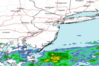 Mount Holly NJ Radar
 Northeast Radar
 East Coast Satellite