Coastal Waters out 25 NM South of Marthas Vineyard and Nantucket Marine Forecast
| Tonight...Ne Winds 15 To 20 Kt With Gusts Up To 30 Kt. Seas 5 To 7 Ft. Wave Detail: S 7 Ft At 8 Seconds And Ne 2 Ft At 3 Seconds. Rain Likely. Patchy Fog After Midnight With Vsby 1 To 3 Nm. |
| Thu...Ne Winds Around 20 Kt With Gusts Up To 25 Kt. Seas 4 To 6 Ft. Wave Detail: Ne 5 Ft At 5 Seconds And S 4 Ft At 7 Seconds. Patchy Fog. Rain Likely In The Morning. A Chance Of Rain In The Afternoon. Vsby 1 To 3 Nm. |
| Thu Night...Ne Winds 15 To 20 Kt With Gusts Up To 25 Kt, Becoming E 10 To 15 Kt After Midnight. Seas 4 To 6 Ft, Subsiding To 3 To 4 Ft After Midnight. Wave Detail: Ne 5 Ft At 6 Seconds And S 2 Ft At 7 Seconds, Becoming E 4 Ft At 6 Seconds And S 2 Ft At 7 Seconds. |
| Fri...Se Winds 10 To 15 Kt, Becoming Sw 15 To 20 Kt With Gusts Up To 25 Kt In The Afternoon. Seas 3 To 5 Ft. Wave Detail: S 4 Ft At 6 Seconds And E 3 Ft At 7 Seconds. |
| Fri Night...Sw Winds 20 To 25 Kt With Gusts Up To 30 Kt. Seas 5 To 7 Ft. Wave Detail: S 7 Ft At 10 Seconds And Sw 6 Ft At 6 Seconds. |
| Sat...W Winds 15 To 20 Kt, Becoming Ne 10 To 15 Kt In The Afternoon. Seas 4 To 6 Ft. Wave Detail: Sw 6 Ft At 7 Seconds And E 2 Ft At 7 Seconds. |
| Sat Night...E Winds 15 To 20 Kt, Becoming S 20 To 25 Kt After Midnight. Seas 3 To 5 Ft. |
| Sun...Sw Winds 25 To 30 Kt With Gusts Up To 35 Kt. Seas 6 To 9 Ft. A Chance Of Showers. |
| Sun Night...W Winds 25 To 30 Kt. Seas 7 To 10 Ft. Showers Likely. |
| Mon...W Winds 15 To 20 Kt. Seas 5 To 7 Ft. A Chance Of Showers. |
| Mon Night...W Winds 15 To 20 Kt. Seas 3 To 5 Ft. Seas Are Reported As Significant Wave Height, Which Is The Average Of The Highest Third Of The Waves. Individual Wave Heights May Be More Than Twice The Significant Wave Height. |
| Area Forecast Discussion National Weather Service Boston/Norton MA 706pm EDT Wednesday April 1 2026 .WHAT HAS CHANGED... Updated Aviation section. No significant changes. .KEY MESSAGES... - Much cooler with periods of rain tonight into Thursday. - Temperature roller coaster continues through next week with continued rain chances through at least Sunday. Drier and cool next week. KEY MESSAGE 1...Much cooler with periods of rain tonight into Thursday. Backdoor front has moved into NE MA with wind shift to N-NE and a sharp temp drop into the 50s. This front will push south and west across SNE through late afternoon with sharply falling temps. Scattered showers will be focused south of the MA Pike this afternoon and there is a brief window for an isolated t-storm across eastern CT-RI and SE MA where marginal instability will develop. The front will set up south of New England tonight as strong high pressure builds over the Maritimes. Low level E-NE flow will bring much cooler temps tonight into Thu with temps dropping into the 30s late tonight with minimal recovery on Thu with highs upper 30s to lower 40s. Meanwhile SW flow aloft overriding the cool air near the surface with deepening moisture in the column and weak surface wave tracking along the boundary will bring periods of rain tonight into Thu. It looks like the bulk of the rain will be later tonight through Thu morning, with some improvement in the afternoon as the deeper moisture plume lifts to the north. But still dreary in the afternoon with low clouds and patchy drizzle. 925 mb temps drop to 0 to -2C across northern MA late tonight into Thu so the rain may mix with sleet here at times but no impact expected. Rainfall amounts of 0.25 to 0.50" expected with localized amounts up to an inch. Cold front will begin to lift back north as a warm front Thu night but remain to the south. Stratus and patchy drizzle and fog will continue with temps remaining steady in the 30s. There is a low risk for localized pockets of freezing drizzle over higher elevations near the VT/NH borders where temps may drop close to 32F. KEY MESSAGE 2...Temperature roller coaster continues through next week with continued rain chances through at least Sunday. Drier and cool next week. Friday the pattern flips again as high pressure exits to the northeast replaced by low pressure crossing northern New England Friday and Friday night. This brings the return of warm, moist south westerly flow pumping temperatures back up into the 60s (low 50s along the south coast thanks to cool onshore flow). A few showers are possible on Friday but most will be dry. It's a brief warm up as the trailing cold front arrives sometime early Saturday bringing the return of colder temperatures and a renewed chance of scattered showers as the front stalls. This all then repeats once again on Sunday with a brief warm frontal passage followed by a more robust cold front accompanying a deeper mid level trough. Still some uncertainty on the timing of the heaviest precip, but a later Sunday/Sunday night period looks most likely. Moisture parameters are better with this round (PWATs (Precipitable Waters) over 1.25") and EPS/GEFS ensemble guidance indicate a 20-40% chance of rainfall totals at or above 0.5". Looking into next week a cooler airmass moves overhead and so while we should dry out, a seasonable to cooler than normal stretch looks on tap with highs in the 40s and low 50s. Marine Forecaster Confidence Levels... Low - less than 30 percent. Moderate - 30 to 60 percent. High - greater than 60 percent. High confidence through Thu night. SCAs (Small Craft Advisories) expanded across all waters except Boston Harbor and Narragansett Bay tonight into Thu for NE gusts to 25 kt. Diminishing E winds Thu night. Outlook /Friday through Monday/... Friday: Low risk for Small Craft Advisory winds with gusts up to 25 kt. Areas of seas approaching 5 ft. Local visibility 1 to 3 nm. Friday Night: Moderate risk for Small Craft Advisory winds with gusts up to 25 kt. Seas up to 5 ft. Saturday: Winds less than 25 kt. Areas of seas approaching 5 ft. Slight chance of rain showers. Saturday Night: Low risk for Small Craft Advisory winds with gusts up to 30 kt. Areas of seas approaching 5 ft. Slight chance of rain showers. Sunday: Strong winds with gusts up to 35 kt. Areas of rough seas. Chance of rain showers. Sunday Night: Low risk for Small Craft Advisory winds with gusts up to 30 kt. Areas of rough seas. Rain showers likely. Monday: Winds less than 25 kt. Local rough seas. NOAA Boston MA Office: Watches - Warnings - Advisories CT...None. MA...None. RI...None. Marine Small Craft Advisory from 2am to 8pm EDT Thursday for ANZ231- 250-251. Small Craft Advisory until 8pm EDT Thursday for ANZ232>234. Small Craft Advisory until 8pm EDT Thursday for ANZ235-237. Small Craft Advisory until 2am EDT Friday for ANZ254>256. |
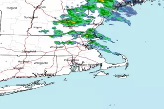 Boston MA Radar
 Northeast Radar
 East Coast Satellite