Eastern Bay, MD Marine Forecast
| Tonight...Se Winds 5 To 10 Kt. Waves 1 Ft. |
| Wed...Se Winds 10 To 15 Kt With Gusts To 20 Kt. Waves 1 Ft. Showers With A Chance Of Tstms. |
| Wed Night...Se Winds 10 To 15 Kt...Becoming W After Midnight. Gusts Up To 20 Kt. Waves 1 Ft. Showers. |
| Thu...Nw Winds 10 To 15 Kt With Gusts To 20 Kt. Waves 2 Ft. |
| Thu Night...Nw Winds 10 To 15 Kt With Gusts To 20 Kt. Waves 1 To 2 Ft. |
| Fri...W Winds 5 To 10 Kt. Waves 1 Ft. A Chance Of Showers. |
| Fri Night...Nw Winds 5 To 10 Kt. Waves 1 Ft. A Chance Of Showers. |
| Sat...Nw Winds 5 To 10 Kt. Waves 1 Ft. A Chance Of Showers Through The Day. |
| Sun...W Winds 5 To 10 Kt. Waves 1 Ft. Winds And Waves Higher And Visibilities Lower In And Near Tstms. |
| Area Forecast Discussion National Weather Service Baltimore MD/Washington DC 303pm EDT Tuesday April 28 2026 .WHAT HAS CHANGED... The only change made to the forecast for this update cycle was to slightly slow down the progression of showers along the warm front Wednesday morning. .KEY MESSAGES... 1) Increasing shower and thunderstorm chances through mid-week as a frontal system approaches. 2) Multiple nigheights of frost/freezing conditions possible late week into the weekend. 3) Additional rain chances Friday into Saturday as a trailing disturbance passes through. KEY MESSAGE 1...Increasing shower and thunderstorm chances through mid-week as a frontal system approaches. Mostly cloudy skies expected to continue this afternoon and throughout the overnight hours. Afternoon highs still rising into the low 60s for most, about on par with the forecast. Overnight lows in the upper 40s to low 50s. Wednesday continues to present itself as the most active day of the forecast period. As is common in convective forecasting in the area, morning clouds/showers may hinder the severe threat later in the afternoon/evening. Starting off the day, warm advection showers will overspread the area from southwest to northeast by mid-morning. Guidance is split on just how much rain comes from this, but at the very least, we will be dealing with junky morning clouds and some drizzle most likely.A The actual surface warm front should reside over southwestern Virginia around daybreak. Through the day, expect this warm front to slowly lift northeastward in time before reaching the metro areas by Wednesday evening. Given the later arrival of this milder/more unstable air mass, this might not time as well with the peak diurnal heating cycle. If anything, the better shot would come during the evening as a cold front pushes eastward across the region. Despite questionable instability, the 0-6 km shear runs around 45 to 55 knots which is plenty sufficient for severe thunderstorm development. Thus, there is a risk of some damaging winds as this cold front tracks through on Wednesday evening. A Marginal Risk continues to be advertised by the Storm Prediction Center for the entire area to cover this risk. Showers and a few thunderstorms linger into the overnight hours. However, the area should experience a drying trend from west to east behind this exiting baroclinic zone. A cool and breezy day is expected on Thursday with northwesterly gusts to around 20 to 30 mph. Despite the large drop in 850-mb temperatures (8 to 10C fall between Wednesday and Thursday afternoons), a well mixed boundary layer should overcome this cooling effect. Forecast highs on Thursday should still push into the upper 50s to mid 60s (40s to mid 50s across the mountains). Outside of some upslope aided rain showers along/west of the Alleghenies, expect a dry day. Nighttime conditions yield lows falling into the mid 30s to mid 40s. KEY MESSAGE 2...Multiple nigheights of frost/freezing conditions possible late week into the weekend. High pressure will build in across the region behind a departing closed low pressure system. Cool air advection, drier air, and diminishing winds could all lead to possible frost formation in parts of the region Friday night through Sunday night. Freezing temperatures could also evolve and spread eastward toward the more populated areas outside of the Alleghenies. Low temperatures each night could be widespread 30s with lower 40s well to the east. We will see a slight uptick in the winds during the day due to diurnal differences, but then become light to calm widespread after sunset each day. KEY MESSAGE 3...Additional rain chances Friday into Saturday as a trailing disturbance passes through. As the main trough of low pressure pulls away from the region, a trailing disturbance or two could follow suit and bring us a few rain showers to the region both Friday and Saturday. It is not out of the question that higher elevations in the Alleghenies could encounter a little light rain and snow mix but accumulations would be light. There is even a hint that a disturbance could move across the region early next week and bring us a little more rain relief. Temperatures would be more seasonable early next week. Marine Winds should remain below SCA (Small Craft Advisory) criteria for the most part this evening, but will be on the increase by Wednesday morning. Small Craft Advisories have been issued for Wednesday as winds will be on the increase, with further wind increases into Wednesday night and Thursday as winds shift to northwesterly behind a cold front. Gusts up to 20 to 25 knots are possible in this post-frontal environment. Before this cold front crosses the waters late Wednesday, some severe weather potential exists which may warrant a few Special Marine Warnings. Small Craft Advisories are likely needed through Thursday afternoon and into the early evening. While most marine zones see winds drop off into the night, winds could remain elevated over the southern most waters. Small Craft Advisories possible Friday and again on Saturday, primarily in the northern Chesapeake Bay. Winds northwest 10 to 15 knots gusts 20 knots each day. Tides / Coastal Flooding Onshore flow continues as high pressure exits the Atlantic coast and waves of low pressure approach from the west. Many locations will reach Action Stage during high tide through Wednesday, with Minor tidal flooding possible, especially at Annapolis and Dahlgren. A couple other tidal sites like Alexandria and Havre de Grace could get close during the higher of the two astronomical high tides, as well. Water levels begin to drop off by Thursday as winds shift to northwesterly. NOAA Baltimore MD/Washington DC Office: Watches - Warnings - Advisories DC...None. MD...None. VA...None. WV...None. Marine Small Craft Advisory from 11am Wednesday to 6am EDT Thursday for ANZ530>543. |
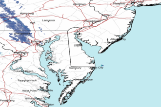
 Dover DE Radar
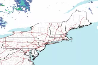
 Northeast Radar