Monterey Bay Marine Forecast
| Today...Nw Wind Around 5 Kt, Backing To W Late This Morning And Early Afternoon, Rising To 10 To 15 Kt Late. Seas 4 To 6 Ft. Wave Detail: S 2 Ft At 12 Seconds And W 5 Ft At 13 Seconds. A Chance Of Rain. Patchy Fog Late This Morning. |
| Tonight...Nw Wind 10 To 15 Kt. Seas 3 To 5 Ft. Wave Detail: W 5 Ft At 12 Seconds. |
| Fri...Nw Wind 10 To 15 Kt, Becoming W 20 To 25 Kt In The Afternoon. Seas 3 To 5 Ft. Wave Detail: Nw 4 Ft At 12 Seconds. |
| Fri Night...Nw Wind 15 To 20 Kt, Becoming N 5 To 10 Kt After Midnight. Seas 3 To 5 Ft. Wave Detail: Nw 5 Ft At 8 Seconds. |
| Sat...N Wind Around 5 Kt, Backing To W In The Afternoon. Seas 3 To 4 Ft. Wave Detail: Nw 4 Ft At 10 Seconds. |
| Sat Night...Nw Wind 10 To 15 Kt, Becoming N Around 5 Kt After Midnight. Seas 3 To 5 Ft. Wave Detail: Nw 4 Ft At 10 Seconds. |
| Sun...Ne Wind Around 5 Kt, Backing To W In The Afternoon. Seas 3 To 4 Ft. Wave Detail: Nw 4 Ft At 9 Seconds. |
| Sun Night...W Wind 5 To 10 Kt, Becoming Nw After Midnight. Seas 3 To 4 Ft. Wave Detail: Nw 3 Ft At 10 Seconds. |
| Mon...S Wind Around 5 Kt, Veering To Sw In The Afternoon. Seas Around 3 Ft. Wave Detail: Nw 3 Ft At 11 Seconds. |
| Mon Night...Sw Wind 5 To 10 Kt, Becoming E After Midnight. Seas Around 3 Ft. Wave Detail: Nw 3 Ft At 10 Seconds. Locally Lower Winds And Seas Across Sheltered Portions Of The Bay. |
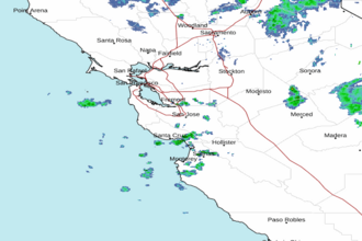
| Area Forecast Discussion National Weather Service San Francisco CA Issued by National Weather Service Eureka CA 500am PDT Thu Oct 2 2025 .SHORT TERM... Issued at 1254am PDT Thu Oct 2 2025 (Today and tonight) The 6Z WPC surface analysis depicts a stationary front parked just off the coast of the Bay Area with a weak low pressure center off of Monterey Bay. The offshore low pressure center has been relatively still since it formed off the coast of Mendocino County yesterday morning, but it will wade its way through the state today, dragging the front with it. Thus, the band of scattered showers that remains over the Bay Area should start to move southward, leaving the Bay Area behind by the afternoon hours and clearing the Central Coast through the late evening. Rainfall totals are expected to be light, at most around a quarter of an inch in the favored upslope regions of the Santa Cruz and eastern Santa Clara Mountains. A complicating factor will be the chance for thunderstorms in the interior Central Coast as the front moves through this afternoon and early evening. Thinking back to the three ingredients for convection: moisture will come from a trailing system whose moisture is being dragged into the state. Instability will come from a developing upper level low moving into the state, with K Index values of 30-35 degrees C suggesting the possibility for scattered thunderstorms. Lift could come from the local topography as is quite common in the area, but the cold front itself will provide another source of lift, extending the thunderstorm risk into areas of the Central Valley. The latest forecast update shows the probability of thunder rising to around 15-20% across most of San Benito County, with chances for thunderstorms around 10-15% across Monterey County and the southern and eastern sections of Santa Clara County. Behind the front, expect a rather chilly day with high temperatures ranging from the lower to middle 70s in the inland valleys, and the upper 70s to lower 80s in southern Monterey County, to the upper 60s to lower 70s along the bays, and the lower to middle 60s near the Pacific coast. For context, these are around 5 to 10 degrees below seasonal averages. Lingering showers are possible through the night, especially in the interior portions of the forecast area. Long Term Issued at 1254am PDT Thu Oct 2 2025 (Friday through Wednesday) The strong upper level low will move through the state through Friday, with drier conditions across the region with the moisture having moved off to our south. A strong pressure gradient over the Bay Area and Central Coast will enhance northwesterly winds across the region, with wind gusts reaching 25 to 35 mph at the immediate coast, within the Salinas Valley, and through favored gaps and passes across the region. Wind Advisories may prove necessary if confidence in more widespread gusty winds increases. Temperatures will be around the same as today for the Bay Area with a drop expected in the Central Coast, with the southern Monterey Bay region and northern Salinas Valley seeing highs in the lower to middle 60s, while the warmest locations in southern Monterey County reach highs in the lower to middle 70s. The weekend features a warmup as the upper level low moves off into the Great Basin. High temperatures range from the middle 70s to the lower 80s in the inland valleys, the lower to middle 70s close to the Bays, and the middle to upper 60s along the Pacific coast. A surface high will develop in the northern Rockies, setting up the possibility for moderate offshore flow Saturday through Monday. These would usually raise fire weather concerns, but the antecedent rainfall and the limited strength of the offshore flow will mitigate the risk. The latest update of the PGE-WRF model shows the SFO-WMC gradient reaching -2 to -6 mb, which will cause some offshore flow, but keep it from being strong enough to warrant any critical fire weather threats. Beyond Monday, upper level troughing is expected to persist over the western United States, at least through the middle part of next week. CPC outlooks lean towards temperatures and precipitation totals near the seasonal average into the middle part of October. Marine (Today through Tuesday) Issued at 450am PDT Thu Oct 2 2025 Buoys are reporting a gentle to moderate southerly breeze with a moderate period NW swell up to 12 feet. A weak cold front will continue to push through the coastal waters today. After the front passes, hazardous small craft conditions will persist as the swell subsides, but winds increase. Building high pressure across the Eastern Pacific will increase winds to a strong NW breeze with near gale force gusts from Friday afternoon through early Sunday. These winds will support rough wind waves up to 10 feet through the weekend. NOAA San Francisco Bay Area Office: Watches - Warnings - Advisories CA...None. PZ...Small Craft Advisory from 3pm this afternoon to 3am PDT Saturday for Mry Bay-Pt Pinos to Pt Piedras Blancas 0-10 nm. Small Craft Advisory from 9pm this evening to 3am PDT Saturday for Pt Arena to Pt Reyes 0-10 nm. Small Craft Advisory from 3am Friday to 3am PDT Saturday for Pigeon Pt to Pt Pinos 10-60 NM-Pt Reyes to Pigeon Pt 0-10 nm. Small Craft Advisory from 3pm this afternoon to 3pm PDT Friday for Pigeon Pt to Pt Pinos 0-10 nm. Gale Watch from Friday afternoon through Friday evening for Pigeon Pt to Pt Pinos 0-10 nm. Small Craft Advisory until 3am PDT Saturday for Pt Arena to Pt Reyes 10-60 NM. Small Craft Advisory until 9am PDT this morning for Pigeon Pt to Pt Pinos 10-60 NM. x.com/nwsbayarea |
 San Francisco Radar
 Southwest Radar