Puerto Rico and US Virgin Islands from 10NM to 19.5N Marine Forecast
| Rest Of Today...West Winds 5 To 10 Knots. Seas 3 To 5 Feet With Occasional Seas Up To 6 Feet. Dominant Period 10 Seconds. Isolated Showers. |
| Tonight...Northwest Winds 10 To 15 Knots, Becoming West After Midnight. Seas 3 To 5 Feet With Occasional Seas Up To 6 Feet. Dominant Period 10 Seconds. Isolated Showers. |
| Thursday...Northwest Winds 10 To 15 Knots. Gusts Up To 25 Knots In The Afternoon. Seas 4 To 6 Feet With Occasional Seas Up To 8 Feet, Building To 6 To 8 Feet With Occasional Seas Up To 10 Feet. Dominant Period 11 Seconds. Numerous Showers. |
| Thursday Night...North Winds 10 To 15 Knots. Gusts Up To 25 Knots In The Evening. Seas 8 To 10 Feet With Occasional Seas Up To 11 Feet. Dominant Period 11 Seconds. Isolated Showers. |
| Friday...North Winds 10 To 15 Knots, Becoming Northeast. Seas 6 To 8 Feet With Occasional Seas Up To 10 Feet. Dominant Period 11 Seconds. Isolated Showers. |
| Saturday...East Winds 5 To 10 Knots, Becoming South. Seas 8 To 10 Feet With Occasional Seas Up To 11 Feet. Dominant Period 12 Seconds. Isolated Showers. |
| Sunday...Southwest Winds 5 To 10 Knots, Becoming East. Seas 6 To 8 Feet With Occasional Seas Up To 10 Feet. Dominant Period 14 Seconds. |
| Area Forecast Discussion National Weather Service San Juan PR 357am AST Sunday April 26 2026 .Short Term(Today through Tuesday)... Issued at 400am AST Sunday April 26 2026 A relatively quiet pattern will persist through tonight, similar to the recent pattern. Isolated to scattered showers will continue to affect eastern Puerto Rico, the U.S. Virgin Islands, and surrounding waters as a lingering band of showers drifts northward across the area. Elsewhere, activity will remain limited, with only isolated development expected. Convection will remain mostly shallow due to somewhat drier air aloft, despite sufficient low- level moisture. Winds will remain light to gentle, occasionally moderate in localized areas, from the east-southeast to south, driven by high pressure over the Atlantic, with local sea breeze variations. A transition toward a wetter and more active pattern is expected beginning Monday and continuing into Tuesday. Deeper moisture will move into the region, supporting more frequent and better coverage of showers and isolated thunderstorms. With light to gentle winds in place, activity will move slowly, allowing showers and storms to persist longer over affected areas. As a result, the risk of flooding will increase from limited on Monday to elevated by Tuesday, especially during the afternoon and evening hours. Periods of heavy rainfall, lightning, and ponding of water on roads will be possible, with localized flooding impacts developing where showers persist. Additionally, a limited heat risk will continue each day due to above-normal temperatures combined with southeasterly flow and increasing moisture. .Long Term(Wednesday through Sunday)... Issued at 400am AST Sunday April 26 2026 Overall, a moist and unstable weather pattern will persist from Wednesday through Friday across Puerto Rico and the U.S. Virgin Islands. Abundant Caribbean moisture, combined with a mid-to-upper- level trough and an induced surface trough, will support unsettled conditions through late week. A surface high pressure system over the central Atlantic will maintain a light to moderate south- southeasterly wind flow, promoting warm temperatures and high humidity. A gradual drying trend is expected over the weekend, allowing for a slight improvement in weather conditions. From Wednesday through Friday, moisture levels will remain above normal, with precipitable water (PWAT) values generally ranging between 1.75 and 2.00 inches. This will support a pattern of daily showers and isolated thunderstorms, with the most active convection developing during the afternoon across the interior and northern portions of Puerto Rico. Morning activity will favor southern and eastern Puerto Rico as well as the U.S. Virgin Islands, followed by afternoon convection affecting urban and metropolitan areas. By Saturday into Sunday, slightly drier air will begin to filter into the region. Although afternoon showers will still develop, overall coverage and intensity should decrease compared to earlier in the period. Warm conditions will persist throughout the period due to the prevailing south-southeasterly flow. Temperatures at the 925 mb level will remain above normal for this time of the year through at least Friday, gradually easing into the weekend. Maximum surface temperatures will range from the upper 80s to low 90s across coastal and urban areas, and from the low to mid-80s in higher terrains. Combined with high humidity, heat indices are expected to exceed 100°F daily, particularly through Friday. Residents and visitors are encouraged to continue monitoring the forecast, stay well hydrated, take frequent breaks from the heat, and limit prolonged sun exposure, especially during peak afternoon hours.... Marine Issued at 400am AST Sunday April 26 2026 The remnants of an old front north of the region will continue to move further north as a surface low enters the northwestern Atlantic today. Meanwhile, a surface high pressure over the central Atlantic will continue to weaken, as the surface low strengthens during the next few days. This pattern will promote light to moderate southerly winds today, turning more ESE through midweek. Pulses of small, long- period NNE swells will continue to spread across the Atlantic waters and passages through next week. Seas will remain below small craft advisory criteria for the next several days. A surface trough is expected to increase shower and thunderstorm activity on Tuesday and Wednesday. Beach Forecast Issued at 400am AST Sunday April 26 2026 A moderate risk of rip currents will prevail across the northern beaches of Puerto Rico and the U.S. Virgin Islands through the end of the workweek. Pulses of small, but long-period NNE swells will reach the Atlantic beaches of the islands during the next few days. These long-period swells can still produce areas of life-threatening rip currents. Beach goers should exercise caution when entering the northern beaches. The risk of rip currents will remain low in the south-facing beaches of the islands. .SJU WATCHES/WARNINGS/ADVISORIES... PR...None. VI...None. AM...None. |
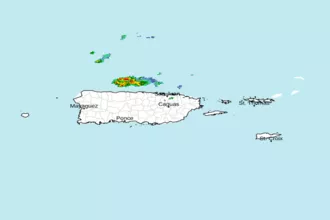
 San Juan Radar
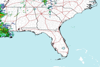
 Southeast Radar