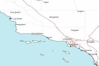
East Santa Barbara Channel from Pt. Conception to Pt. Mugu CA including Santa Cruz Island Marine Forecast
| Today...Western Portion, Nw Winds 10 To 20 Kt With Gusts To 25 Kt, Becoming 15 To 25 Kt With Gusts To 30 Kt In The Afternoon. Eastern Portion, Ne Winds 5 To 10 Kt, Becoming W 10 To 15 Kt In The Afternoon. Combined Seas 6 To 8 Ft Dominant Period 9 Seconds. |
| Tonight...Western Portion, Nw Winds 15 To 25 Kt With Gusts To 30 Kt, Becoming 10 To 20 Kt After Midnight. Eastern Portion, W Winds 10 To 15 Kt In The Evening, Becoming N 5 To 10 Kt. Combined Seas 6 To 8 Ft Dominant Period 10 Seconds. |
| Tue...Western Portion, Nw Winds 10 To 15 Kt, Becoming 10 To 20 Kt With Gusts To 25 Kt In The Afternoon. Eastern Portion, Ne Winds 5 To 10 Kt, Becoming W 10 To 15 Kt In The Afternoon. Combined Seas 5 To 7 Ft Dominant Period 11 Seconds. |
| Tue Night...Western Portion, Nw Winds 10 To 20 Kt With Gusts To 25 Kt Becoming 10 To 15 Kt After Midnight. Eastern Portion, W Winds 10 To 15 Kt Becoming E After Midnight. Combined Seas 6 To 8 Ft Dominant Period 11 Seconds. |
| Wed...N Winds 10 To 20 Kt, Becoming W In The Afternoon. Combined Seas 5 To 7 Ft Dominant Period 11 Seconds. |
| Wed Night...Western Portion, Nw Winds 15 To 20 Kt Becoming 10 To 15 Kt After Midnight. Eastern Portion, W Winds 10 To 15 Kt Becoming Ne 5 To 10 Kt After Midnight. Combined Seas 5 To 7 Ft Dominant Period 11 Seconds. |
| Thu...Nw Winds 10 To 15 Kt. Wind Waves 2 Ft Or Less. W Swell 3 To 5 Ft. |
| Fri...Nw Winds 10 To 15 Kt. Wind Waves 2 Ft Or Less. W Swell 2 To 4 Ft. |
| Area Forecast Discussion ...UPDATED National Weather Service Los Angeles/Oxnard CA 540am PDT Monday April 29 2024 Synopsis 29/222 AM. Mostly clear skies and warmer temperatures will prevail across the region through this week, with just some night through morning coastal low clouds and fog. Gusty northwest to north winds will prevail over the mountains and deserts at least through Tuesday. Short Term - Today through Wednesday ...29/301 AM. Not much going on for the next three days. Winds will be the only concern. The state will be under NW slightly cyclonic flow through the period with hgts near 576 dam today and Tuesday falling to 574 dam on Wed. There will be continuous offshore flow from the north through the three day period peaking near 5 mb early Tuesday morning. There will be weak onshore flow to the east both today and Wednesday but it will be weakly onshore on Tuesday. Skies will be mostly clear through the period. The only possible exceptions will be some night through morning low clouds over two small areas. The first area will be the western portion of SBA county where west winds will create back building low clouds in the Santa Ynez valley which will spread back into the coastal plain. The second area will be the LGB-LAX area where a weak eddy may bring some low clouds up from the south in the early mornings. As mentioned above winds will be the biggest issue over the next 72 hours. The offshore N to S gradients will combine with the northerly upper level flow to produce periods of advisory level winds from now until Tuesday afternoon and beyond into Wednesday. The winds will peak tonight as the offshore surface gradients reach their peak. Due to the diurnal cycle of the pressure gradients there will be lulls in the winds esp in the afternoons and early evenings. Please see the product LAXNPWLOX for all of the wind advisory informations. Most areas will warm today and Tuesday. Max temps will cool some on Wednesday as the offshore flow relaxes. Most max temps across the csts/vlys will be in the 70s with a smattering of lower 80s in the warmest vly locations. These max temps will be a few degrees either side of normal. Long Term - Thursday through Sunday 29/319 AM. The EC and GFS (Global Forecast System) both ensembles and deterministic runs are in decent agreement Thu and Fri. At the upper levels there will be increasing trough.iness which would normally cool things, but another round of offshore flow from both the north and east will prevent that and actually warming to the coasts and vlys. On Friday a reversal to onshore flow will bring increased morning low clouds and cooling to the csts and vlys. Mdl agreement wanes sharply for the weekend day 6 and 7 forecast. The GFS and esp its deterministic run is steadfast in its resolve to bring a late season storm to the area. The EC and most of its ensembles just run a broad trough over the area. The GFS ensembles are pretty varied and do not strongly support the stormy scenario. At this time the weekend forecast is biased towards the EC solutions and is dry. There will be a cooling trend each day with the GFS coming in much cooler than the EC. Again the cooling trend has been slanted in the EC's direction. Still need to keep an eye on the evolution of the GFS's forecast and if the EC shows any trend towards a deeper wetter soln as well. Marine 29/321 AM. A very long period of gale force winds is expected to continue thru at least Tuesday night for the outer waters. SCA (Small Craft Advisory) conds are expected Wednesday thru Fri, with a 30% chance of gales persisting into Wednesday night. In the inner waters N of Pt. Sal, SCA (Small Craft Advisory) level winds are likely thru Tuesday night, especially in the afternoon/evening hours. There is a 25% chance of gale force winds this afternoon and evening. There is a 50% chance of SCA (Small Craft Advisory) conds during the afternoon/evening hours Wednesday thru Fri. Seas are expected to be near SCA (Small Craft Advisory) levels during the periods of weaker winds. In the SBA Channel, SCA (Small Craft Advisory) level W-NW winds are expected across western portions during the afternoon thru late night hours thru Wed. Winds will likely remain below SCA (Small Craft Advisory) levels for eastern portions of the channel through the period. In the southern inner waters, there is a 20% chance of SCA (Small Craft Advisory) level W to NW winds across northwestern portions, mainly from Anacapa Island to Malibu during the late afternoon thru late evening hours thru Tue. Widespread strong to gale force winds will keep dangerous sea conditions across much of the coastal waters (particularly the outer waters) thru the middle of the week, with short-period, steep, and choppy waves. There may be dangerous breaking waves near west-facing harbors. Mariners should plan accordingly. Beaches 29/358 AM. Persistent strong winds and outer water swell heigheights of 10-15 feet with a 10 second period will lead to high surf (8-12 feet) along the Central Coast through Tuesday night. Surf will be highest across northwest-facing beaches. There is a 40% chance of high surf advisory criteria lingering through Wednesday evening. NO coastal flooding is expected. NOAA Los Angeles/Oxnard CA Office: Watches - Warnings - Advisories CA...High Surf Advisory in effect from 2pm this afternoon to 2 AM PDT Wednesday for zones 340-346. (See LAXCFWLOX). Wind Advisory now in effect until 3pm PDT Tuesday for zones 349-351. Wind Advisory in effect until 3pm PDT Tuesday for zones 352-353-376-377. Wind Advisory remains in effect until 3pm PDT Tuesday for zones 378-381-383. PZ...Small Craft Advisory in effect until 3am PDT Wednesday for zone 645. Small Craft Advisory in effect until 3am PDT Tuesday for zone 650. Gale Warning in effect until 3am PDT Wednesday for zones 670-673-676. https://www.weather.gov/erh/ghwo?wfo=lox |
 Los Angeles Radar
 Pacific Southwest Radar