Tidal Potomac from Cobb Island MD to Smith Point VA Marine Forecast
| Tonight...Se Winds 15 Kt With Gusts To 20 Kt. Waves 2 Ft. |
| Sat...Se Winds 10 To 15 Kt. Waves 2 Ft. |
| Sat Night...S Winds 10 To 15 Kt. Waves 2 Ft. |
| Sun...Sw Winds 5 To 10 Kt. Waves 1 Ft. |
| Sun Night...Sw Winds 5 To 10 Kt. Waves 1 Ft. |
| Mon...Sw Winds 5 To 10 Kt. Waves 1 Ft. |
| Mon Night...S Winds 5 To 10 Kt. Waves 1 Ft. |
| Tue...Sw Winds 5 To 10 Kt. Waves 1 Ft. |
| Wed...Nw Winds 5 To 10 Kt...Becoming S. Waves 1 Ft. |
| Area Forecast Discussion National Weather Service Baltimore MD/Washington DC 830pm EDT Fri April 26 2024 Synopsis Surface high pressure will remain situated along the East Coast through Saturday. A warm front will lift north of the area by Sunday. A series of fronts will cross the area during the middle of next week. Near Term - Until 6am Saturday Morning Upper-level ridging will continue building in from the west through tonight. Meanwhile, a surface high over southern New England will begin to slide south into the western Atlantic Ocean. Dry conditions continue as of mid evening. However, onshore flow continues to result in clouds banked against the central Appalachians and Blue Ridge. Clouds will gradually expand across the area tonight as overrunning moisture and warm advection spreads in from the southwest. Light showers will be possible mainly west of I-81 during the second half of the night. With the thickening clouds, overnight lows for much of the area will be in the mid 40s to near 50. However, northeast Maryland could drop closer to 40 as these areas will be clearer longer. Short Term - 6am Saturday Morning Through Sunday Night The surface ridge will remain along the east coast Saturday while the mid/upper level ridge builds overhead. A perturbation within the ridge may provide some lift, but the main contributer to rain chances will be the advancement of the low level warm and moist advection axis. The highest chance for greater than a tenth of an inch of rain will be west of the Blue Ridge. Showers will tend to fall apart to the east as they encounter a drier airmass closer to the surface high. Thick cloud cover will limit highs to the mid 50s to lower 60s for much of the area. Although there could be some lingering light showers or patchy drizzle Saturday night, most areas will be dry as the best forcing departs. Milder temperatures in the upper 40s to mid 50s are expected. Deep ridging engulfs much of the Southeast and Mid-Atlantic Sunday, bringing clearing skies and a drastic warm up. Highs will reach the lower to mid 80s for much of the area outside of the higher elevations and Chesapeake Bay vicinity. Some guidance indicates potential for a stray shower or thunderstorm to develop during the afternoon along the higher terrain, but with weak forcing and lapse rates, any activity will be short lived. The pattern shift will translate to overnight lows in the mid 50s to lower 60s. Long Term - Monday Through Friday A strong upper-level reaches its peak intensity over the region on Monday. Additionally, high pressure is set up in prime position off the east coast to pump in warm and moist air into the region out of the south. This will lead to well above average temperatures, with some ares potentially pushing for 90 on Monday along the I-95 corridor. Higher end guidance even has much of the area into the low- mid 90s, but I would consider that a low-end probability solution. Dew points Monday only reach the upper 50s to low 60s, so it won't feel quite as muggy as when we get this sort of setup during the summertime, but still a day where staying cool and hydrated will be important if doing work outdoors. A weakening upper trough will lift to our northwest on Tuesday as it ejects out of the central CONUS into the Great Lakes region. A weak piece of shortwave energy breaks off as this happens and slides across our region. An accompanying "cold front" will push through and perhaps Probability of Precipitation off some thunderstorms during the afternoon/evening hours. The amount of instability and shear available is still very much in question. As previously mentioned, this isn't the muggiest air mass, so won't have quite as much CAPE as one would expect since there really isn't a direct link into the Gulf of Mexico. Wind shear will be modest (30-40 kts of deep layer shear), but nothing too impressive, as the shortwave moves through. Most likely initiating source will be a pre-frontal trough in the lee of the Blue Ridge. Forecast soundings depict an inverted-V feature in the lowest few kilometers of the atmosphere, which would be indicative of downburst potential with any storms that do manage to get going. Something to watch in the coming days, but a very marginal threat at best at this time. A warm and unsettled pattern continues Wednesday and Thursday as pieces of upper-level energy ride along the periphery of the aforementioned upper ridge. High temperatures each day will be in the mid 80s with dew points again in the upper 50s to low 60s. This will yield similar instability values each day. However, shear/forcing is weaker, especially on Wednesday. So severe potential is somewhat lower that day in particular. Could see Thursday being the next day to watch, but again it doesn't appear to be a slam dunk at this point in the forecast. As always with the long term portion of the forecast, the finer details can, and likely will, change as we move closer. So tune into the latest forecast from our office at weather.gov/lwx. Marine Onshore/SE flow will continue through tonight. Periods of SCA (Small Craft Advisory) conditions are likely across most of the waters this evening. Southeast winds are likely to result in several hours of gusts to around 20 knots, so a Small Craft Advisory remains in effect. After a break Saturday morning, southerly channeling is likely to result in additional SCA (Small Craft Advisory) winds Saturday afternoon into Saturday night, especially on the Chesapeake Bay. High pressure builds across the region Sunday, likely keeping southwest winds at 10 knots or less. Surface high pressure offshore will bring a southerly flow to the region, which could channel up the Chesapeake Bay at times. This could necessitate SCAs (Small Craft Advisories) through Tuesday. In addition to this, there will be the potential for some afternoon/early evening thunderstorms Tuesday afternoon. Thermal profiles are supportive of strong gusty winds with storms that do develop, so SMWs are a possibility. Tides / Coastal Flooding Onshore/southeast winds will keep water levels elevated through Saturday. Thepm high tide is lower astronomically, so most locations should remain below flood stage. Additional advisories will likely be needed for the Saturday morning high tide. Beyond that, additional flooding becomes less certain. High pressure and light southwest winds may allow for gradual draining of water from the estuary. NOAA Baltimore MD/Washington DC Office: Watches - Warnings - Advisories DC...None. MD...None. VA...None. WV...None. Marine Small Craft Advisory until 2am EDT Saturday for ANZ530>533- 536-538>542. Small Craft Advisory until 4am EDT Saturday for ANZ534-537- 543. Small Craft Advisory until midnight EDT tonight for ANZ535. |
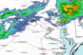 Baltimore/Washington Radar
 Northeast Radar
 East Coast Satellite